
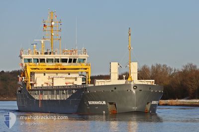
BORNHOLM
Cargo
Current Trip
| Time Travelled | 2 days |
|---|---|
| Remaining Time | 20 h, 19 mins |
| Distance Travelled | 409.46 nm |
| Remaining Distance | 129.05 nm |
| AVG Speed | 8.8 Knots |
| MAX Speed | 12.8 Knots |
| AVG Wind | 7.7 knots |
| MAX Wind | 15 knots |
| MIN Temp | -0.6°C / 30.92°F |
| MAX Temp | 3.7°C / 38.66°F |
| Draught | 4 m |
| Position Received | 1 m ago |
Current Position
| Longitude | --- |
|---|---|
| Latitude | --- |
| Status | Under way using engine |
| Speed | 6.2 Knots |
| Course | 57.6° |
| Area | Skaggerak |
| Station | T-AIS |
| Position Received | 1 m ago |
Info
Information
The current position of BORNHOLM is in Skaggerak with coordinates 57.54093° / 9.44977° as reported on 2025-02-18 02:55 by AIS to our vessel tracker app. The vessel's current speed is 6.2 Knots and is heading at the port of FALKENBERG. The estimated time of arrival as calculated by MyShipTracking vessel tracking app is 2025-02-19 00:15 LT
The vessel BORNHOLM (IMO: 9968267, MMSI: 255864560) is a Cargo It's sailing under the flag of [PT] Portugal.
In this page you can find informations about the vessels current position, last detected port calls, and current voyage information. If the vessels is not in coverage by AIS you will find the latest position.
The current position of BORNHOLM is detected by our AIS receivers and we are not responsible for the reliability of the data. The last position was recorded while the vessel was in Coverage by the Ais receivers of our vessel tracking app.
The current draught of BORNHOLM as reported by AIS is 4 meters
Weather
| Temperature | 3.7°C / 38.66°F |
|---|---|
| Wind Speed | 9 knots |
| Direction | 282° WNW |
| Pressure | 1026.2 hPa |
| Humidity | 47.2 % |
| Cloud Coverage | --- |
Featured Company
Last Port Calls
| Port | Arrival | Departure | Time In Port |
|---|---|---|---|
| 2025-02-14 01:38 | 2025-02-15 15:35 | 1 d | |
| 2025-02-12 22:20 | 2025-02-14 01:14 | 1 d | |
| 2025-02-07 06:24 | 2025-02-07 22:22 | 15 h | |
| 2025-02-05 18:23 | 2025-02-06 11:14 | 16 h | |
| 2025-01-30 00:04 | 2025-02-01 16:55 | 2 d | |
| 2025-01-27 04:28 | 2025-01-29 00:29 | 1 d | |
| 2025-01-23 22:27 | 2025-01-25 11:10 | 1 d | |
| 2025-01-17 22:52 | 2025-01-20 17:13 | 2 d | |
| 2025-01-13 10:47 | 2025-01-15 20:48 | 2 d | |
| 2025-01-05 10:45 | 2025-01-08 19:34 | 3 d |
Most Visited Ports (Last year)
| Port | Arrivals | |
|---|---|---|
| 2 | ||
| 2 | ||
| 2 | ||
| 1 | ||
| 1 | ||
| 1 |
Last Trips
| Origin | Departure | Destination | Arrival | Distance | |
|---|---|---|---|---|---|
| 2025-02-14 01:14 | 2025-02-14 01:38 | 1.58 nm | |||
| 2025-02-07 22:22 | 2025-02-12 22:20 | 1103.37 nm | |||
| 2025-02-06 11:14 | 2025-02-07 06:24 | 196.94 nm | |||
| 2025-02-01 16:55 | 2025-02-05 18:23 | 1016.44 nm | |||
| 2025-01-29 00:29 | 2025-01-30 00:04 | 186.20 nm | |||
| 2025-01-25 11:10 | 2025-01-27 04:28 | 203.27 nm | |||
| 2025-01-20 17:13 | 2025-01-23 22:27 | 25.35 nm | |||
| 2025-01-15 20:48 | 2025-01-17 22:52 | 366.11 nm | |||
| 2025-01-08 19:34 | 2025-01-13 10:47 | 339.43 nm | |||
| 2025-01-03 11:10 | 2025-01-05 10:45 | 378.82 nm |
Events
| Time | Event | Details | Position / Dest | Info |
|---|---|---|---|---|
| 2025-02-17 20:55 | Change Sea Area | Danish part of the Skaggerak Danish part of the North Sea |
57.20253 / 8.47944
Skaggerak
SE FAG
|
Speed: 6.5 kn Course: 52.8° |
| 2025-02-17 11:58 | IN Coverage |
56.42813 / 7.50066
North Sea
SE FAG
|
Speed: 6.2 kn Course: 29.8° |
|
| 2025-02-17 10:05 | OUT of Coverage |
56.25671 / 7.32246
North Sea
SE FAG
|
Speed: 6.2 kn Course: 30.1° |
|
| 2025-02-17 08:00 | Change Sea Area | Danish part of the North Sea Dutch part of the North Sea |
56.06392 / 7.11963
North Sea
SE FAG
|
Speed: 6.7 kn Course: 31.9° |
| 2025-02-17 08:00 | IN Coverage |
56.06392 / 7.11963
North Sea
SE FAG
|
Speed: 6.7 kn Course: 31.9° |
|
| 2025-02-16 02:33 | OUT of Coverage |
53.20650 / 4.52722
North Sea
SE FAG
|
Speed: 6.5 kn Course: 28.4° |
|
| 2025-02-16 00:04 | IN Coverage |
52.96408 / 4.33615
North Sea
SE FAG
|
Speed: 6.3 kn Course: 22° |
|
| 2025-02-15 19:18 | OUT of Coverage |
52.50502 / 3.91069
North Sea
SE FAG
|
Speed: 8.4 kn Course: 10.1° |
|
| 2025-02-15 14:35 | PORT DEPARTURE |
|
51.89528 / 4.39675
SE FAG
|
Speed: 9.6 kn Course: 297° |
| 2025-02-15 14:29 | START Moving |
51.88659 / 4.40669
[NL] ROTTERDAM WAALHAVEN
|
Speed: 3.2 kn Course: 315° |