

BORE WAVE
Cargo

Current Trip
| Time Travelled | 12 h, 3 mins |
|---|---|
| Remaining Time | --- |
| Distance Travelled | 146.90 nm |
| Remaining Distance | --- |
| AVG Speed | 12.7 Knots |
| MAX Speed | 13.9 Knots |
| AVG Wind | 7.2 knots |
| MAX Wind | 13 knots |
| MIN Temp | -10.3°C / 13.46°F |
| MAX Temp | 1.3°C / 34.34°F |
| Draught | 6.7 m |
| Position Received | 42 m ago |
Current Position
| Longitude | --- |
|---|---|
| Latitude | --- |
| Status | Under way using engine |
| Speed | 12.9 Knots |
| Course | 253.3° |
| Area | Baltic Sea |
| Station | T-AIS |
| Position Received | 42 m ago |
Information
The current position of BORE WAVE is in Baltic Sea with coordinates 59.51497° / 22.67646° as reported on 2025-02-20 12:55 by AIS to our vessel tracker app. The vessel's current speed is 12.9 Knots and is heading at the port of AMSTERDAM. The estimated time of arrival as calculated by MyShipTracking vessel tracking app is 2025-02-23 23:00 LT
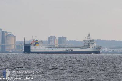
The vessel BORE WAVE (IMO: 9892896, MMSI: 246278000) is a Cargo It's sailing under the flag of [NL] Netherlands.
In this page you can find informations about the vessels current position, last detected port calls, and current voyage information. If the vessels is not in coverage by AIS you will find the latest position.
The current position of BORE WAVE is detected by our AIS receivers and we are not responsible for the reliability of the data. The last position was recorded while the vessel was in Coverage by the Ais receivers of our vessel tracking app.
The current draught of BORE WAVE as reported by AIS is 6.7 meters
Weather
| Temperature | 1.4°C / 34.52°F |
|---|---|
| Wind Speed | 10 knots |
| Direction | 233° SW |
| Pressure | 1030.9 hPa |
| Humidity | 75.4 % |
| Cloud Coverage | 7 % |


Featured Company
Last Port Calls
| Port | Arrival | Departure | Time In Port |
|---|---|---|---|
| 2025-02-19 02:31 | 2025-02-20 01:35 | 23 h | |
| 2025-02-14 07:37 | 2025-02-17 20:26 | 3 d | |
| 2025-02-04 10:27 | 2025-02-05 15:23 | 1 d | |
| 2025-02-01 12:00 | 2025-02-03 16:09 | 2 d | |
| 2025-01-29 05:01 | 2025-01-29 05:58 | 57 m | |
| 2025-01-26 20:13 | 2025-01-29 03:39 | 2 d | |
| 2025-01-22 00:58 | 2025-01-22 20:12 | 19 h | |
| 2025-01-17 06:43 | 2025-01-20 14:14 | 3 d | |
| 2025-01-10 03:22 | 2025-01-13 14:29 | 3 d | |
| 2025-01-07 11:19 | 2025-01-07 16:43 | 5 h |
Last Trips
| Origin | Departure | Destination | Arrival | Distance | |
|---|---|---|---|---|---|
| 2025-02-17 22:26 | 2025-02-19 04:31 | 375.67 nm | |||
| 2025-02-05 16:23 | 2025-02-14 09:37 | 1933.27 nm | |||
| 2025-02-03 17:09 | 2025-02-04 11:27 | 224.16 nm | |||
| 2025-01-29 06:58 | 2025-02-01 13:00 | 808.63 nm | |||
| 2025-01-29 04:39 | 2025-01-29 06:01 | 4.29 nm | |||
| 2025-01-22 22:12 | 2025-01-26 21:13 | 1021.68 nm | |||
| 2025-01-20 16:14 | 2025-01-22 02:58 | 379.32 nm | |||
| 2025-01-13 15:29 | 2025-01-17 08:43 | 1017.75 nm | |||
| 2025-01-07 17:43 | 2025-01-10 04:22 | 749.69 nm | |||
| 2025-01-06 14:09 | 2025-01-07 12:19 | 223.77 nm |
Events
| Time | Event | Details | Position / Dest | Info |
|---|---|---|---|---|
| 2025-02-20 12:58 | Status Changed | Default Under way using engine |
59.51200 / 22.65713
NLAMS
|
Speed: 12.9 kn Course: 253.3° |
| 2025-02-20 12:52 | Status Changed | Under way using engine Default |
59.51860 / 22.69981
NLAMS
|
Speed: 12.9 kn Course: 254° |
| 2025-02-20 12:39 | Status Changed | Default Under way using engine |
59.53199 / 22.78661
NLAMS
|
Speed: 12.9 kn Course: 253.2° |
| 2025-02-20 11:52 | Detected in Sea | Finnish part of the Baltic Sea |
59.58159 / 23.10842
Baltic Sea
NLAMS
|
Speed: 13.2 kn Course: 252.7° |
| 2025-02-20 10:43 | Status Changed | Under way using engine Default |
59.65363 / 23.58447
NLAMS
|
Speed: 13.5 kn Course: 254° |
| 2025-02-20 10:37 | Status Changed | Default Under way using engine |
59.66001 / 23.62806
NLAMS
|
Speed: 13.5 kn Course: 253.8° |
| 2025-02-20 09:59 | Status Changed | Under way using engine Default |
59.69929 / 23.89744
NLAMS
|
Speed: 13.4 kn Course: 254° |
| 2025-02-20 09:41 | Status Changed | Default Under way using engine |
59.71694 / 24.01859
NLAMS
|
Speed: 13.2 kn Course: 254.1° |
| 2025-02-20 09:36 | Status Changed | Under way using engine Default |
59.72226 / 24.05448
NLAMS
|
Speed: 13.2 kn Course: 253° |
| 2025-02-20 09:05 | Status Changed | Default Under way using engine |
59.75340 / 24.26999
NLAMS
|
Speed: 13.1 kn Course: 253.3° |