

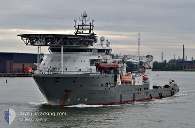
BOKA DA VINCI
Diving Support Vessel

Current Trip
HEWETT OIL FIELD
| Time Travelled | 3 days |
|---|---|
| Remaining Time | --- |
| Distance Travelled | 134.30 nm |
| Remaining Distance | --- |
| AVG Speed | 5.9 Knots |
| MAX Speed | 11.6 Knots |
| AVG Wind | 14.7 knots |
| MAX Wind | 19 knots |
| MIN Temp | 2.1°C / 35.78°F |
| MAX Temp | 4.3°C / 39.74°F |
| Draught | 6.5 m |
| Position Received | Now |
Current Position
| Longitude | --- |
|---|---|
| Latitude | --- |
| Status | Restricted manoeuverability |
| Speed | 0.1 Knots |
| Course | 130° |
| Area | North Sea |
| Station | T-AIS |
| Position Received | Now |
Information
The current position of BOKA DA VINCI is in North Sea with coordinates 52.99823° / 1.84736° as reported on 2025-02-18 13:12 by AIS to our vessel tracker app. The vessel's current speed is 0.1 Knots
The vessel BOKA DA VINCI (IMO: 9441233, MMSI: 538003647) is a Diving Support Vessel that was built in 2011 ( 14 years old ). It's sailing under the flag of [MH] Marshall Is.
In this page you can find informations about the vessels current position, last detected port calls, and current voyage information. If the vessels is not in coverage by AIS you will find the latest position.
The current position of BOKA DA VINCI is detected by our AIS receivers and we are not responsible for the reliability of the data. The last position was recorded while the vessel was in Coverage by the Ais receivers of our vessel tracking app.
The current draught of BOKA DA VINCI as reported by AIS is 6.5 meters
Weather
| Temperature | 3.2°C / 37.76°F |
|---|---|
| Wind Speed | 17 knots |
| Direction | 135° SE |
| Pressure | 1024.5 hPa |
| Humidity | 67 % |
| Cloud Coverage | 38 % |


Featured Company
Events
| Time | Event | Details | Position / Dest | Info |
|---|---|---|---|---|
| 2025-02-18 04:37 | STOP Moving |
52.99901 / 1.84580
HEWETT OIL FIELD
|
Speed: 0.2 kn Course: 151° |
|
| 2025-02-18 02:51 | START Moving |
53.08975 / 1.77006
HEWETT OIL FIELD
|
Speed: 3.1 kn Course: 144° |
|
| 2025-02-17 16:09 | STOP Moving |
53.09272 / 1.76979
HEWETT OIL FIELD
|
Speed: 0.3 kn Course: 156° |
|
| 2025-02-17 14:40 | START Moving |
53.00064 / 1.84529
HEWETT OIL FIELD
|
Speed: 3.1 kn Course: 340° |
|
| 2025-02-17 06:22 | STOP Moving |
52.99913 / 1.84285
HEWETT OIL FIELD
|
Speed: 0.3 kn Course: 125° |
|
| 2025-02-17 05:54 | START Moving |
53.01485 / 1.81341
HEWETT OIL FIELD
|
Speed: 3.2 kn Course: 130° |
|
| 2025-02-16 09:12 | STOP Moving |
53.01821 / 1.78496
HEWETT OIL FIELD
|
Speed: 0.2 kn Course: 150° |
|
| 2025-02-16 08:00 | START Moving |
53.09114 / 1.76762
HEWETT OIL FIELD
|
Speed: 3.1 kn Course: 169° |
|
| 2025-02-15 15:14 | STOP Moving |
53.09253 / 1.76957
HEWETT OIL FIELD
|
Speed: 0.2 kn Course: 158° |
|
| 2025-02-15 14:08 | START Moving |
53.02360 / 1.79003
HEWETT OIL FIELD
|
Speed: 3.1 kn Course: 292° |