

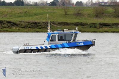
BLUE
Dredging or underwater ops

Current Trip
| Trip Time | 5 days |
|---|---|
| Trip Distance | 118.79 nm |
| AVG Speed | 12 Knots |
| MAX Speed | 12 Knots |
| Draught | 0.6 m |
| AVG Wind | 7.4 knots |
| MAX Wind | 12 knots |
| MIN Temp | 9.5°C / 49.1°F |
| MAX Temp | 15.1°C / 59.18°F |
| Position Received | 7 h, 35 m ago |
Current Position
| Longitude | --- |
|---|---|
| Latitude | --- |
| Status | Under way using engine |
| Speed | 0.1 Knots |
| Course | --- |
| Area | North Sea |
| Station | T-AIS |
| Position Received | 7 h, 35 m ago |
Information
The current position of BLUE is in North Sea with coordinates 51.34135° / 3.82573° as reported on 2025-04-22 10:49 by AIS to our vessel tracker app. The vessel's current speed is 0.1 Knots and is currently inside the port of TERNEUZEN.
The vessel BLUE (MMSI: 244013024) is a Dredging or underwater ops It's sailing under the flag of [NL] Netherlands.
In this page you can find informations about the vessels current position, last detected port calls, and current voyage information. If the vessels is not in coverage by AIS you will find the latest position.
The current position of BLUE is detected by our AIS receivers and we are not responsible for the reliability of the data. The last position was recorded while the vessel was in Coverage by the Ais receivers of our vessel tracking app.
The current draught of BLUE as reported by AIS is 0.6 meters
Weather
| Temperature | 14.7°C / 58.46°F |
|---|---|
| Wind Speed | 8 knots |
| Direction | 249° WSW |
| Pressure | 1017.4 hPa |
| Humidity | 63.2 % |
| Cloud Coverage | 92 % |
Featured Company
Last Port Calls
| Port | Arrival | Departure | Time In Port |
|---|---|---|---|
| 2025-04-22 12:35 | |||
| 2025-04-15 17:27 | 2025-04-16 12:44 | 19 h | |
| 2025-04-15 15:57 | 2025-04-15 15:59 | 2 m | |
| 2025-04-15 15:30 | 2025-04-15 15:32 | 1 m | |
| 2025-04-14 18:20 | 2025-04-15 13:51 | 19 h | |
| 2025-04-10 17:03 | 2025-04-14 12:42 | 3 d | |
| 2025-04-10 09:31 | |||
| 2025-04-09 18:38 | |||
| 2025-04-09 18:38 | |||
| 2025-04-09 17:14 |
Most Visited Ports (Last year)
| Port | Arrivals | |
|---|---|---|
| 45 | ||
| 31 | ||
| 26 | ||
| 24 | ||
| 23 | ||
| 9 |
Last Trips
| Origin | Departure | Destination | Arrival | Distance | |
|---|---|---|---|---|---|
| 2025-04-16 12:44 | 2025-04-22 12:35 | 118.79 nm | |||
| 2025-04-15 15:59 | 2025-04-15 17:27 | 15.94 nm | |||
| 2025-04-15 15:32 | 2025-04-15 15:57 | 1.96 nm | |||
| 2025-04-15 13:51 | 2025-04-15 15:30 | 7.84 nm | |||
| 2025-04-14 12:42 | 2025-04-14 18:20 | 31.00 nm | |||
| 2025-04-10 09:31 | 2025-04-10 17:03 | 72.29 nm | |||
| 2025-04-09 18:38 | 2025-04-09 18:38 | --- | |||
| 2025-04-09 17:11 | 2025-04-09 17:14 | 0.90 nm | |||
| 2025-04-09 17:05 | 2025-04-09 17:07 | 1.58 nm | |||
| 2025-04-09 17:00 | 2025-04-09 17:04 | 1.06 nm |
Events
| Time | Event | Details | Position / Dest | Info |
|---|---|---|---|---|
| 2025-04-22 10:49 | OUT of Coverage |
51.34135 / 3.82573
North Sea
[NL] TERNEUZEN
|
Speed: 0.1 kn Course: 228.8° |
|
| 2025-04-22 10:35 | STOP Moving |
51.34134 / 3.82572
[NL] TERNEUZEN
|
Speed: 0.3 kn Course: 511° |
|
| 2025-04-22 10:35 | PORT ARRIVAL |
|
51.34134 / 3.82572
[NL] TERNEUZEN
|
Speed: 2.9 kn Course: 511° |
| 2025-04-22 09:35 | IN Coverage |
51.37769 / 4.05927
North Sea
|
Speed: 18.6 kn Course: 295.1° |
|
| 2025-04-22 07:31 | OUT of Coverage |
51.36735 / 4.11271
North Sea
|
Speed: 19.2 kn Course: 85.7° |
|
| 2025-04-22 07:20 | IN Coverage |
51.37939 / 4.04218
North Sea
|
Speed: 19 kn Course: 152.7° |
|
| 2025-04-17 09:47 | OUT of Coverage |
51.46593 / 4.00708
North Sea
|
Speed: 10.7 kn Course: 168.3° |
|
| 2025-04-17 07:11 | IN Coverage |
51.46295 / 4.00858
North Sea
|
Speed: 8.4 kn Course: 354.7° |
|
| 2025-04-16 17:30 | OUT of Coverage |
51.45175 / 4.01156
North Sea
|
Speed: 9.3 kn Course: 349.2° |
|
| 2025-04-16 10:44 | PORT DEPARTURE |
|
51.39863 / 3.57411
PEILEN
|
Speed: 14.6 kn Course: 107.8° |