

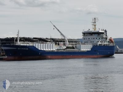
BIT POWER
Asphalt/Bitumen Tanker

Current Trip
| Time Travelled | 2 days |
|---|---|
| Remaining Time | 2 days |
| Distance Travelled | 383.29 nm |
| Remaining Distance | 633.24 nm |
| AVG Speed | 12.1 Knots |
| MAX Speed | 13.9 Knots |
| AVG Wind | 21.4 knots |
| MAX Wind | 40.7 knots |
| MIN Temp | 8.4°C / 47.12°F |
| MAX Temp | 11.9°C / 53.42°F |
| Draught | 6.4 m |
| Position Received | 1 m ago |
Current Position
| Longitude | --- |
|---|---|
| Latitude | --- |
| Status | Under way using engine |
| Speed | 12.7 Knots |
| Course | 95.1° |
| Area | English Channel |
| Station | T-AIS |
| Position Received | 1 m ago |
Information
The current position of BIT POWER is in English Channel with coordinates 49.84517° / -4.16705° as reported on 2025-02-22 19:47 by AIS to our vessel tracker app. The vessel's current speed is 12.7 Knots and is heading at the port of HAMBURG. The estimated time of arrival as calculated by MyShipTracking vessel tracking app is 2025-02-24 20:16 LT
The vessel BIT POWER (IMO: 9256432, MMSI: 244944000) is a Asphalt/Bitumen Tanker that was built in 2003 ( 22 years old ). It's sailing under the flag of [NL] Netherlands.
In this page you can find informations about the vessels current position, last detected port calls, and current voyage information. If the vessels is not in coverage by AIS you will find the latest position.
The current position of BIT POWER is detected by our AIS receivers and we are not responsible for the reliability of the data. The last position was recorded while the vessel was in Coverage by the Ais receivers of our vessel tracking app.
The current draught of BIT POWER as reported by AIS is 6.4 meters
Weather
| Temperature | 10.8°C / 51.44°F |
|---|---|
| Wind Speed | 12 knots |
| Direction | 231° SW |
| Pressure | 1020.7 hPa |
| Humidity | 88 % |
| Cloud Coverage | --- |


Featured Company
Last Port Calls
| Port | Arrival | Departure | Time In Port |
|---|---|---|---|
| 2025-02-19 03:13 | 2025-02-20 02:37 | 23 h | |
| 2025-01-31 12:30 | 2025-02-02 00:40 | 1 d | |
| 2025-01-31 06:49 | 2025-01-31 09:57 | 3 h | |
| 2025-01-24 13:05 | 2025-01-25 09:38 | 20 h | |
| 2025-01-20 15:42 | 2025-01-21 14:38 | 22 h | |
| 2025-01-20 06:03 | 2025-01-20 12:26 | 6 h | |
| 2025-01-16 07:58 | 2025-01-17 13:29 | 1 d | |
| 2025-01-13 07:10 | 2025-01-14 01:35 | 18 h | |
| 2025-01-10 16:18 | 2025-01-12 18:15 | 2 d | |
| 2025-01-03 23:51 | 2025-01-09 10:17 | 5 d |
Most Visited Ports (Last year)
| Port | Arrivals | |
|---|---|---|
| 18 | ||
| 18 | ||
| 11 | ||
| 8 | ||
| 6 | ||
| 4 |
Last Trips
| Origin | Departure | Destination | Arrival | Distance | |
|---|---|---|---|---|---|
| 2025-02-02 00:40 | 2025-02-19 03:13 | 3321.37 nm | |||
| 2025-01-25 10:38 | 2025-01-31 12:30 | 749.82 nm | |||
| 2025-01-25 10:38 | 2025-01-31 06:49 | 723.89 nm | |||
| 2025-01-21 14:38 | 2025-01-24 14:05 | 740.32 nm | |||
| 2025-01-17 14:29 | 2025-01-20 15:42 | 722.26 nm | |||
| 2025-01-17 14:29 | 2025-01-20 06:03 | 695.92 nm | |||
| 2025-01-14 02:35 | 2025-01-16 08:58 | 556.02 nm | |||
| 2025-01-12 19:15 | 2025-01-13 08:10 | 148.18 nm | |||
| 2025-01-09 11:17 | 2025-01-10 17:18 | 336.12 nm | |||
| 2024-12-26 23:21 | 2025-01-04 00:51 | 649.55 nm |
Events
| Time | Event | Details | Position / Dest | Info |
|---|---|---|---|---|
| 2025-02-22 18:17 | Status Changed | Under way using engine Default |
49.85785 / -4.67127
GB EAM > DE HAM
|
Speed: 13.2 kn Course: 92° |
| 2025-02-22 17:43 | Status Changed | Default Under way using engine |
49.86047 / -4.86378
GB EAM > DE HAM
|
Speed: 12.9 kn Course: 92.1° |
| 2025-02-22 17:33 | Status Changed | Under way using engine Default |
49.86114 / -4.92314
GB EAM > DE HAM
|
Speed: 13 kn Course: 93° |
| 2025-02-22 17:32 | Status Changed | Default Under way using engine |
49.86126 / -4.93095
GB EAM > DE HAM
|
Speed: 13.2 kn Course: 95.9° |
| 2025-02-22 17:21 | Destination Changed | GB EAM > DE HAM LYNAS ANCHORAGE |
49.86250 / -5.00401
GB EAM > DE HAM
|
Speed: 12.7 kn Course: 92.1° |
| 2025-02-22 17:21 | ETA Changed | 2025/02/24 17:00 2025/02/20 06:00 |
49.86250 / -5.00401
GB EAM > DE HAM
|
Speed: 12.7 kn Course: 92.1° |
| 2025-02-22 16:43 | Detected in Sea | United Kingdom part of the English Channel |
49.86510 / -5.19906
English Channel
|
Speed: 13 kn Course: 93.3° |
| 2025-02-22 16:43 | IN Coverage |
49.86510 / -5.19906
English Channel
|
Speed: 13 kn Course: 93.3° |
|
| 2025-02-22 16:43 | Status Changed | Under way using engine Default |
49.86525 / -5.20442
LYNAS ANCHORAGE
|
Speed: 12.9 kn Course: 91° |
| 2025-02-21 19:47 | OUT of Coverage |
53.41839 / -4.89539
Irish Sea and St. George's Channel
|
Speed: 12.8 kn Course: 215.6° |