

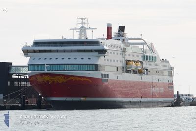
BERGENSFJORD
Ro-Ro/Passenger Ship

Current Trip
| Time Travelled | 10 h, 21 mins |
|---|---|
| Remaining Time | 16 mins |
| Distance Travelled | 175.99 nm |
| Remaining Distance | 10.70 nm |
| AVG Speed | 16.9 Knots |
| MAX Speed | 18.3 Knots |
| AVG Wind | 21 knots |
| MAX Wind | 26.8 knots |
| MIN Temp | 6.2°C / 43.16°F |
| MAX Temp | 7.2°C / 44.96°F |
| Draught | 6.5 m |
| Position Received | Now |
Current Position
| Longitude | --- |
|---|---|
| Latitude | --- |
| Status | Under way using engine |
| Speed | 17.3 Knots |
| Course | 102.1° |
| Area | Skaggerak |
| Station | T-AIS |
| Position Received | Now |
Information
The current position of BERGENSFJORD is in Skaggerak with coordinates 57.62475° / 9.83396° as reported on 2025-03-28 06:24 by AIS to our vessel tracker app. The vessel's current speed is 17.3 Knots and is heading at the port of HIRTSHALS. The estimated time of arrival as calculated by MyShipTracking vessel tracking app is 2025-03-28 07:40 LT
The vessel BERGENSFJORD (IMO: 9586617, MMSI: 219348000) is a Ro-Ro/Passenger Ship that was built in 2014 ( 11 years old ). It's sailing under the flag of [DK] Denmark.
In this page you can find informations about the vessels current position, last detected port calls, and current voyage information. If the vessels is not in coverage by AIS you will find the latest position.
The current position of BERGENSFJORD is detected by our AIS receivers and we are not responsible for the reliability of the data. The last position was recorded while the vessel was in Coverage by the Ais receivers of our vessel tracking app.
The current draught of BERGENSFJORD as reported by AIS is 6.5 meters
Weather
| Temperature | 6.8°C / 44.24°F |
|---|---|
| Wind Speed | 25 knots |
| Direction | 203° SSW |
| Pressure | 1004.6 hPa |
| Humidity | 89.8 % |
| Cloud Coverage | 100 % |


Featured Company
Last Port Calls
| Port | Arrival | Departure | Time In Port |
|---|---|---|---|
| 2025-03-27 19:17 | 2025-03-27 21:03 | 1 h | |
| 2025-03-27 12:48 | 2025-03-27 13:59 | 1 h | |
| 2025-03-27 06:46 | 2025-03-27 07:32 | 46 m | |
| 2025-03-26 22:47 | 2025-03-26 23:26 | 39 m | |
| 2025-03-26 18:01 | 2025-03-26 19:29 | 1 h | |
| 2025-03-26 13:06 | 2025-03-26 14:38 | 1 h | |
| 2025-03-26 07:46 | 2025-03-26 09:29 | 1 h | |
| 2025-03-25 19:17 | 2025-03-25 21:05 | 1 h | |
| 2025-03-25 12:47 | 2025-03-25 13:58 | 1 h | |
| 2025-03-25 06:36 | 2025-03-25 07:30 | 54 m |
Most Visited Ports (Last year)
| Port | Arrivals | |
|---|---|---|
| 332 | ||
| 329 | ||
| 274 | ||
| 166 | ||
| 2 | ||
| 1 |
Last Trips
| Origin | Departure | Destination | Arrival | Distance | |
|---|---|---|---|---|---|
| 2025-03-27 13:59 | 2025-03-27 19:17 | 103.12 nm | |||
| 2025-03-27 07:32 | 2025-03-27 12:48 | 104.00 nm | |||
| 2025-03-26 23:26 | 2025-03-27 06:46 | 125.76 nm | |||
| 2025-03-26 19:29 | 2025-03-26 22:47 | 70.58 nm | |||
| 2025-03-26 14:38 | 2025-03-26 18:01 | 70.73 nm | |||
| 2025-03-26 09:29 | 2025-03-26 13:06 | 71.40 nm | |||
| 2025-03-25 21:05 | 2025-03-26 07:46 | 181.86 nm | |||
| 2025-03-25 13:58 | 2025-03-25 19:17 | 103.28 nm | |||
| 2025-03-25 07:30 | 2025-03-25 12:47 | 110.94 nm | |||
| 2025-03-24 23:24 | 2025-03-25 06:36 | 125.69 nm |
Events
| Time | Event | Details | Position / Dest | Info |
|---|---|---|---|---|
| 2025-03-28 04:37 | Change Sea Area | Danish part of the Skaggerak Norwegian part of the Skaggerak |
57.72181 / 8.94114
Skaggerak
HIRTSHALS
|
Speed: 17.6 kn Course: 101.3° |
| 2025-03-28 01:18 | Change Sea Area | Norwegian part of the Skaggerak Norwegian part of the North Sea |
57.91581 / 7.14930
Skaggerak
HIRTSHALS
|
Speed: 18.2 kn Course: 102.2° |
| 2025-03-27 20:03 | PORT DEPARTURE |
|
58.93083 / 5.56867
HIRTSHALS
|
Speed: 13.7 kn Course: 295° |
| 2025-03-27 19:59 | START Moving |
58.92358 / 5.58339
[NO] TANANGER
|
Speed: 7 kn Course: 346° |
|
| 2025-03-27 18:30 | STOP Moving |
58.92152 / 5.58357
[NO] TANANGER
|
Speed: 0.3 kn Course: 358° |
|
| 2025-03-27 18:17 | PORT ARRIVAL |
|
58.92938 / 5.57247
[NO] TANANGER
|
Speed: 13.3 kn Course: 136° |
| 2025-03-27 18:17 | Destination Changed | HIRTSHALS RISAVIKA |
58.93097 / 5.56944
HIRTSHALS
|
Speed: 13.4 kn Course: 134.9° |
| 2025-03-27 18:17 | ETA Changed | 2025/03/28 07:00 2025/03/27 18:30 |
58.93097 / 5.56944
HIRTSHALS
|
Speed: 13.4 kn Course: 134.9° |
| 2025-03-27 12:59 | PORT DEPARTURE |
|
60.39832 / 5.28825
RISAVIKA
|
Speed: 12.1 kn Course: 292° |
| 2025-03-27 12:56 | START Moving |
60.39441 / 5.30554
[NO] BERGEN
|
Speed: 3.5 kn Course: 304° |