
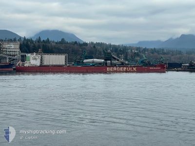
BERGE MOLDOVEANU
Cargo
Current Trip
| Time Travelled | 12 days |
|---|---|
| Remaining Time | --- |
| Distance Travelled | 3479.38 nm |
| Remaining Distance | --- |
| AVG Speed | 11.3 Knots |
| MAX Speed | 13.6 Knots |
| AVG Wind | 15.9 knots |
| MAX Wind | 27.3 knots |
| MIN Temp | 19°C / 66.2°F |
| MAX Temp | 26.3°C / 79.34°F |
| Draught | 18.8 m |
| Position Received | 7 h, 4 m ago |
Current Position
| Longitude | --- |
|---|---|
| Latitude | --- |
| Status | Under way using engine |
| Speed | 9.8 Knots |
| Course | 117.3° |
| Area | South Atlantic Ocean |
| Station | T-AIS |
| Position Received | 7 h, 4 m ago |
Info
Information
The current position of BERGE MOLDOVEANU is in South Atlantic Ocean with coordinates -34.76881° / 18.16402° as reported on 2026-01-03 16:42 by AIS to our vessel tracker app. The vessel's current speed is 9.8 Knots and is heading at the port of QINGDAO. The estimated time of arrival as calculated by MyShipTracking vessel tracking app is 2026-02-02 00:01 LT
The vessel BERGE MOLDOVEANU (IMO: 9843390, MMSI: 232024253) is a Cargo It's sailing under the flag of [GB] United Kingdom.
In this page you can find informations about the vessels current position, last detected port calls, and current voyage information. If the vessels is not in coverage by AIS you will find the latest position.
The current position of BERGE MOLDOVEANU is detected by our AIS receivers and we are not responsible for the reliability of the data. The last position was recorded while the vessel was in Coverage by the Ais receivers of our vessel tracking app.
The current draught of BERGE MOLDOVEANU as reported by AIS is 18.8 meters
Weather
| Temperature | 20.8°C / 69.44°F |
|---|---|
| Wind Speed | 15 knots |
| Direction | 119° ESE |
| Pressure | 1016.3 hPa |
| Humidity | 68.5 % |
| Cloud Coverage | 88 % |
Featured Company
Most Visited Ports (Last year)
| Port | Arrivals | |
|---|---|---|
| 2 | ||
| 2 | ||
| 1 | ||
| 1 | ||
| 1 |
Events
| Time | Event | Details | Position / Dest | Info |
|---|---|---|---|---|
| 2026-01-03 16:54 | Status Changed | Default Under way using engine |
-34.78105 / 18.20205
QINGDAO
|
Speed: 9.8 kn Course: 117.3° |
| 2026-01-03 16:42 | OUT of Coverage |
-34.76881 / 18.16402
South Atlantic Ocean
QINGDAO
|
Speed: 9.8 kn Course: 117.3° |
|
| 2026-01-03 16:41 | Status Changed | Under way using engine Default |
-34.76734 / 18.16059
QINGDAO
|
Speed: 9.5 kn Course: 123° |
| 2026-01-03 16:34 | Status Changed | Default Under way using engine |
-34.75850 / 18.14093
QINGDAO
|
Speed: 9.4 kn Course: 136.6° |
| 2026-01-03 16:30 | Status Changed | Under way using engine Default |
-34.75132 / 18.13030
QINGDAO
|
Speed: 9.3 kn Course: 155° |
| 2026-01-03 15:38 | Status Changed | Default Under way using engine |
-34.61874 / 18.11183
QINGDAO
|
Speed: 9.4 kn Course: 179.3° |
| 2026-01-03 15:32 | Status Changed | Under way using engine Default |
-34.60178 / 18.11167
QINGDAO
|
Speed: 9.5 kn Course: 179° |
| 2026-01-03 15:23 | Status Changed | Default Under way using engine |
-34.57725 / 18.11175
QINGDAO
|
Speed: 9.5 kn Course: 179.8° |
| 2026-01-03 15:08 | Status Changed | Under way using engine Default |
-34.53733 / 18.11179
QINGDAO
|
Speed: 9.6 kn Course: 180° |
| 2026-01-03 15:01 | Status Changed | Default Under way using engine |
-34.51853 / 18.11187
QINGDAO
|
Speed: 9.4 kn Course: 180.4° |