
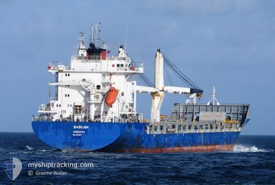
BASILISK
General Cargo
Current Trip
CVMIN
| Time Travelled | 10 days |
|---|---|
| Remaining Time | --- |
| Distance Travelled | 3089.44 nm |
| Remaining Distance | --- |
| AVG Speed | 15 Knots |
| MAX Speed | 16.5 Knots |
| AVG Wind | 18 knots |
| MAX Wind | 26.5 knots |
| MIN Temp | 9.2°C / 48.56°F |
| MAX Temp | 29.7°C / 85.46°F |
| Draught | 7.9 m |
| Position Received | 5 d ago |
Current Position
| Longitude | -25.01393° |
|---|---|
| Latitude | 16.89929° |
| Status | Under way using engine |
| Speed | 4.7 Knots |
| Course | 134° |
| Area | North Atlantic Ocean |
| Station | T-AIS |
| Position Received | 5 d ago |
Info
Information
The current position of BASILISK is in North Atlantic Ocean with coordinates 16.89929° / -25.01393° as reported on 2024-05-01 17:18 by AIS to our vessel tracker app. The vessel's current speed is 4.7 Knots
The vessel BASILISK (IMO: 9539377, MMSI: 636022571) is a General Cargo that was built in 2012 ( 12 years old ). It's sailing under the flag of [LR] Liberia.
In this page you can find informations about the vessels current position, last detected port calls, and current voyage information. If the vessels is not in coverage by AIS you will find the latest position.
The current position of BASILISK is detected by our AIS receivers and we are not responsible for the reliability of the data. The last position was recorded while the vessel was in Coverage by the Ais receivers of our vessel tracking app.
The current draught of BASILISK as reported by AIS is 7.9 meters
Weather
| Temperature | 27.2°C / 80.96°F |
|---|---|
| Wind Speed | 10 knots |
| Direction | 138° SE |
| Pressure | 1009.8 hPa |
| Humidity | 84.9 % |
| Cloud Coverage | 47 % |
Featured Company
Last Port Calls
| Port | Arrival | Departure | Time In Port |
|---|---|---|---|
| 2024-04-26 09:16 | 2024-04-26 19:20 | 10 h | |
| 2024-04-21 08:13 | 2024-04-23 09:54 | 2 d | |
| 2024-04-18 16:14 | 2024-04-18 16:58 | 44 m | |
| 2024-04-16 22:33 | 2024-04-17 15:47 | 17 h | |
| 2024-04-14 22:13 | 2024-04-14 22:19 | 5 m | |
| 2024-04-10 05:28 | 2024-04-11 15:26 | 1 d | |
| 2024-04-06 11:21 | 2024-04-09 11:25 | 3 d | |
| 2024-03-15 13:08 | 2024-03-27 00:51 | 11 d |
Most Visited Ports (Last year)
| Port | Arrivals | |
|---|---|---|
| 2 | ||
| 1 | ||
| 1 | ||
| 1 | ||
| 1 | ||
| 1 |
Last Trips
| Origin | Departure | Destination | Arrival | Distance | |
|---|---|---|---|---|---|
| 2024-04-23 11:54 | 2024-04-26 11:16 | 934.26 nm | |||
| 2024-04-18 18:58 | 2024-04-21 10:13 | 380.08 nm | |||
| 2024-04-17 17:47 | 2024-04-18 18:14 | 360.13 nm | |||
| 2024-04-15 00:19 | 2024-04-17 00:33 | 360.34 nm | |||
| 2024-04-11 17:26 | 2024-04-15 00:13 | 1064.09 nm | |||
| 2024-04-09 13:25 | 2024-04-10 07:28 | 261.05 nm | |||
| 2024-03-26 20:51 | 2024-04-06 13:21 | 3767.16 nm | |||
| 2023-12-29 08:52 | 2024-03-15 09:08 | 1243.52 nm |
Events
| Time | Event | Details | Position / Dest | Info |
|---|---|---|---|---|
| 2024-05-01 17:50 | STOP Moving |
16.88850 / -25.00633
CVMIN
|
Speed: 0.1 kn Course: 30° |
|
| 2024-05-01 17:44 | Status Changed | Default Under way using engine |
16.88900 / -25.00683
CVMIN
|
Speed: 4.7 kn Course: 134° |
| 2024-05-01 17:18 | OUT of Coverage |
16.89929 / -25.01393
North Atlantic Ocean
CVMIN
|
Speed: 4.7 kn Course: 140° |
|
| 2024-05-01 16:47 | Status Changed | Under way using engine Default |
16.94650 / -25.01850
CVMIN
|
Speed: 11.8 kn Course: 221° |
| 2024-05-01 16:31 | IN Coverage |
16.94650 / -25.01850
North Atlantic Ocean
CVMIN
|
Speed: 11.4 kn Course: 214° |
|
| 2024-05-01 11:23 | Status Changed | Default Under way using engine |
17.96350 / -24.13433
CVMIN
|
Speed: 15.2 kn Course: 219° |
| 2024-05-01 10:56 | OUT of Coverage |
18.07543 / -24.03623
North Atlantic Ocean
CVMIN
|
Speed: 15.2 kn Course: 219° |
|
| 2024-05-01 10:22 | Status Changed | Under way using engine Default |
18.18650 / -23.94133
CVMIN
|
Speed: 15.1 kn Course: 219° |
| 2024-05-01 10:17 | Status Changed | Default Under way using engine |
18.17950 / -23.94733
CVMIN
|
Speed: 15.8 kn Course: 221° |
| 2024-05-01 09:27 | Status Changed | Under way using engine Default |
18.36667 / -23.78083
CVMIN
|
Speed: 15.5 kn Course: 221° |