
BARBARA
Not available
Current Trip
| Time Travelled | 5 days |
|---|---|
| Remaining Time | --- |
| Distance Travelled | 395.24 nm |
| Remaining Distance | --- |
| AVG Speed | 11.4 Knots |
| MAX Speed | 15.2 Knots |
| AVG Wind | 15.5 knots |
| MAX Wind | 18.8 knots |
| MIN Temp | 25.5°C / 77.9°F |
| MAX Temp | 26.8°C / 80.24°F |
| Draught | 4 m |
| Position Received | 16 h, 33 m ago |
Current Position
| Longitude | --- |
|---|---|
| Latitude | --- |
| Status | Under way using engine |
| Speed | 14.2 Knots |
| Course | 233.1° |
| Area | Caribbean Sea |
| Station | T-AIS |
| Position Received | 16 h, 33 m ago |
Info
Information
The current position of BARBARA is in Caribbean Sea with coordinates 17.66015° / -63.72585° as reported on 2026-02-22 17:40 by AIS to our vessel tracker app. The vessel's current speed is 14.2 Knots and is heading at the port of WILLEMSTAD.
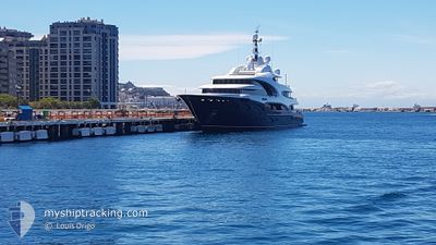
The vessel BARBARA (MMSI: 319104200) is a Not available It's sailing under the flag of [KY] Cayman Is.
In this page you can find informations about the vessels current position, last detected port calls, and current voyage information. If the vessels is not in coverage by AIS you will find the latest position.
The current position of BARBARA is detected by our AIS receivers and we are not responsible for the reliability of the data. The last position was recorded while the vessel was in Coverage by the Ais receivers of our vessel tracking app.
The current draught of BARBARA as reported by AIS is 4 meters
Weather
| Temperature | 26.2°C / 79.16°F |
|---|---|
| Wind Speed | 16 knots |
| Direction | 102° ESE |
| Pressure | 1017.4 hPa |
| Humidity | 68.1 % |
| Cloud Coverage | 39 % |
Featured Company
Last Port Calls
| Port | Arrival | Departure | Time In Port |
|---|---|---|---|
| 2026-02-17 08:47 | 2026-02-17 17:52 | 9 h | |
| 2026-01-20 12:22 | 2026-02-09 15:13 | 20 d | |
| 2026-01-05 11:34 | 2026-01-14 10:10 | 8 d | |
| 2025-12-19 08:18 | 2025-12-22 10:50 | 3 d | |
| 2025-12-05 07:36 | 2025-12-19 07:30 | 13 d |
Last Trips
| Origin | Departure | Destination | Arrival | Distance | |
|---|---|---|---|---|---|
| 2026-02-09 15:13 | 2026-02-17 08:47 | 626.86 nm | |||
| 2026-01-14 10:10 | 2026-01-20 12:22 | 420.53 nm | |||
| 2025-12-22 10:50 | 2026-01-05 11:34 | 574.67 nm | |||
| 2025-12-19 07:30 | 2025-12-19 08:18 | 2.47 nm | |||
| 2025-11-27 16:43 | 2025-12-05 07:36 | 1496.19 nm |
Events
| Time | Event | Details | Position / Dest | Info |
|---|---|---|---|---|
| 2026-02-22 17:40 | OUT of Coverage |
17.66015 / -63.72585
Caribbean Sea
|
Speed: 14.2 kn Course: 233.1° |
|
| 2026-02-22 15:53 | Change Sea Area | Saba part of the Caribbean Sea Saint-Martin part of the Caribbean Sea |
17.88730 / -63.36870
Caribbean Sea
|
Speed: 14 kn Course: 238.2° |
| 2026-02-22 15:08 | Change Sea Area | Saint-Martin part of the Caribbean Sea Sint-Maarten part of the Caribbean Sea |
17.97318 / -63.20813
Caribbean Sea
|
Speed: 14.3 kn Course: 240.4° |
| 2026-02-22 14:39 | START Moving | --- |
18.03215 / -63.11093
WILLEMSTAD, CUR
|
Speed: 4.2 kn Course: 200° |
| 2026-02-22 14:17 | Status Changed | Under way using engine At anchor |
18.03387 / -63.11126
WILLEMSTAD, CUR
|
Speed: 0.4 kn Course: 109° |
| 2026-02-22 13:07 | Destination Changed | WILLEMSTAD, CUR SIMPSON BAY, SXM |
18.03348 / -63.11105
WILLEMSTAD, CUR
|
Speed: Course: 113° |
| 2026-02-22 10:54 | Status Changed | At anchor Under way using engine |
18.03383 / -63.11075
SIMPSON BAY, SXM
|
Speed: 0.7 kn Course: 97° |
| 2026-02-22 10:51 | STOP Moving | --- |
18.03388 / -63.11042
SIMPSON BAY, SXM
|
Speed: Course: 88° |
| 2026-02-22 10:08 | Change Sea Area | Sint-Maarten part of the Caribbean Sea Saint-Martin part of the Caribbean Sea |
17.95217 / -63.02783
Caribbean Sea
|
Speed: 15 kn Course: 300° |
| 2026-02-22 09:33 | Destination Changed | SIMPSON BAY, SXM GUSTAUNG |
17.89062 / -62.88898
SIMPSON BAY, SXM
|
Speed: 14 kn Course: 290.5° |