
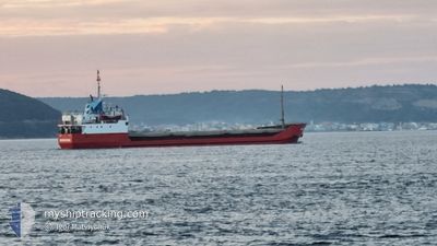
BARACUDA
General Cargo
Current Trip
| Time Travelled | 2 days |
|---|---|
| Remaining Time | --- |
| Distance Travelled | 344.31 nm |
| Remaining Distance | --- |
| AVG Speed | 6.5 Knots |
| MAX Speed | 7.5 Knots |
| AVG Wind | 10.1 knots |
| MAX Wind | 27.5 knots |
| MIN Temp | 19.5°C / 67.1°F |
| MAX Temp | 29.5°C / 85.1°F |
| Draught | 3.5 m |
| Position Received | 51 m ago |
Current Position
| Longitude | 29.39201° |
|---|---|
| Latitude | 36.14737° |
| Status | Under way using engine |
| Speed | 4.3 Knots |
| Course | 296.5° |
| Area | Mediterranean Sea - Eastern Basin |
| Station | T-AIS |
| Position Received | 51 m ago |
Info
Information
The current position of BARACUDA is in Mediterranean Sea - Eastern Basin with coordinates 36.14737° / 29.39201° as reported on 2024-05-02 16:28 by AIS to our vessel tracker app. The vessel's current speed is 4.3 Knots and is heading at the port of BATUMI. The estimated time of arrival as calculated by MyShipTracking vessel tracking app is 2024-05-10 15:00 LT
The vessel BARACUDA (IMO: 7514440, MMSI: 671370100) is a General Cargo that was built in 1977 ( 47 years old ). It's sailing under the flag of [TG] Togo.
In this page you can find informations about the vessels current position, last detected port calls, and current voyage information. If the vessels is not in coverage by AIS you will find the latest position.
The current position of BARACUDA is detected by our AIS receivers and we are not responsible for the reliability of the data. The last position was recorded while the vessel was in Coverage by the Ais receivers of our vessel tracking app.
The current draught of BARACUDA as reported by AIS is 3.5 meters
Weather
| Temperature | 20.5°C / 68.9°F |
|---|---|
| Wind Speed | 19 knots |
| Direction | 308° NW |
| Pressure | 1006.6 hPa |
| Humidity | 74.6 % |
| Cloud Coverage | --- |
Featured Company
Last Port Calls
| Port | Arrival | Departure | Time In Port |
|---|---|---|---|
| 2024-04-29 18:12 | 2024-04-30 12:28 | 18 h | |
| 2024-04-15 08:40 | 2024-04-27 14:44 | 12 d | |
| 2024-03-30 10:51 | 2024-04-01 07:51 | 1 d | |
| 2024-03-23 22:38 | 2024-03-25 15:09 | 1 d | |
| 2024-03-21 07:19 | 2024-03-22 20:25 | 1 d | |
| 2024-03-08 04:49 |
Most Visited Ports (Last year)
| Port | Arrivals | |
|---|---|---|
| 4 | ||
| 4 | ||
| 2 | ||
| 2 | ||
| 1 | ||
| 1 |
Last Trips
| Origin | Departure | Destination | Arrival | Distance | |
|---|---|---|---|---|---|
| 2024-04-27 17:44 | 2024-04-29 21:12 | 178.32 nm | |||
| 2024-04-01 09:51 | 2024-04-15 11:40 | 285.94 nm | |||
| 2024-03-25 17:09 | 2024-03-30 12:51 | 245.28 nm | |||
| 2024-03-22 22:25 | 2024-03-24 00:38 | 11.04 nm | |||
| 2024-03-08 06:49 | 2024-03-21 09:19 | 1121.82 nm |
Events
| Time | Event | Details | Position / Dest | Info |
|---|---|---|---|---|
| 2024-05-02 16:42 | Status Changed | Default Under way using engine |
36.15402 / 29.37152
GE BUS
|
Speed: 4.3 kn Course: 296.5° |
| 2024-05-02 16:28 | Change Sea Area | Turkish part of the Mediterranean Sea - Eastern Basin Greek part of the Mediterranean Sea - Eastern Basin |
36.14737 / 29.39201
Mediterranean Sea - Eastern Basin
GE BUS
|
Speed: 4.3 kn Course: 296.5° |
| 2024-05-02 16:28 | Status Changed | Under way using engine Default |
36.14737 / 29.39201
GE BUS
|
Speed: 4 kn Course: -1° |
| 2024-05-02 16:00 | Status Changed | Default Under way using engine |
36.13334 / 29.43500
GE BUS
|
Speed: 4.6 kn Course: 286.9° |
| 2024-05-02 15:51 | Status Changed | Under way using engine Default |
36.13112 / 29.44931
GE BUS
|
Speed: 4.6 kn Course: -1° |
| 2024-05-02 15:51 | IN Coverage |
36.13112 / 29.44931
Mediterranean Sea - Eastern Basin
GE BUS
|
Speed: 4.6 kn Course: 286.9° |
|
| 2024-05-02 14:34 | Status Changed | Default Under way using engine |
36.09443 / 29.56768
GE BUS
|
Speed: 4.8 kn Course: 298° |
| 2024-05-02 14:28 | OUT of Coverage |
36.09121 / 29.57619
Mediterranean Sea - Eastern Basin
GE BUS
|
Speed: 4.8 kn Course: 298° |
|
| 2024-05-02 13:55 | Change Sea Area | Greek part of the Mediterranean Sea - Eastern Basin Turkish part of the Mediterranean Sea - Eastern Basin |
36.07211 / 29.62690
Mediterranean Sea - Eastern Basin
GE BUS
|
Speed: 4.9 kn Course: 292.5° |
| 2024-05-02 12:31 | Status Changed | Under way using engine Default |
36.02664 / 29.75207
GE BUS
|
Speed: 4 kn Course: -1° |