
BALTSUND
Tug
Current Trip
GUARDVESSEL F MIRA A
| Time Travelled | 3 days |
|---|---|
| Remaining Time | --- |
| Distance Travelled | 6.05 nm |
| Remaining Distance | --- |
| AVG Speed | 7.4 Knots |
| MAX Speed | 8.4 Knots |
| AVG Wind | 9 knots |
| MAX Wind | 11 knots |
| MIN Temp | 2.3°C / 36.14°F |
| MAX Temp | 3.8°C / 38.84°F |
| Draught | 2.7 m |
| Position Received | 1 m ago |
Current Position
| Longitude | --- |
|---|---|
| Latitude | --- |
| Status | At anchor |
| Speed | |
| Course | --- |
| Area | Kattegat |
| Station | T-AIS |
| Position Received | 1 m ago |
Info
Information
The current position of BALTSUND is in Kattegat with coordinates 55.73624° / 12.62603° as reported on 2025-03-17 17:10 by AIS to our vessel tracker app. The vessel's current speed is 0 Knots
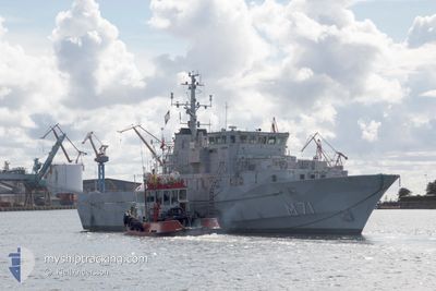
The vessel BALTSUND (IMO: 9136307, MMSI: 220466000) is a Tug that was built in 1996 ( 29 years old ). It's sailing under the flag of [DK] Denmark.
In this page you can find informations about the vessels current position, last detected port calls, and current voyage information. If the vessels is not in coverage by AIS you will find the latest position.
The current position of BALTSUND is detected by our AIS receivers and we are not responsible for the reliability of the data. The last position was recorded while the vessel was in Coverage by the Ais receivers of our vessel tracking app.
The current draught of BALTSUND as reported by AIS is 2.7 meters
Weather
| Temperature | 3.2°C / 37.76°F |
|---|---|
| Wind Speed | 9 knots |
| Direction | 300° WNW |
| Pressure | 1030.6 hPa |
| Humidity | 50 % |
| Cloud Coverage | --- |
Featured Company
Last Port Calls
| Port | Arrival | Departure | Time In Port |
|---|---|---|---|
| 2025-03-14 15:22 | 2025-03-14 15:54 | 32 m | |
| 2025-03-13 12:33 | 2025-03-13 12:40 | 6 m | |
| 2025-03-13 09:22 | 2025-03-13 09:35 | 13 m | |
| 2025-03-11 07:37 | 2025-03-11 15:32 | 7 h | |
| 2025-03-08 18:22 | 2025-03-08 19:07 | 44 m | |
| 2025-03-08 13:41 | 2025-03-08 14:00 | 19 m | |
| 2025-03-07 17:22 | 2025-03-07 17:31 | 8 m | |
| 2025-03-07 13:51 | 2025-03-07 14:27 | 35 m | |
| 2025-03-07 08:19 | 2025-03-07 12:31 | 4 h | |
| 2025-03-06 09:37 | 2025-03-06 09:47 | 9 m |
Last Trips
| Origin | Departure | Destination | Arrival | Distance | |
|---|---|---|---|---|---|
| 2025-03-13 12:40 | 2025-03-14 15:22 | 7.48 nm | |||
| 2025-03-13 09:35 | 2025-03-13 12:33 | 3.48 nm | |||
| 2025-03-11 15:32 | 2025-03-13 09:22 | 11.21 nm | |||
| 2025-03-08 19:07 | 2025-03-11 07:37 | 10.66 nm | |||
| 2025-03-08 14:00 | 2025-03-08 18:22 | 8.31 nm | |||
| 2025-03-07 17:31 | 2025-03-08 13:41 | 11.47 nm | |||
| 2025-03-07 14:27 | 2025-03-07 17:22 | 9.43 nm | |||
| 2025-03-07 12:31 | 2025-03-07 13:51 | 7.15 nm | |||
| 2025-03-06 09:47 | 2025-03-07 08:19 | 18.97 nm | |||
| 2025-03-04 17:19 | 2025-03-06 09:37 | 18.34 nm |
Events
| Time | Event | Details | Position / Dest | Info |
|---|---|---|---|---|
| 2025-03-17 14:52 | Status Changed | At anchor Under way using engine |
55.73600 / 12.62557
GUARDVESSEL F MIRA A
|
Speed: 0.2 kn Course: 511° |
| 2025-03-17 14:50 | STOP Moving | 2.33 nm, North of COPENHAGEN |
55.73582 / 12.62584
GUARDVESSEL F MIRA A
|
Speed: 0.3 kn Course: 511° |
| 2025-03-17 14:14 | START Moving | 2.18 nm, South East of COPENHAGEN |
55.67074 / 12.64707
GUARDVESSEL F MIRA A
|
Speed: 6.8 kn Course: 75.6° |
| 2025-03-17 14:12 | Status Changed | Under way using engine Moored |
55.67078 / 12.64385
GUARDVESSEL F MIRA A
|
Speed: 2.7 kn Course: 511° |
| 2025-03-17 13:35 | Status Changed | Moored Default |
55.67083 / 12.64159
GUARDVESSEL F MIRA A
|
Speed: Course: -1° |
| 2025-03-17 13:32 | Status Changed | Default Moored |
55.67084 / 12.64161
GUARDVESSEL F MIRA A
|
Speed: Course: 511° |
| 2025-03-16 16:35 | Status Changed | Moored Default |
55.67079 / 12.64163
GUARDVESSEL F MIRA A
|
Speed: Course: -1° |
| 2025-03-16 16:32 | Status Changed | Default Moored |
55.67081 / 12.64157
GUARDVESSEL F MIRA A
|
Speed: Course: 511° |
| 2025-03-15 08:53 | Status Changed | Moored Default |
55.67090 / 12.64161
GUARDVESSEL F MIRA A
|
Speed: Course: -1° |
| 2025-03-15 08:47 | Status Changed | Default Moored |
55.67088 / 12.64159
GUARDVESSEL F MIRA A
|
Speed: Course: 511° |