
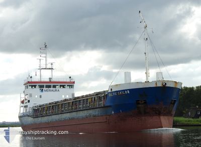
BALTIC SAILOR
General Cargo
Current Trip
| Time Travelled | 1 day |
|---|---|
| Remaining Time | --- |
| Distance Travelled | 170.08 nm |
| Remaining Distance | --- |
| AVG Speed | 9.4 Knots |
| MAX Speed | 10.4 Knots |
| AVG Wind | 9.8 knots |
| MAX Wind | 16.8 knots |
| MIN Temp | 7.7°C / 45.86°F |
| MAX Temp | 11.9°C / 53.42°F |
| Draught | 3.6 m |
| Position Received | 22 h, 53 m ago |
Current Position
| Longitude | --- |
|---|---|
| Latitude | --- |
| Status | Under way using engine |
| Speed | 0.3 Knots |
| Course | 7° |
| Area | Baltic Sea |
| Station | T-AIS |
| Position Received | 22 h, 53 m ago |
Info
Information
The current position of BALTIC SAILOR is in Baltic Sea with coordinates 53.48936° / 14.61636° as reported on 2025-12-10 11:57 by AIS to our vessel tracker app. The vessel's current speed is 0.3 Knots
The vessel BALTIC SAILOR (IMO: 9138214, MMSI: 275513000) is a General Cargo that was built in 1998 ( 27 years old ). It's sailing under the flag of [LV] Latvia.
In this page you can find informations about the vessels current position, last detected port calls, and current voyage information. If the vessels is not in coverage by AIS you will find the latest position.
The current position of BALTIC SAILOR is detected by our AIS receivers and we are not responsible for the reliability of the data. The last position was recorded while the vessel was in Coverage by the Ais receivers of our vessel tracking app.
The current draught of BALTIC SAILOR as reported by AIS is 3.6 meters
Weather
| Temperature | 9.1°C / 48.38°F |
|---|---|
| Wind Speed | 10 knots |
| Direction | 245° WSW |
| Pressure | 1019.8 hPa |
| Humidity | 75 % |
| Cloud Coverage | 61 % |
Featured Company
Last Port Calls
| Port | Arrival | Departure | Time In Port |
|---|---|---|---|
| 2025-12-07 18:32 | 2025-12-09 19:17 | 2 d | |
| 2025-12-03 00:01 | 2025-12-04 20:29 | 1 d | |
| 2025-11-29 11:38 | 2025-12-02 19:22 | 3 d | |
| 2025-11-19 22:25 | 2025-11-22 03:08 | 2 d | |
| 2025-11-18 08:58 | 2025-11-19 18:04 | 1 d | |
| 2025-11-14 15:53 | 2025-11-15 18:15 | 1 d | |
| 2025-11-08 12:12 | 2025-11-10 18:44 | 2 d | |
| 2025-11-02 17:47 | 2025-11-04 20:39 | 2 d | |
| 2025-10-30 17:05 | 2025-10-31 18:21 | 1 d | |
| 2025-10-25 09:58 | 2025-10-29 14:33 | 4 d |
Last Trips
| Origin | Departure | Destination | Arrival | Distance | |
|---|---|---|---|---|---|
| 2025-12-04 20:29 | 2025-12-07 18:32 | 638.47 nm | |||
| 2025-12-02 19:22 | 2025-12-03 00:01 | 39.63 nm | |||
| 2025-11-22 03:08 | 2025-11-29 11:38 | 766.00 nm | |||
| 2025-11-19 18:04 | 2025-11-19 22:25 | 37.27 nm | |||
| 2025-11-15 18:15 | 2025-11-18 08:58 | 476.46 nm | |||
| 2025-11-10 18:44 | 2025-11-14 15:53 | 435.38 nm | |||
| 2025-11-04 20:39 | 2025-11-08 12:12 | 811.03 nm | |||
| 2025-10-31 18:21 | 2025-11-02 17:47 | 278.32 nm | |||
| 2025-10-29 14:33 | 2025-10-30 17:05 | 224.81 nm | |||
| 2025-10-21 16:51 | 2025-10-25 09:58 | 652.57 nm |
Events
| Time | Event | Details | Position / Dest | Info |
|---|---|---|---|---|
| 2025-12-10 12:01 | Status Changed | Default Under way using engine |
53.48965 / 14.61612
PLSZZ
|
Speed: 0.3 kn Course: 7° |
| 2025-12-10 11:57 | STOP Moving | 4.28 nm, North East of SZCZECIN |
53.48936 / 14.61636
PLSZZ
|
Speed: 0.3 kn Course: 7° |
| 2025-12-10 11:57 | OUT of Coverage |
53.48936 / 14.61636
Baltic Sea
PLSZZ
|
Speed: 0.3 kn Course: 336.3° |
|
| 2025-12-10 11:21 | Status Changed | Under way using engine Default |
53.54130 / 14.62698
PLSZZ
|
Speed: 10 kn Course: 135° |
| 2025-12-10 11:17 | Status Changed | Default Under way using engine |
53.54934 / 14.61364
PLSZZ
|
Speed: 9.8 kn Course: 176° |
| 2025-12-10 11:01 | Status Changed | Under way using engine Default |
53.58915 / 14.59461
PLSZZ
|
Speed: 9.9 kn Course: 169° |
| 2025-12-10 10:48 | Status Changed | Default Under way using engine |
53.62264 / 14.58326
PLSZZ
|
Speed: 10 kn Course: 148.5° |
| 2025-12-10 10:31 | Status Changed | Under way using engine Default |
53.65878 / 14.53960
PLSZZ
|
Speed: 10.1 kn Course: 142° |
| 2025-12-10 10:31 | IN Coverage |
53.65878 / 14.53960
Baltic Sea
PLSZZ
|
Speed: 9.7 kn Course: 142.1° |
|
| 2025-12-09 22:07 | OUT of Coverage |
55.44334 / 14.57031
Baltic Sea
PLSZZ
|
Speed: 9.9 kn Course: 214.3° |