
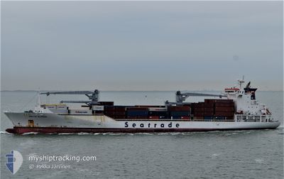
BALTIC KLIPPER
Reefer
Current Trip
| Time Travelled | 7 h, 16 mins |
|---|---|
| Remaining Time | 10 h, 8 mins |
| Distance Travelled | 83.76 nm |
| Remaining Distance | 126.83 nm |
| AVG Speed | 10.8 Knots |
| MAX Speed | 15 Knots |
| AVG Wind | 26.8 knots |
| MAX Wind | 31 knots |
| MIN Temp | 5.3°C / 41.54°F |
| MAX Temp | 12.1°C / 53.78°F |
| Draught | 9.3 m |
| Position Received | Now |
Current Position
| Longitude | --- |
|---|---|
| Latitude | --- |
| Status | Under way using engine |
| Speed | 13 Knots |
| Course | 228.6° |
| Area | North Sea |
| Station | T-AIS |
| Position Received | Now |
Info
Information
The current position of BALTIC KLIPPER is in North Sea with coordinates 51.15391° / 1.61650° as reported on 2025-12-06 06:17 by AIS to our vessel tracker app. The vessel's current speed is 13 Knots and is heading at the port of PORTSMOUTH. The estimated time of arrival as calculated by MyShipTracking vessel tracking app is 2025-12-06 16:26 LT
The vessel BALTIC KLIPPER (IMO: 9454759, MMSI: 636014655) is a Reefer that was built in 2010 ( 15 years old ). It's sailing under the flag of [LR] Liberia.
In this page you can find informations about the vessels current position, last detected port calls, and current voyage information. If the vessels is not in coverage by AIS you will find the latest position.
The current position of BALTIC KLIPPER is detected by our AIS receivers and we are not responsible for the reliability of the data. The last position was recorded while the vessel was in Coverage by the Ais receivers of our vessel tracking app.
The current draught of BALTIC KLIPPER as reported by AIS is 9.3 meters
Weather
| Temperature | 10.6°C / 51.08°F |
|---|---|
| Wind Speed | 22 knots |
| Direction | 229° SW |
| Pressure | 995.7 hPa |
| Humidity | 87.7 % |
| Cloud Coverage | 84 % |
Featured Company
Last Port Calls
| Port | Arrival | Departure | Time In Port |
|---|---|---|---|
| 2025-12-04 12:04 | 2025-12-05 23:02 | 1 d | |
| 2025-11-23 02:51 | 2025-11-25 01:01 | 1 d | |
| 2025-11-21 03:21 | 2025-11-21 17:11 | 13 h | |
| 2025-11-18 06:13 | 2025-11-20 08:50 | 2 d | |
| 2025-11-16 09:17 | 2025-11-16 22:53 | 13 h | |
| 2025-11-14 14:08 | 2025-11-15 02:21 | 12 h | |
| 2025-11-13 10:10 | 2025-11-13 23:46 | 13 h | |
| 2025-11-11 16:04 | 2025-11-12 02:19 | 10 h | |
| 2025-11-01 07:37 | 2025-11-02 23:46 | 1 d | |
| 2025-10-30 02:04 | 2025-10-31 18:31 | 1 d |
Most Visited Ports (Last year)
| Port | Arrivals | |
|---|---|---|
| 11 | ||
| 10 | ||
| 10 | ||
| 10 | ||
| 10 | ||
| 10 |
Last Trips
| Origin | Departure | Destination | Arrival | Distance | |
|---|---|---|---|---|---|
| 2025-11-24 21:01 | 2025-12-04 13:04 | 4278.45 nm | |||
| 2025-11-21 12:11 | 2025-11-22 22:51 | 649.86 nm | |||
| 2025-11-20 03:50 | 2025-11-20 22:21 | 284.25 nm | |||
| 2025-11-16 18:53 | 2025-11-18 01:13 | 619.16 nm | |||
| 2025-11-14 22:21 | 2025-11-16 05:17 | 517.64 nm | |||
| 2025-11-13 19:46 | 2025-11-14 10:08 | 271.47 nm | |||
| 2025-11-11 22:19 | 2025-11-13 06:10 | 180.93 nm | |||
| 2025-11-02 23:46 | 2025-11-11 12:04 | 3682.57 nm | |||
| 2025-10-31 19:31 | 2025-11-01 07:37 | 208.93 nm | |||
| 2025-10-20 23:36 | 2025-10-30 03:04 | 3997.89 nm |
Events
| Time | Event | Details | Position / Dest | Info |
|---|---|---|---|---|
| 2025-12-06 04:23 | Change Sea Area | United Kingdom part of the North Sea French part of the North Sea |
51.40261 / 2.05711
North Sea
GBPME
|
Speed: 15 kn Course: 292.7° |
| 2025-12-06 03:32 | Change Sea Area | French part of the North Sea Belgian part of the North Sea |
51.34414 / 2.33786
North Sea
GBPME
|
Speed: 12.5 kn Course: 248.8° |
| 2025-12-06 00:17 | Change Sea Area | Belgian part of the North Sea Dutch part of the North Sea |
51.40952 / 3.31729
North Sea
GBPME
|
Speed: 10.7 kn Course: 278.2° |
| 2025-12-05 23:02 | PORT DEPARTURE |
|
51.44669 / 3.67139
GBPME
|
Speed: 10.5 kn Course: 224° |
| 2025-12-05 22:37 | START Moving |
51.47179 / 3.70759
[NL] VLISSINGEN
|
Speed: 3.1 kn Course: 339° |
|
| 2025-12-05 22:22 | Status Changed | Under way using engine Moored |
51.47773 / 3.70349
[NL] VLISSINGEN
|
Speed: 0.6 kn Course: 239° |
| 2025-12-05 21:23 | Draught Changed | 9.3 9.4 |
51.47784 / 3.70286
[NL] VLISSINGEN
|
Speed: 0.1 kn Course: 239° |
| 2025-12-05 19:47 | Draught Changed | 9.4 9.7 |
51.47762 / 3.70297
[NL] VLISSINGEN
|
Speed: 0.1 kn Course: 239° |
| 2025-12-05 19:47 | ETA Changed | 2025/12/06 16:00 2025/12/06 10:00 |
51.47762 / 3.70297
[NL] VLISSINGEN
|
Speed: 0.1 kn Course: 239° |
| 2025-12-05 18:22 | Destination Changed | GBPME NL VLI |
51.47760 / 3.70296
[NL] VLISSINGEN
|
Speed: Course: 239° |