
BAKKEDAL
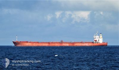
Cabu Carrier
Current Trip
| Time Travelled | 3 days |
|---|---|
| Remaining Time | --- |
| Distance Travelled | 1083.55 nm |
| Remaining Distance | --- |
| AVG Speed | 9.6 Knots |
| MAX Speed | 14.1 Knots |
| AVG Wind | 11.7 knots |
| MAX Wind | 25 knots |
| MIN Temp | 19°C / 66.2°F |
| MAX Temp | 27.4°C / 81.32°F |
| Draught | 11.7 m |
| Position Received | 3 d ago |
Current Position
| Longitude | 114.28538° |
|---|---|
| Latitude | -28.63642° |
| Status | Under way using engine |
| Speed | 12.7 Knots |
| Course | 308° |
| Area | Indian Ocean |
| Station | T-AIS |
| Position Received | 3 d ago |
Info
Information
The current position of BAKKEDAL is in Indian Ocean with coordinates -28.63642° / 114.28538° as reported on 2024-06-08 01:50 by AIS to our vessel tracker app. The vessel's current speed is 12.7 Knots and is heading at the port of QINGDAO. The estimated time of arrival as calculated by MyShipTracking vessel tracking app is 2024-06-20 12:00 LT
The vessel BAKKEDAL (IMO: 9308728, MMSI: 538002618) is a Cabu Carrier that was built in 2007 ( 17 years old ). It's sailing under the flag of [MH] Marshall Is.
In this page you can find informations about the vessels current position, last detected port calls, and current voyage information. If the vessels is not in coverage by AIS you will find the latest position.
The current position of BAKKEDAL is detected by our AIS receivers and we are not responsible for the reliability of the data. The last position was recorded while the vessel was in Coverage by the Ais receivers of our vessel tracking app.
The current draught of BAKKEDAL as reported by AIS is 11.7 meters
Weather
| Temperature | 26.5°C / 79.7°F |
|---|---|
| Wind Speed | 12 knots |
| Direction | 91° E |
| Pressure | 1014.1 hPa |
| Humidity | 65.2 % |
| Cloud Coverage | 59 % |
Featured Company
Last Trips
Events
| Time | Event | Details | Position / Dest | Info |
|---|---|---|---|---|
| 2024-06-08 01:55 | Status Changed | Default Under way using engine |
-28.62558 / 114.27032
CN QDG
|
Speed: 12.7 kn Course: 308° |
| 2024-06-08 01:50 | OUT of Coverage |
-28.63642 / 114.28538
Indian Ocean
CN QDG
|
Speed: 12.7 kn Course: 308° |
|
| 2024-06-08 01:49 | Status Changed | Under way using engine Default |
-28.63847 / 114.28818
CN QDG
|
Speed: 13.3 kn Course: 309° |
| 2024-06-08 01:36 | Status Changed | Default Under way using engine |
-28.67102 / 114.33297
CN QDG
|
Speed: 12.6 kn Course: 308° |
| 2024-06-08 01:25 | Status Changed | Under way using engine Default |
-28.69380 / 114.36512
CN QDG
|
Speed: 11.8 kn Course: 307° |
| 2024-06-08 01:19 | Status Changed | Default Under way using engine |
-28.70767 / 114.38586
CN QDG
|
Speed: 10.9 kn Course: 302° |
| 2024-06-07 23:26 | PORT DEPARTURE |
|
-28.76228 / 114.60065
CN QDG
|
Speed: 4.8 kn Course: 340° |
| 2024-06-07 23:20 | START Moving |
-28.76967 / 114.60037
[AU] GERALDTON
|
Speed: 3.1 kn Course: 5° |
|
| 2024-06-07 22:51 | Status Changed | Under way using engine Moored |
-28.77590 / 114.59373
[AU] GERALDTON
|
Speed: Course: 21° |
| 2024-06-07 22:13 | Status Changed | Moored Default |
-28.77583 / 114.59370
[AU] GERALDTON
|
Speed: Course: 20° |