
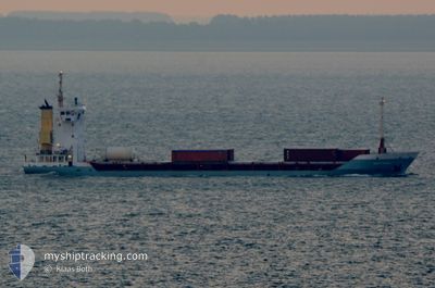
BABUN EXPRESS
General Cargo
Current Trip
DOPOP
| Time Travelled | 1 day |
|---|---|
| Remaining Time | --- |
| Distance Travelled | 159.23 nm |
| Remaining Distance | --- |
| AVG Speed | 6.6 Knots |
| MAX Speed | 10.7 Knots |
| AVG Wind | 16.4 knots |
| MAX Wind | 20 knots |
| MIN Temp | 19°C / 66.2°F |
| MAX Temp | 26.1°C / 78.98°F |
| Draught | 3.6 m |
| Position Received | 2 m ago |
Current Position
| Longitude | --- |
|---|---|
| Latitude | --- |
| Status | At anchor |
| Speed | |
| Course | 113° |
| Area | North Atlantic Ocean |
| Station | T-AIS |
| Position Received | 2 m ago |
Info
Information
The current position of BABUN EXPRESS is in North Atlantic Ocean with coordinates 21.71858° / -72.28194° as reported on 2026-01-07 13:01 by AIS to our vessel tracker app. The vessel's current speed is 0 Knots
The vessel BABUN EXPRESS (IMO: 9142667, MMSI: 334978000) is a General Cargo that was built in 1996 ( 30 years old ). It's sailing under the flag of [HN] Honduras.
In this page you can find informations about the vessels current position, last detected port calls, and current voyage information. If the vessels is not in coverage by AIS you will find the latest position.
The current position of BABUN EXPRESS is detected by our AIS receivers and we are not responsible for the reliability of the data. The last position was recorded while the vessel was in Coverage by the Ais receivers of our vessel tracking app.
The current draught of BABUN EXPRESS as reported by AIS is 3.6 meters
Weather
| Temperature | 25.4°C / 77.72°F |
|---|---|
| Wind Speed | 14 knots |
| Direction | 80° E |
| Pressure | 1017.4 hPa |
| Humidity | 64.1 % |
| Cloud Coverage | 15 % |
Featured Company
Last Port Calls
| Port | Arrival | Departure | Time In Port |
|---|---|---|---|
| 2026-01-05 23:37 | 2026-01-06 04:08 | 4 h | |
| 2026-01-02 19:54 | 2026-01-02 20:55 | 1 h | |
| 2025-12-27 21:28 | 2025-12-27 22:42 | 1 h | |
| 2025-12-23 06:31 | 2025-12-23 17:27 | 10 h | |
| 2025-12-19 21:13 | 2025-12-19 21:42 | 28 m | |
| 2025-12-16 01:46 | 2025-12-16 02:47 | 1 h | |
| 2025-12-11 03:58 | 2025-12-12 00:10 | 20 h | |
| 2025-12-06 22:08 | 2025-12-06 23:16 | 1 h | |
| 2025-12-05 19:27 | 2025-12-05 20:34 | 1 h | |
| 2025-12-01 07:52 | 2025-12-01 22:43 | 14 h |
Most Visited Ports (Last year)
| Port | Arrivals | |
|---|---|---|
| 49 | ||
| 16 | ||
| 6 | ||
| 2 | ||
| 2 |
Last Trips
| Origin | Departure | Destination | Arrival | Distance | |
|---|---|---|---|---|---|
| 2026-01-02 20:55 | 2026-01-05 23:37 | 712.85 nm | |||
| 2025-12-27 22:42 | 2026-01-02 19:54 | 5.10 nm | |||
| 2025-12-23 17:27 | 2025-12-27 21:28 | 742.89 nm | |||
| 2025-12-19 21:42 | 2025-12-23 06:31 | 711.39 nm | |||
| 2025-12-16 02:47 | 2025-12-19 21:13 | 6.68 nm | |||
| 2025-12-12 00:10 | 2025-12-16 01:46 | 961.79 nm | |||
| 2025-12-06 23:16 | 2025-12-11 03:58 | 938.92 nm | |||
| 2025-12-05 20:34 | 2025-12-06 22:08 | 4.75 nm | |||
| 2025-12-01 22:43 | 2025-12-05 19:27 | 926.46 nm | |||
| 2025-11-24 19:57 | 2025-12-01 07:52 | 953.11 nm |
Events
| Time | Event | Details | Position / Dest | Info |
|---|---|---|---|---|
| 2026-01-07 01:34 | Status Changed | At anchor Under way sailing |
21.71838 / -72.28203
DOPOP
|
Speed: Course: 95° |
| 2026-01-07 01:16 | STOP Moving |
21.71796 / -72.28099
DOPOP
|
Speed: 0.1 kn Course: 50° |
|
| 2026-01-06 22:28 | Status Changed | Under way sailing Default |
21.51825 / -72.38952
DOPOP
|
Speed: 9.3 kn Course: 4° |
| 2026-01-06 22:25 | Status Changed | Default Under way sailing |
21.51088 / -72.39007
DOPOP
|
Speed: 8.7 kn Course: 14.3° |
| 2026-01-06 22:14 | Status Changed | Under way sailing Default |
21.48164 / -72.39261
DOPOP
|
Speed: 9.6 kn Course: 311° |
| 2026-01-06 21:57 | Status Changed | Default Under way sailing |
21.44977 / -72.35949
DOPOP
|
Speed: 9.8 kn Course: 311.8° |
| 2026-01-06 21:18 | Detected in Sea | Turks and Caicos part of the North Atlantic Ocean |
21.38281 / -72.27756
North Atlantic Ocean
|
Speed: 9.8 kn Course: 311.8° |
| 2026-01-06 21:18 | Status Changed | Under way sailing Default |
21.38281 / -72.27756
DOPOP
|
Speed: 10.1 kn Course: 313° |
| 2026-01-06 21:18 | IN Coverage |
21.38281 / -72.27756
North Atlantic Ocean
|
Speed: 9.8 kn Course: 311.8° |
|
| 2026-01-06 08:08 | PORT DEPARTURE |
|
19.80939 / -70.69501
DOPOP
|
Speed: Course: 13° |