
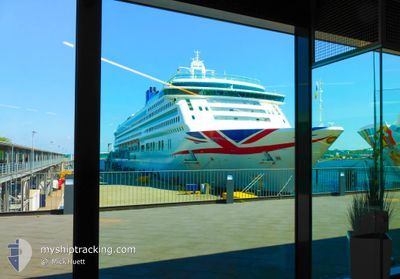
AURORA
Passengers Ship
Current Trip
PTFNC
| Time Travelled | 12 h, 20 mins |
|---|---|
| Remaining Time | --- |
| Distance Travelled | 202.83 nm |
| Remaining Distance | --- |
| AVG Speed | 17.7 Knots |
| MAX Speed | 18.4 Knots |
| AVG Wind | 13.8 knots |
| MAX Wind | 16.9 knots |
| MIN Temp | 17.3°C / 63.14°F |
| MAX Temp | 19.8°C / 67.64°F |
| Draught | 8.4 m |
| Position Received | 1 d ago |
Current Position
| Longitude | --- |
|---|---|
| Latitude | --- |
| Status | Under way using engine |
| Speed | 10.4 Knots |
| Course | 354.1° |
| Area | North Atlantic Ocean |
| Station | T-AIS |
| Position Received | 1 d ago |
Info
Information
The current position of AURORA is in North Atlantic Ocean with coordinates 31.94703° / -16.48227° as reported on 2024-12-01 00:51 by AIS to our vessel tracker app. The vessel's current speed is 10.4 Knots
The vessel AURORA (IMO: 9169524, MMSI: 310556000) is a Passengers Ship that was built in 2000 ( 24 years old ). It's sailing under the flag of [BM] Bermuda.
In this page you can find informations about the vessels current position, last detected port calls, and current voyage information. If the vessels is not in coverage by AIS you will find the latest position.
The current position of AURORA is detected by our AIS receivers and we are not responsible for the reliability of the data. The last position was recorded while the vessel was in Coverage by the Ais receivers of our vessel tracking app.
The current draught of AURORA as reported by AIS is 8.4 meters
Weather
| Temperature | 18°C / 64.4°F |
|---|---|
| Wind Speed | 11 knots |
| Direction | 16° NNE |
| Pressure | 1024.1 hPa |
| Humidity | 69.6 % |
| Cloud Coverage | 26 % |
Featured Company
Last Port Calls
| Port | Arrival | Departure | Time In Port |
|---|---|---|---|
| 2024-12-01 06:03 | 2024-12-01 17:58 | 11 h | |
| 2024-11-29 06:50 | 2024-11-29 20:51 | 14 h | |
| 2024-11-28 05:48 | 2024-11-28 18:29 | 12 h | |
| 2024-11-27 07:37 | 2024-11-27 19:06 | 11 h | |
| 2024-11-25 07:45 | 2024-11-25 17:03 | 9 h | |
| 2024-11-22 04:52 | 2024-11-22 17:14 | 12 h | |
| 2024-11-12 10:45 | 2024-11-13 01:05 | 14 h | |
| 2024-11-11 09:54 | 2024-11-11 22:01 | 12 h | |
| 2024-11-09 10:10 | 2024-11-09 21:18 | 11 h | |
| 2024-11-08 10:40 | 2024-11-08 21:55 | 11 h |
Last Trips
| Origin | Departure | Destination | Arrival | Distance | |
|---|---|---|---|---|---|
| 2024-11-29 20:51 | 2024-12-01 06:03 | 319.17 nm | |||
| 2024-11-28 18:29 | 2024-11-29 06:50 | 159.27 nm | |||
| 2024-11-27 19:06 | 2024-11-28 05:48 | 118.03 nm | |||
| 2024-11-25 17:03 | 2024-11-27 07:37 | 633.32 nm | |||
| 2024-11-22 17:14 | 2024-11-25 07:45 | 989.59 nm | |||
| 2024-11-12 21:05 | 2024-11-22 04:52 | 3700.99 nm | |||
| 2024-11-11 18:01 | 2024-11-12 06:45 | 113.57 nm | |||
| 2024-11-09 17:18 | 2024-11-11 05:54 | 444.75 nm | |||
| 2024-11-08 17:55 | 2024-11-09 06:10 | 117.32 nm | |||
| 2024-11-02 17:54 | 2024-11-08 06:40 | 2648.43 nm |
Events
| Time | Event | Details | Position / Dest | Info |
|---|---|---|---|---|
| 2024-12-01 18:17 | START Moving | 4.25 nm, South East of FUNCHAL |
32.61052 / -16.83090
PTFNC
|
Speed: 14 kn Course: 100° |
| 2024-12-01 17:58 | PORT DEPARTURE |
|
32.61052 / -16.83090
PTFNC
|
Speed: Course: 90° |
| 2024-12-01 06:33 | STOP Moving |
32.64223 / -16.90787
[PT] FUNCHAL
|
Speed: Course: 90° |
|
| 2024-12-01 06:03 | PORT ARRIVAL |
|
32.64223 / -16.90787
[PT] FUNCHAL
|
Speed: 4.9 kn Course: 7° |
| 2024-12-01 00:57 | Status Changed | Default Under way using engine |
31.96473 / -16.48383
PTFNC
|
Speed: 10.4 kn Course: 354.1° |
| 2024-12-01 00:51 | OUT of Coverage |
31.94703 / -16.48227
North Atlantic Ocean
PTFNC
|
Speed: 10.4 kn Course: 354.1° |
|
| 2024-12-01 00:49 | Status Changed | Under way using engine Default |
31.94088 / -16.48157
PTFNC
|
Speed: 10.4 kn Course: 356° |
| 2024-12-01 00:45 | Status Changed | Default Under way using engine |
31.93072 / -16.48043
PTFNC
|
Speed: 10.4 kn Course: 353.1° |
| 2024-12-01 00:39 | Status Changed | Under way using engine Default |
31.91337 / -16.47884
PTFNC
|
Speed: 10.2 kn Course: 355° |
| 2024-12-01 00:35 | Status Changed | Default Under way using engine |
31.90148 / -16.47760
PTFNC
|
Speed: 10.6 kn Course: 355° |