
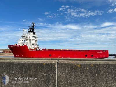
ATLANTICA CARRIER
Offshore Supply Ship
Current Trip
LEMAN FIELD
| Time Travelled | 1 day |
|---|---|
| Remaining Time | --- |
| Distance Travelled | 170.77 nm |
| Remaining Distance | --- |
| AVG Speed | 9.1 Knots |
| MAX Speed | 11.9 Knots |
| AVG Wind | 12.9 knots |
| MAX Wind | 22 knots |
| MIN Temp | 2.5°C / 36.5°F |
| MAX Temp | 4.5°C / 40.1°F |
| Draught | 4.7 m |
| Position Received | 1 m ago |
Current Position
| Longitude | --- |
|---|---|
| Latitude | --- |
| Status | Under way using engine |
| Speed | 8.7 Knots |
| Course | 179.5° |
| Area | North Sea |
| Station | T-AIS |
| Position Received | 1 m ago |
Info
Information
The current position of ATLANTICA CARRIER is in North Sea with coordinates 52.32123° / 2.37385° as reported on 2025-02-18 19:09 by AIS to our vessel tracker app. The vessel's current speed is 8.7 Knots
The vessel ATLANTICA CARRIER (IMO: 9365104, MMSI: 209644000) is a Offshore Supply Ship that was built in 2006 ( 19 years old ). It's sailing under the flag of [CY] Cyprus.
In this page you can find informations about the vessels current position, last detected port calls, and current voyage information. If the vessels is not in coverage by AIS you will find the latest position.
The current position of ATLANTICA CARRIER is detected by our AIS receivers and we are not responsible for the reliability of the data. The last position was recorded while the vessel was in Coverage by the Ais receivers of our vessel tracking app.
The current draught of ATLANTICA CARRIER as reported by AIS is 4.7 meters
Weather
| Temperature | 4.5°C / 40.1°F |
|---|---|
| Wind Speed | 22 knots |
| Direction | 124° SE |
| Pressure | 1021.7 hPa |
| Humidity | 56.9 % |
| Cloud Coverage | 93 % |
Featured Company
Last Port Calls
| Port | Arrival | Departure | Time In Port |
|---|---|---|---|
| 2025-02-15 08:13 | 2025-02-17 14:31 | 2 d | |
| 2025-02-13 10:36 |
Most Visited Ports (Last year)
| Port | Arrivals | |
|---|---|---|
| 42 | ||
| 8 | ||
| 5 | ||
| 4 | ||
| 3 | ||
| 3 |
Last Trips
| Origin | Departure | Destination | Arrival | Distance | |
|---|---|---|---|---|---|
| 2025-02-13 11:36 | 2025-02-15 09:13 | 261.45 nm |
Events
| Time | Event | Details | Position / Dest | Info |
|---|---|---|---|---|
| 2025-02-18 17:51 | IN Coverage |
52.50537 / 2.36762
North Sea
|
Speed: 8.9 kn Course: 176.6° |
|
| 2025-02-18 14:11 | OUT of Coverage |
53.00958 / 2.22077
North Sea
|
Speed: 8.7 kn Course: 106.9° |
|
| 2025-02-18 14:08 | START Moving |
53.00780 / 2.21252
LEMAN FIELD
|
Speed: 3.6 kn Course: 46° |
|
| 2025-02-18 13:51 | STOP Moving |
53.00706 / 2.21593
LEMAN FIELD
|
Speed: 0.3 kn Course: 73° |
|
| 2025-02-18 13:47 | IN Coverage |
53.00710 / 2.21596
North Sea
|
Speed: 0.6 kn Course: 32° |
|
| 2025-02-18 12:19 | OUT of Coverage |
53.00538 / 2.21431
North Sea
|
Speed: 0.6 kn Course: 20.3° |
|
| 2025-02-18 10:06 | IN Coverage |
53.00534 / 2.21346
North Sea
LEMAN FIELD
|
Speed: Course: 299° |
|
| 2025-02-18 05:58 | OUT of Coverage |
53.01049 / 2.20881
North Sea
LEMAN FIELD
|
Speed: 1.9 kn Course: 151.4° |
|
| 2025-02-18 05:22 | IN Coverage |
53.01539 / 2.22140
North Sea
LEMAN FIELD
|
Speed: 4.4 kn Course: 306° |
|
| 2025-02-18 03:53 | OUT of Coverage |
52.88392 / 2.31027
North Sea
LEMAN FIELD
|
Speed: 6.8 kn Course: 350.3° |