

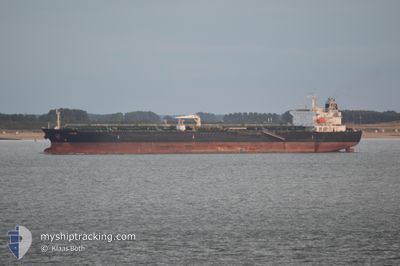
ATHIRI
Oil/Chemical Tanker

Current Trip
| Time Travelled | 9 days |
|---|---|
| Remaining Time | --- |
| Distance Travelled | 1717.11 nm |
| Remaining Distance | --- |
| AVG Speed | 10.2 Knots |
| MAX Speed | 11.6 Knots |
| AVG Wind | 13.7 knots |
| MAX Wind | 23.7 knots |
| MIN Temp | 22.9°C / 73.22°F |
| MAX Temp | 29.3°C / 84.74°F |
| Draught | 9 m |
| Position Received | 5 d ago |
Current Position
| Longitude | --- |
|---|---|
| Latitude | --- |
| Status | Under way using engine |
| Speed | 11.4 Knots |
| Course | 153.9° |
| Area | Red Sea |
| Station | T-AIS |
| Position Received | 5 d ago |
Information
The current position of ATHIRI is in Red Sea with coordinates 14.31599° / 42.16654° as reported on 2025-03-23 11:10 by AIS to our vessel tracker app. The vessel's current speed is 11.4 Knots and is heading at the port of YANBU.
The vessel ATHIRI (IMO: 9457763, MMSI: 538003994) is a Oil/Chemical Tanker that was built in 2010 ( 15 years old ). It's sailing under the flag of [MH] Marshall Is.
In this page you can find informations about the vessels current position, last detected port calls, and current voyage information. If the vessels is not in coverage by AIS you will find the latest position.
The current position of ATHIRI is detected by our AIS receivers and we are not responsible for the reliability of the data. The last position was recorded while the vessel was in Coverage by the Ais receivers of our vessel tracking app.
The current draught of ATHIRI as reported by AIS is 9 meters
Weather
| Temperature | 25.3°C / 77.54°F |
|---|---|
| Wind Speed | 12 knots |
| Direction | 70° ENE |
| Pressure | 1012.9 hPa |
| Humidity | 56.5 % |
| Cloud Coverage | 100 % |


Featured Company
Last Port Calls
| Port | Arrival | Departure | Time In Port |
|---|---|---|---|
| 2025-03-18 06:09 | 2025-03-19 13:06 | 1 d | |
| 2025-03-16 14:22 | 2025-03-17 20:12 | 1 d | |
| 2025-03-04 16:29 | 2025-03-05 15:23 | 22 h | |
| 2025-03-03 02:18 | 2025-03-04 16:01 | 1 d | |
| 2025-02-22 09:30 | 2025-02-24 13:12 | 2 d | |
| 2025-02-17 15:02 | 2025-02-19 21:56 | 2 d | |
| 2025-02-08 15:45 | 2025-02-10 04:45 | 1 d | |
| 2025-02-02 22:32 | 2025-02-05 16:51 | 2 d | |
| 2025-01-24 10:07 | 2025-01-25 06:26 | 20 h | |
| 2025-01-21 05:52 | 2025-01-24 09:16 | 3 d |
Most Visited Ports (Last year)
| Port | Arrivals | |
|---|---|---|
| 41 | ||
| 11 | ||
| 3 | ||
| 2 | ||
| 1 |
Last Trips
| Origin | Departure | Destination | Arrival | Distance | |
|---|---|---|---|---|---|
| 2025-03-17 20:12 | 2025-03-18 06:09 | 104.53 nm | |||
| 2025-03-05 15:23 | 2025-03-16 14:22 | 1187.13 nm | |||
| 2025-03-04 16:01 | 2025-03-04 16:29 | 1.29 nm | |||
| 2025-02-24 13:12 | 2025-03-03 02:18 | 470.93 nm | |||
| 2025-02-19 21:56 | 2025-02-22 09:30 | 251.40 nm | |||
| 2025-02-10 04:45 | 2025-02-17 15:02 | 848.30 nm | |||
| 2025-02-05 16:51 | 2025-02-08 15:45 | 461.48 nm | |||
| 2025-01-25 06:26 | 2025-02-02 22:32 | 1175.34 nm | |||
| 2025-01-24 09:16 | 2025-01-24 10:07 | 1.48 nm | |||
| 2025-01-11 11:03 | 2025-01-21 05:52 | 27.45 nm |
Events
| Time | Event | Details | Position / Dest | Info |
|---|---|---|---|---|
| 2025-03-23 11:14 | Status Changed | Default Under way using engine |
14.30342 / 42.17277
EG SUZ>>SA YNB
|
Speed: 11.4 kn Course: 153.9° |
| 2025-03-23 11:10 | OUT of Coverage |
14.31599 / 42.16654
Red Sea
|
Speed: 11.4 kn Course: 153.9° |
|
| 2025-03-23 08:40 | Status Changed | Under way using engine Default |
14.73834 / 41.95087
EG SUZ>>SA YNB
|
Speed: 11.1 kn Course: 147° |
| 2025-03-23 08:30 | Status Changed | Default Under way using engine |
14.76523 / 41.93454
EG SUZ>>SA YNB
|
Speed: 11.1 kn Course: 148.5° |
| 2025-03-23 08:29 | Status Changed | Under way using engine Default |
14.76786 / 41.93285
EG SUZ>>SA YNB
|
Speed: 11 kn Course: 152° |
| 2025-03-23 08:29 | IN Coverage |
14.76786 / 41.93285
Red Sea
|
Speed: 11.1 kn Course: 148.5° |
|
| 2025-03-23 08:29 | Change Sea Area | Eritrean part of the Red Sea Egyptian part of the Red Sea |
14.76786 / 41.93285
Red Sea
|
Speed: 11.1 kn Course: 148.5° |
| 2025-03-21 08:32 | START Moving |
22.12333 / 38.44870
EG SUZ>>SA YNB
|
Speed: 5.1 kn Course: 156° |
|
| 2025-03-19 14:09 | STOP Moving |
22.52021 / 38.52567
EG SUZ>>SA YNB
|
Speed: 0.3 kn Course: 265° |
|
| 2025-03-19 10:06 | PORT DEPARTURE |
|
22.73056 / 38.96904
EG SUZ>>SA YNB
|
Speed: 4.5 kn Course: 238° |