
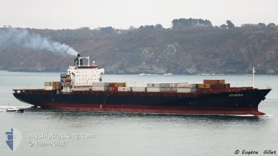
ATHENA
Container Ship
Current Trip
| Time Travelled | 12 days |
|---|---|
| Remaining Time | --- |
| Distance Travelled | 2480.96 nm |
| Remaining Distance | --- |
| AVG Speed | 10.3 Knots |
| MAX Speed | 13.7 Knots |
| AVG Wind | 13.8 knots |
| MAX Wind | 30.3 knots |
| MIN Temp | 6.7°C / 44.06°F |
| MAX Temp | 30.4°C / 86.72°F |
| Draught | 8.7 m |
| Position Received | 12 d ago |
Current Position
| Longitude | --- |
|---|---|
| Latitude | --- |
| Status | Under way using engine |
| Speed | 8 Knots |
| Course | 51° |
| Area | South China Sea |
| Station | T-AIS |
| Position Received | 12 d ago |
Info
Information
The current position of ATHENA is in South China Sea with coordinates 1.33208° / 104.38062° as reported on 2025-02-05 08:50 by AIS to our vessel tracker app. The vessel's current speed is 8 Knots and is heading at the port of VUNG TAU. The estimated time of arrival as calculated by MyShipTracking vessel tracking app is 2025-02-08 05:00 LT
The vessel ATHENA (IMO: 9275361, MMSI: 357231000) is a Container Ship that was built in 2003 ( 22 years old ). It's sailing under the flag of [PA] Panama.
In this page you can find informations about the vessels current position, last detected port calls, and current voyage information. If the vessels is not in coverage by AIS you will find the latest position.
The current position of ATHENA is detected by our AIS receivers and we are not responsible for the reliability of the data. The last position was recorded while the vessel was in Coverage by the Ais receivers of our vessel tracking app.
The current draught of ATHENA as reported by AIS is 8.7 meters
Weather
| Temperature | 7.3°C / 45.14°F |
|---|---|
| Wind Speed | 17 knots |
| Direction | 7° N |
| Pressure | 1029 hPa |
| Humidity | 61.8 % |
| Cloud Coverage | 89 % |
Featured Company
Last Port Calls
| Port | Arrival | Departure | Time In Port |
|---|---|---|---|
| 2025-02-04 05:48 | 2025-02-05 01:14 | 19 h | |
| 2025-02-03 07:01 | 2025-02-03 22:56 | 15 h | |
| 2025-02-01 09:29 | 2025-02-02 07:57 | 22 h | |
| 2025-01-30 21:33 | 2025-01-31 16:07 | 18 h | |
| 2025-01-30 04:55 | 2025-01-30 21:17 | 16 h | |
| 2025-01-27 15:35 | 2025-01-28 06:20 | 14 h | |
| 2025-01-21 20:14 | 2025-01-22 07:53 | 11 h | |
| 2025-01-14 17:44 | 2025-01-15 05:01 | 11 h | |
| 2024-12-28 10:41 | 2024-12-29 03:59 | 17 h | |
| 2024-12-26 20:53 | 2024-12-28 08:20 | 1 d |
Most Visited Ports (Last year)
| Port | Arrivals | |
|---|---|---|
| 32 | ||
| 14 | ||
| 9 | ||
| 8 | ||
| 7 | ||
| 7 |
Last Trips
| Origin | Departure | Destination | Arrival | Distance | |
|---|---|---|---|---|---|
| 2025-02-04 06:56 | 2025-02-04 13:48 | 49.72 nm | |||
| 2025-02-02 15:57 | 2025-02-03 15:01 | 191.82 nm | |||
| 2025-02-01 00:07 | 2025-02-01 17:29 | 188.63 nm | |||
| 2025-01-31 05:17 | 2025-01-31 05:33 | 1.07 nm | |||
| 2025-01-28 13:20 | 2025-01-30 12:55 | 582.03 nm | |||
| 2025-01-22 15:53 | 2025-01-27 22:35 | 1996.36 nm | |||
| 2025-01-15 13:01 | 2025-01-22 04:14 | 715.22 nm | |||
| 2024-12-29 11:59 | 2025-01-15 01:44 | 2771.69 nm | |||
| 2024-12-28 16:20 | 2024-12-28 18:41 | 17.71 nm | |||
| 2024-12-24 21:53 | 2024-12-27 04:53 | 316.95 nm |
Events
| Time | Event | Details | Position / Dest | Info |
|---|---|---|---|---|
| 2025-02-17 20:27 | START Moving |
30.87910 / 123.35828
VNVUT
|
Speed: 4.6 kn Course: 42° |
|
| 2025-02-17 15:32 | STOP Moving |
30.92571 / 123.37483
VNVUT
|
Speed: Course: 27° |
|
| 2025-02-17 15:13 | START Moving |
30.90970 / 123.36405
VNVUT
|
Speed: 5.3 kn Course: 21° |
|
| 2025-02-17 04:21 | STOP Moving |
31.13667 / 123.40833
VNVUT
|
Speed: Course: -1° |
|
| 2025-02-16 21:46 | START Moving |
30.43045 / 124.00312
VNVUT
|
Speed: 7.8 kn Course: 312° |
|
| 2025-02-15 17:05 | STOP Moving |
30.86422 / 123.67778
VNVUT
|
Speed: 0.1 kn Course: 266° |
|
| 2025-02-10 02:01 | START Moving | 13.33 nm, South East of VUNG TAU |
10.22630 / 107.23550
VNVUT
|
Speed: 3.3 kn Course: 155° |
| 2025-02-09 16:14 | STOP Moving | 13.74 nm, South East of VUNG TAU |
10.24445 / 107.26452
VNVUT
|
Speed: Course: 93° |
| 2025-02-09 00:53 | START Moving | 14.41 nm, South East of VUNG TAU |
10.20497 / 107.23770
VNVUT
|
Speed: 3.8 kn Course: 112° |
| 2025-02-08 15:36 | STOP Moving | 14.12 nm, South East of VUNG TAU |
10.24117 / 107.27026
VNVUT
|
Speed: 0.3 kn Course: 110° |