
ATA
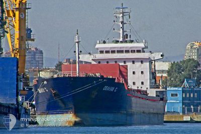
Bulk Carrier
Current Trip
| Time Travelled | 3 days |
|---|---|
| Remaining Time | --- |
| Distance Travelled | 224.33 nm |
| Remaining Distance | --- |
| AVG Speed | 8.2 Knots |
| MAX Speed | 11.7 Knots |
| AVG Wind | 9.7 knots |
| MAX Wind | 17.8 knots |
| MIN Temp | 11.8°C / 53.24°F |
| MAX Temp | 17.9°C / 64.22°F |
| Draught | 8.5 m |
| Position Received | 1 h, 3 m ago |
Current Position
| Longitude | 27.07271° |
|---|---|
| Latitude | 40.55919° |
| Status | Under way using engine |
| Speed | 8.5 Knots |
| Course | 245.1° |
| Area | Sea of Marmara |
| Station | T-AIS |
| Position Received | 1 h, 3 m ago |
Info
Information
The current position of ATA is in Sea of Marmara with coordinates 40.55919° / 27.07271° as reported on 2024-05-01 19:00 by AIS to our vessel tracker app. The vessel's current speed is 8.5 Knots and is heading at the port of DAMIETTA. The estimated time of arrival as calculated by MyShipTracking vessel tracking app is 2024-05-04 21:00 LT
The vessel ATA (IMO: 9521899, MMSI: 370429000) is a Bulk Carrier that was built in 2009 ( 15 years old ). It's sailing under the flag of [PA] Panama.
In this page you can find informations about the vessels current position, last detected port calls, and current voyage information. If the vessels is not in coverage by AIS you will find the latest position.
The current position of ATA is detected by our AIS receivers and we are not responsible for the reliability of the data. The last position was recorded while the vessel was in Coverage by the Ais receivers of our vessel tracking app.
The current draught of ATA as reported by AIS is 8.5 meters
Weather
| Temperature | 14.3°C / 57.74°F |
|---|---|
| Wind Speed | 12 knots |
| Direction | 56° NE |
| Pressure | 1016.4 hPa |
| Humidity | 83.1 % |
| Cloud Coverage | 23 % |
Featured Company
Last Port Calls
| Port | Arrival | Departure | Time In Port |
|---|---|---|---|
| 2024-04-26 11:36 | 2024-04-28 18:04 | 2 d | |
| 2024-03-07 10:29 | 2024-04-10 00:01 | ||
| 2024-03-01 18:39 | 2024-03-02 04:00 | 9 h |
Last Trips
| Origin | Departure | Destination | Arrival | Distance | |
|---|---|---|---|---|---|
| 2024-04-10 01:01 | 2024-04-26 14:36 | 1822.35 nm | |||
| 2024-03-02 05:00 | 2024-03-07 11:29 | 742.40 nm | |||
| 2024-02-03 03:34 | 2024-03-01 19:39 | 2095.00 nm |
Events
| Time | Event | Details | Position / Dest | Info |
|---|---|---|---|---|
| 2024-05-01 19:16 | Status Changed | Default Under way using engine |
40.54327 / 27.02718
EG DAM
|
Speed: 8.5 kn Course: 245.1° |
| 2024-05-01 19:00 | OUT of Coverage |
40.55919 / 27.07271
Sea of Marmara
EG DAM
|
Speed: 8.5 kn Course: 245.1° |
|
| 2024-05-01 18:22 | Status Changed | Under way using engine Default |
40.60042 / 27.18352
EG DAM
|
Speed: 9.5 kn Course: 245° |
| 2024-05-01 17:49 | Status Changed | Default Under way using engine |
40.63730 / 27.28524
EG DAM
|
Speed: 9.3 kn Course: 245.6° |
| 2024-05-01 12:47 | Status Changed | Under way using engine Default |
40.83810 / 28.23887
EG DAM
|
Speed: 9.2 kn Course: 258° |
| 2024-05-01 12:47 | IN Coverage |
40.83690 / 28.23104
Sea of Marmara
EG DAM
|
Speed: 9.3 kn Course: 258.6° |
|
| 2024-05-01 11:39 | Status Changed | Default Under way using engine |
40.87725 / 28.45903
EG DAM
|
Speed: 8.6 kn Course: 256.4° |
| 2024-05-01 11:34 | OUT of Coverage |
40.88010 / 28.47623
Sea of Marmara
EG DAM
|
Speed: 8.6 kn Course: 256.4° |
|
| 2024-05-01 10:17 | ETA Changed | 2024/05/04 21:00 2024/05/04 20:00 |
40.90553 / 28.70505
EG DAM
|
Speed: 8.1 kn Course: 259.6° |
| 2024-05-01 09:15 | START Moving | 1.91 nm, South East of YESILKOY |
40.93453 / 28.85738
EG DAM
|
Speed: 3.2 kn Course: 124° |