

ASTRID MAERSK
Cargo A

Current Trip
| Time Travelled | 11 days |
|---|---|
| Remaining Time | 18 days |
| Distance Travelled | 2514.55 nm |
| Remaining Distance | 10016.20 nm |
| AVG Speed | 11.5 Knots |
| MAX Speed | 21 Knots |
| AVG Wind | 7 knots |
| MAX Wind | 19.8 knots |
| MIN Temp | 7.8°C / 46.04°F |
| MAX Temp | 19°C / 66.2°F |
| Draught | 13.4 m |
| Position Received | 2 d ago |
Current Position
| Longitude | --- |
|---|---|
| Latitude | --- |
| Status | Under way using engine |
| Speed | 20.3 Knots |
| Course | 203.2° |
| Area | North Atlantic Ocean |
| Station | T-AIS |
| Position Received | 2 d ago |
Information
The current position of ASTRID MAERSK is in North Atlantic Ocean with coordinates 27.51210° / -15.27065° as reported on 2025-02-18 02:55 by AIS to our vessel tracker app. The vessel's current speed is 20.3 Knots and is heading at the port of SINGAPORE. The estimated time of arrival as calculated by MyShipTracking vessel tracking app is 2025-03-10 15:12 LT
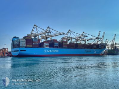
The vessel ASTRID MAERSK (IMO: 9948750, MMSI: 219608000) is a Cargo A It's sailing under the flag of [DK] Denmark.
In this page you can find informations about the vessels current position, last detected port calls, and current voyage information. If the vessels is not in coverage by AIS you will find the latest position.
The current position of ASTRID MAERSK is detected by our AIS receivers and we are not responsible for the reliability of the data. The last position was recorded while the vessel was in Coverage by the Ais receivers of our vessel tracking app.
The current draught of ASTRID MAERSK as reported by AIS is 13.4 meters
Weather
| Temperature | 18.9°C / 66.02°F |
|---|---|
| Wind Speed | 16 knots |
| Direction | 246° WSW |
| Pressure | 1013 hPa |
| Humidity | 78.5 % |
| Cloud Coverage | --- |


Featured Company
Most Visited Ports (Last year)
| Port | Arrivals | |
|---|---|---|
| 5 | ||
| 4 | ||
| 3 | ||
| 3 | ||
| 2 | ||
| 2 |
Events
| Time | Event | Details | Position / Dest | Info |
|---|---|---|---|---|
| 2025-02-18 02:55 | OUT of Coverage |
27.51210 / -15.27065
North Atlantic Ocean
ES ALR>SG PWBGA
|
Speed: 20.3 kn Course: 203.2° |
|
| 2025-02-17 19:28 | Detected in Sea | Spanish (Canary Islands) part of the North Atlantic Ocean |
29.74992 / -13.87924
North Atlantic Ocean
ES ALR>SG PWBGA
|
Speed: 20.8 kn Course: 224.5° |
| 2025-02-17 19:28 | IN Coverage |
29.74992 / -13.87924
North Atlantic Ocean
ES ALR>SG PWBGA
|
Speed: 20.8 kn Course: 224.5° |
|
| 2025-02-17 00:05 | OUT of Coverage |
34.43549 / -8.16088
North Atlantic Ocean
ES ALR>SG PWBGA
|
Speed: 20.5 kn Course: 227° |
|
| 2025-02-17 00:05 | IN Coverage |
34.43549 / -8.16088
North Atlantic Ocean
ES ALR>SG PWBGA
|
Speed: 20.5 kn Course: 227° |
|
| 2025-02-16 18:33 | OUT of Coverage |
35.75653 / -6.50418
North Atlantic Ocean
ES ALR>SG PWBGA
|
Speed: 19.9 kn Course: 220.1° |
|
| 2025-02-16 17:55 | Change Sea Area | Moroccan part of the North Atlantic Ocean Spanish part of the North Atlantic Ocean |
35.91797 / -6.33832
North Atlantic Ocean
ES ALR>SG PWBGA
|
Speed: 18.9 kn Course: 228.3° |
| 2025-02-16 17:23 | Detected in Sea | Spanish part of the North Atlantic Ocean |
35.94809 / -6.14527
North Atlantic Ocean
ES ALR>SG PWBGA
|
Speed: 18.2 kn Course: 267.8° |
| 2025-02-16 16:26 | Change Sea Area | Moroccan part of the Strait of Gibraltar Spanish part of the Strait of Gibraltar |
35.94232 / -5.80955
Strait of Gibraltar
ES ALR>SG PWBGA
|
Speed: 15.5 kn Course: 266.3° |
| 2025-02-16 14:29 | START Moving | 3.56 nm, South of ALGECIRAS |
36.08054 / -5.39697
ES ALR>SG PWBGA
|
Speed: 3.1 kn Course: 180° |