
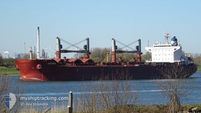
ASTORIA
Bulk Carrier
Current Trip
| Time Travelled | 7 days |
|---|---|
| Remaining Time | 1 day |
| Distance Travelled | 1539.15 nm |
| Remaining Distance | 755.81 nm |
| AVG Speed | 9.1 Knots |
| MAX Speed | 13.7 Knots |
| AVG Wind | 16.2 knots |
| MAX Wind | 39 knots |
| MIN Temp | 7.2°C / 44.96°F |
| MAX Temp | 18°C / 64.4°F |
| Draught | 12 m |
| Position Received | 3 d ago |
Current Position
| Longitude | --- |
|---|---|
| Latitude | --- |
| Status | Under way using engine |
| Speed | 10.2 Knots |
| Course | 265.6° |
| Area | Strait of Gibraltar |
| Station | T-AIS |
| Position Received | 3 d ago |
Information
The current position of ASTORIA is in Strait of Gibraltar with coordinates 35.94702° / -5.76153° as reported on 2025-01-30 18:30 by AIS to our vessel tracker app. The vessel's current speed is 10.2 Knots and is heading at the port of DAKAR. The estimated time of arrival as calculated by MyShipTracking vessel tracking app is 2025-02-04 17:35 LT
The vessel ASTORIA (IMO: 9663635, MMSI: 636015672) is a Bulk Carrier that was built in 2013 ( 12 years old ). It's sailing under the flag of [LR] Liberia.
In this page you can find informations about the vessels current position, last detected port calls, and current voyage information. If the vessels is not in coverage by AIS you will find the latest position.
The current position of ASTORIA is detected by our AIS receivers and we are not responsible for the reliability of the data. The last position was recorded while the vessel was in Coverage by the Ais receivers of our vessel tracking app.
The current draught of ASTORIA as reported by AIS is 12 meters
Weather
| Temperature | 17.5°C / 63.5°F |
|---|---|
| Wind Speed | 14 knots |
| Direction | 20° NNE |
| Pressure | 1021.5 hPa |
| Humidity | 75 % |
| Cloud Coverage | 2 % |
Featured Company
Last Port Calls
| Port | Arrival | Departure | Time In Port |
|---|---|---|---|
| 2025-01-21 16:01 | 2025-01-26 05:39 | 4 d | |
| 2025-01-01 12:41 | 2025-01-09 13:25 | 8 d | |
| 2024-12-12 20:44 |
Most Visited Ports (Last year)
| Port | Arrivals | |
|---|---|---|
| 4 | ||
| 2 | ||
| 2 | ||
| 2 | ||
| 2 | ||
| 1 |
Last Trips
| Origin | Departure | Destination | Arrival | Distance | |
|---|---|---|---|---|---|
| 2025-01-09 14:25 | 2025-01-21 17:01 | 339.24 nm | |||
| 2024-12-12 22:44 | 2025-01-01 13:41 | 1758.95 nm |
Events
| Time | Event | Details | Position / Dest | Info |
|---|---|---|---|---|
| 2025-01-30 18:35 | Status Changed | Default Under way using engine |
35.94124 / -5.77748
DAKAR
|
Speed: 10.2 kn Course: 265.6° |
| 2025-01-30 18:30 | OUT of Coverage |
35.94702 / -5.76153
Strait of Gibraltar
DAKAR
|
Speed: 10.2 kn Course: 265.6° |
|
| 2025-01-30 18:16 | Status Changed | Under way using engine Default |
35.95018 / -5.71279
DAKAR
|
Speed: 9.8 kn Course: 264° |
| 2025-01-30 18:14 | Status Changed | Default Under way using engine |
35.95066 / -5.70658
DAKAR
|
Speed: 9.6 kn Course: 264.1° |
| 2025-01-30 16:17 | Change Sea Area | Spanish part of the Strait of Gibraltar Gibraltarian part of the Strait of Gibraltar |
36.09438 / -5.38784
Strait of Gibraltar
DAKAR
|
Speed: 10 kn Course: 181.1° |
| 2025-01-30 15:55 | START Moving | 0.9 nm, West of GIBRALTAR |
36.14258 / -5.38025
DAKAR
|
Speed: 3.2 kn Course: 211° |
| 2025-01-30 15:43 | Status Changed | Under way using engine At anchor |
36.14490 / -5.37703
DAKAR
|
Speed: 0.2 kn Course: 280° |
| 2025-01-30 14:49 | ETA Changed | 2025/02/04 14:00 2025/12/27 22:30 |
36.14334 / -5.37629
DAKAR
|
Speed: 0.1 kn Course: 322° |
| 2025-01-30 14:42 | Destination Changed | DAKAR DJEN-DJEN |
36.14332 / -5.37611
DAKAR
|
Speed: 0.2 kn Course: 317° |
| 2025-01-29 11:55 | Status Changed | At anchor Moored |
36.14400 / -5.37852
DJEN-DJEN
|
Speed: 0.3 kn Course: 353° |