
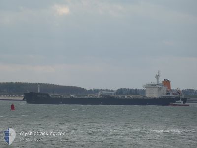
ASPHALT SPLENDOR
Tanker
Current Trip
| Time Travelled | 13 h, 19 mins |
|---|---|
| Remaining Time | 1 day |
| Distance Travelled | 162.14 nm |
| Remaining Distance | 580.42 nm |
| AVG Speed | 10.1 Knots |
| MAX Speed | 13.6 Knots |
| AVG Wind | 6 knots |
| MAX Wind | 18.8 knots |
| MIN Temp | 27.6°C / 81.68°F |
| MAX Temp | 31.2°C / 88.16°F |
| Draught | 8.2 m |
| Position Received | 10 h, 55 m ago |
Current Position
| Longitude | -74.68314° |
|---|---|
| Latitude | 11.36744° |
| Status | Under way using engine |
| Speed | 13.4 Knots |
| Course | 42.9° |
| Area | Caribbean Sea |
| Station | T-AIS |
| Position Received | 10 h, 55 m ago |
Info
Information
The current position of ASPHALT SPLENDOR is in Caribbean Sea with coordinates 11.36744° / -74.68314° as reported on 2024-06-15 21:30 by AIS to our vessel tracker app. The vessel's current speed is 13.4 Knots and is heading at the port of SAN JUAN. The estimated time of arrival as calculated by MyShipTracking vessel tracking app is 2024-06-18 03:42 LT
The vessel ASPHALT SPLENDOR (IMO: 9763332, MMSI: 538006655) is a Tanker It's sailing under the flag of [MH] Marshall Is.
In this page you can find informations about the vessels current position, last detected port calls, and current voyage information. If the vessels is not in coverage by AIS you will find the latest position.
The current position of ASPHALT SPLENDOR is detected by our AIS receivers and we are not responsible for the reliability of the data. The last position was recorded while the vessel was in Coverage by the Ais receivers of our vessel tracking app.
The current draught of ASPHALT SPLENDOR as reported by AIS is 8.2 meters
Weather
| Temperature | 27.6°C / 81.68°F |
|---|---|
| Wind Speed | 18 knots |
| Direction | 78° ENE |
| Pressure | 1010.3 hPa |
| Humidity | 87.4 % |
| Cloud Coverage | 78 % |
Featured Company
Last Port Calls
| Port | Arrival | Departure | Time In Port |
|---|---|---|---|
| 2024-06-13 05:00 | 2024-06-15 19:06 | 2 d | |
| 2024-06-02 06:20 | 2024-06-04 11:26 | 2 d | |
| 2024-05-25 22:09 | 2024-05-28 13:16 | 2 d | |
| 2024-05-16 18:01 | 2024-05-21 18:50 | 5 d | |
| 2024-05-04 00:33 | 2024-05-05 13:44 | 1 d |
Most Visited Ports (Last year)
| Port | Arrivals | |
|---|---|---|
| 4 | ||
| 2 | ||
| 2 | ||
| 2 | ||
| 2 | ||
| 1 |
Last Trips
| Origin | Departure | Destination | Arrival | Distance | |
|---|---|---|---|---|---|
| 2024-06-04 07:26 | 2024-06-13 00:00 | 1498.87 nm | |||
| 2024-05-28 09:16 | 2024-06-02 02:20 | 1187.89 nm | |||
| 2024-05-21 14:50 | 2024-05-25 18:09 | 1184.38 nm | |||
| 2024-05-05 10:44 | 2024-05-16 14:01 | 1754.13 nm | |||
| 2024-03-21 05:31 | 2024-05-03 21:33 | 2180.67 nm |
Events
| Time | Event | Details | Position / Dest | Info |
|---|---|---|---|---|
| 2024-06-15 21:36 | Status Changed | Default Under way using engine |
11.38167 / -74.66666
PRSJU
|
Speed: 13.4 kn Course: 42.9° |
| 2024-06-15 21:30 | OUT of Coverage |
11.36744 / -74.68314
Caribbean Sea
PRSJU
|
Speed: 13.4 kn Course: 42.9° |
|
| 2024-06-15 20:45 | ETA Changed | 2024/06/18 06:00 2024/06/18 03:00 |
11.25455 / -74.79142
PRSJU
|
Speed: 11.5 kn Course: 45.8° |
| 2024-06-15 19:06 | PORT DEPARTURE |
|
11.03826 / -74.81189
PRSJU
|
Speed: 11.6 kn Course: 299° |
| 2024-06-15 18:36 | Draught Changed | 8.2 7 |
10.97085 / -74.75661
[CO] BARRANQUILLA
|
Speed: 8.3 kn Course: 355° |
| 2024-06-15 18:36 | Destination Changed | PRSJU COBAQ |
10.97085 / -74.75661
[CO] BARRANQUILLA
|
Speed: 8.3 kn Course: 355° |
| 2024-06-15 18:36 | ETA Changed | 2024/06/18 03:00 2024/06/12 10:00 |
10.97085 / -74.75661
[CO] BARRANQUILLA
|
Speed: 8.3 kn Course: 355° |
| 2024-06-15 18:26 | START Moving |
10.95387 / -74.75664
[CO] BARRANQUILLA
|
Speed: 3.2 kn Course: 36° |
|
| 2024-06-15 18:21 | Status Changed | Under way using engine Default |
10.95292 / -74.75841
[CO] BARRANQUILLA
|
Speed: Course: -1° |
| 2024-06-15 18:21 | IN Coverage |
10.95289 / -74.75825
Caribbean Sea
[CO] BARRANQUILLA
|
Speed: 0.3 kn Course: 107.8° |