
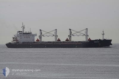
ASL ILEANA
Bulk Carrier
Current Trip
| Time Travelled | 48 days |
|---|---|
| Remaining Time | --- |
| Distance Travelled | 217.64 nm |
| Remaining Distance | --- |
| AVG Speed | 10.5 Knots |
| MAX Speed | 12.7 Knots |
| AVG Wind | 7.3 knots |
| MAX Wind | 14.5 knots |
| MIN Temp | 18.3°C / 64.94°F |
| MAX Temp | 20.7°C / 69.26°F |
| Draught | 6.5 m |
| Position Received | 1 d ago |
Current Position
| Longitude | --- |
|---|---|
| Latitude | --- |
| Status | At anchor |
| Speed | |
| Course | 68° |
| Area | Mediterranean Sea - Eastern Basin |
| Station | T-AIS |
| Position Received | 1 d ago |
Info
Information
The current position of ASL ILEANA is in Mediterranean Sea - Eastern Basin with coordinates 31.21848° / 29.74585° as reported on 2025-03-14 18:04 by AIS to our vessel tracker app. The vessel's current speed is 0 Knots
The vessel ASL ILEANA (IMO: 9554042, MMSI: 636021970) is a Bulk Carrier that was built in 2010 ( 15 years old ). It's sailing under the flag of [LR] Liberia.
In this page you can find informations about the vessels current position, last detected port calls, and current voyage information. If the vessels is not in coverage by AIS you will find the latest position.
The current position of ASL ILEANA is detected by our AIS receivers and we are not responsible for the reliability of the data. The last position was recorded while the vessel was in Coverage by the Ais receivers of our vessel tracking app.
The current draught of ASL ILEANA as reported by AIS is 6.5 meters
Weather
| Temperature | 18.7°C / 65.66°F |
|---|---|
| Wind Speed | 6 knots |
| Direction | 53° NE |
| Pressure | 1019.3 hPa |
| Humidity | 80 % |
| Cloud Coverage | --- |
Featured Company
Events
| Time | Event | Details | Position / Dest | Info |
|---|---|---|---|---|
| 2025-03-14 18:07 | Status Changed | Default At anchor |
31.21852 / 29.74583
EGEDK/EL DEKHEILA
|
Speed: Course: 68° |
| 2025-03-14 18:04 | Status Changed | At anchor Default |
31.21848 / 29.74585
EGEDK/EL DEKHEILA
|
Speed: Course: 71° |
| 2025-03-14 18:04 | OUT of Coverage |
31.21848 / 29.74585
Mediterranean Sea - Eastern Basin
EGEDK/EL DEKHEILA
|
Speed: Course: 124° |
|
| 2025-03-14 17:46 | Status Changed | Default At anchor |
31.21843 / 29.74577
EGEDK/EL DEKHEILA
|
Speed: Course: 68° |
| 2025-03-14 17:37 | Status Changed | At anchor Default |
31.21850 / 29.74572
EGEDK/EL DEKHEILA
|
Speed: Course: 64° |
| 2025-03-14 17:37 | IN Coverage |
31.21850 / 29.74572
Mediterranean Sea - Eastern Basin
EGEDK/EL DEKHEILA
|
Speed: Course: 124° |
|
| 2025-03-14 15:52 | Status Changed | Default At anchor |
31.21810 / 29.74600
EGEDK/EL DEKHEILA
|
Speed: Course: 51° |
| 2025-03-14 15:46 | OUT of Coverage |
31.21800 / 29.74605
Mediterranean Sea - Eastern Basin
EGEDK/EL DEKHEILA
|
Speed: Course: 121° |
|
| 2025-03-14 15:37 | Status Changed | At anchor Default |
31.21805 / 29.74598
EGEDK/EL DEKHEILA
|
Speed: Course: 50° |
| 2025-03-14 15:31 | Status Changed | Default At anchor |
31.21805 / 29.74628
EGEDK/EL DEKHEILA
|
Speed: Course: 53° |