
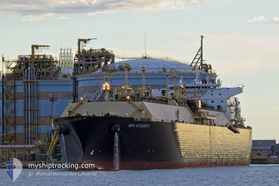
ASIA INTEGRITY
Tanker A
Current Trip
| Trip Time | 11 days |
|---|---|
| Trip Distance | 3696.44 nm |
| AVG Speed | 14.8 Knots |
| MAX Speed | 20.4 Knots |
| Draught | 9.9 m |
| AVG Wind | 10.8 knots |
| MAX Wind | 24.7 knots |
| MIN Temp | 17.4°C / 63.32°F |
| MAX Temp | 30.1°C / 86.18°F |
| Position Received | 1 d ago |
Current Position
| Longitude | 115.74463° |
|---|---|
| Latitude | -20.77238° |
| Status | At anchor |
| Speed | |
| Course | 41° |
| Area | Indian Ocean |
| Station | T-AIS |
| Position Received | 1 d ago |
Info
Information
The current position of ASIA INTEGRITY is in Indian Ocean with coordinates -20.77238° / 115.74463° as reported on 2024-06-01 15:45 by AIS to our vessel tracker app. The vessel's current speed is 0 Knots and is currently inside the port of BARROW ISLAND.
The vessel ASIA INTEGRITY (IMO: 9680188, MMSI: 311000227) is a Tanker A It's sailing under the flag of [BS] Bahamas.
In this page you can find informations about the vessels current position, last detected port calls, and current voyage information. If the vessels is not in coverage by AIS you will find the latest position.
The current position of ASIA INTEGRITY is detected by our AIS receivers and we are not responsible for the reliability of the data. The last position was recorded while the vessel was in Coverage by the Ais receivers of our vessel tracking app.
The current draught of ASIA INTEGRITY as reported by AIS is 9.9 meters
Weather
| Temperature | 25.1°C / 77.18°F |
|---|---|
| Wind Speed | 8 knots |
| Direction | 159° SSE |
| Pressure | 1017.4 hPa |
| Humidity | 54.6 % |
| Cloud Coverage | --- |
Featured Company
Last Port Calls
| Port | Arrival | Departure | Time In Port |
|---|---|---|---|
| 2024-06-02 20:21 | |||
| 2024-05-21 13:17 | 2024-05-22 12:30 | 23 h | |
| 2024-04-05 09:18 | 2024-04-06 07:09 | 21 h |
Most Visited Ports (Last year)
| Port | Arrivals | |
|---|---|---|
| 3 | ||
| 2 | ||
| 1 | ||
| 1 | ||
| 1 | ||
| 1 |
Last Trips
| Origin | Departure | Destination | Arrival | Distance | |
|---|---|---|---|---|---|
| 2024-05-22 12:30 | 2024-06-02 20:21 | 3696.44 nm | |||
| 2024-04-06 07:09 | 2024-05-21 13:17 | 11856.85 nm | |||
| 2024-03-23 12:47 | 2024-04-05 09:18 | 4681.50 nm |
Events
| Time | Event | Details | Position / Dest | Info |
|---|---|---|---|---|
| 2024-06-02 13:05 | STOP Moving |
-20.81323 / 115.49094
[AU] BARROW ISLAND
|
Speed: Course: 180° |
|
| 2024-06-02 12:21 | PORT ARRIVAL |
|
-20.81839 / 115.49339
[AU] BARROW ISLAND
|
Speed: 3.5 kn Course: 278° |
| 2024-06-02 10:01 | START Moving | 11.55 nm, South East of VARANUS |
-20.76767 / 115.74933
AU BWB
|
Speed: 3.6 kn Course: 257° |
| 2024-06-01 15:52 | Status Changed | Default At anchor |
-20.77167 / 115.74500
AU BWB
|
Speed: Course: 41° |
| 2024-06-01 15:45 | OUT of Coverage |
-20.77238 / 115.74463
Indian Ocean
AU BWB
|
Speed: Course: 244.8° |
|
| 2024-06-01 15:30 | Draught Changed | 9.9 9.1 |
-20.77242 / 115.74467
AU BWB
|
Speed: Course: 39° |
| 2024-06-01 15:30 | ETA Changed | 2024/06/02 13:00 2024/06/02 09:30 |
-20.77242 / 115.74467
AU BWB
|
Speed: Course: 39° |
| 2024-06-01 15:21 | Status Changed | At anchor Default |
-20.77235 / 115.74458
AU BWB
|
Speed: Course: -1° |
| 2024-06-01 15:13 | Status Changed | Default At anchor |
-20.77167 / 115.74500
AU BWB
|
Speed: Course: 43° |
| 2024-06-01 15:06 | Status Changed | At anchor Default |
-20.77231 / 115.74452
AU BWB
|
Speed: Course: -1° |