
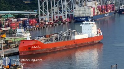
ASIA CEMENT NO.9
Cargo
Current Trip
| Time Travelled | 19 days |
|---|---|
| Remaining Time | --- |
| Distance Travelled | 203.07 nm |
| Remaining Distance | --- |
| AVG Speed | 7.6 Knots |
| MAX Speed | 13 Knots |
| AVG Wind | 20.4 knots |
| MAX Wind | 23.3 knots |
| MIN Temp | 15.3°C / 59.54°F |
| MAX Temp | 19.1°C / 66.38°F |
| Draught | 4.7 m |
| Position Received | 1 d ago |
Current Position
| Longitude | --- |
|---|---|
| Latitude | --- |
| Status | Under way using engine |
| Speed | 12.2 Knots |
| Course | 39.1° |
| Area | Eastern China Sea |
| Station | T-AIS |
| Position Received | 1 d ago |
Info
Information
The current position of ASIA CEMENT NO.9 is in Eastern China Sea with coordinates 25.23052° / 121.78791° as reported on 2025-02-25 09:44 by AIS to our vessel tracker app. The vessel's current speed is 12.2 Knots
The vessel ASIA CEMENT NO.9 (IMO: 9983279, MMSI: 416081000) is a Cargo It's sailing under the flag of [TW] Taiwan.
In this page you can find informations about the vessels current position, last detected port calls, and current voyage information. If the vessels is not in coverage by AIS you will find the latest position.
The current position of ASIA CEMENT NO.9 is detected by our AIS receivers and we are not responsible for the reliability of the data. The last position was recorded while the vessel was in Coverage by the Ais receivers of our vessel tracking app.
The current draught of ASIA CEMENT NO.9 as reported by AIS is 4.7 meters
Weather
| Temperature | 17.7°C / 63.86°F |
|---|---|
| Wind Speed | 18 knots |
| Direction | 134° SE |
| Pressure | 1023.4 hPa |
| Humidity | 69.9 % |
| Cloud Coverage | 85 % |
Featured Company
Last Port Calls
| Port | Arrival | Departure | Time In Port |
|---|---|---|---|
| 2025-02-06 22:49 | 2025-02-07 15:51 | 17 h | |
| 2025-02-03 23:37 | 2025-02-04 11:09 | 11 h | |
| 2025-01-31 03:12 | 2025-01-31 20:25 | 17 h | |
| 2025-01-21 17:32 | 2025-01-22 10:25 | 16 h | |
| 2025-01-15 17:54 | 2025-01-16 09:15 | 15 h | |
| 2025-01-13 03:32 | 2025-01-13 13:31 | 9 h | |
| 2025-01-01 20:48 | 2025-01-02 14:15 | 17 h | |
| 2024-12-28 15:11 | 2024-12-29 19:09 | 1 d | |
| 2024-12-21 07:17 | 2024-12-22 00:38 | 17 h | |
| 2024-12-15 14:04 | 2024-12-16 17:54 | 1 d |
Most Visited Ports (Last year)
| Port | Arrivals | |
|---|---|---|
| 29 | ||
| 26 | ||
| 3 | ||
| 1 | ||
| 1 | ||
| 1 |
Last Trips
| Origin | Departure | Destination | Arrival | Distance | |
|---|---|---|---|---|---|
| 2025-02-04 19:09 | 2025-02-07 06:49 | 17.99 nm | |||
| 2025-02-01 04:25 | 2025-02-04 07:37 | 369.58 nm | |||
| 2025-01-22 18:25 | 2025-01-31 11:12 | 378.64 nm | |||
| 2025-01-16 17:15 | 2025-01-22 01:32 | 399.12 nm | |||
| 2025-01-13 21:31 | 2025-01-16 01:54 | 30.38 nm | |||
| 2025-01-02 22:15 | 2025-01-13 11:32 | 394.23 nm | |||
| 2024-12-30 03:09 | 2025-01-02 04:48 | 22.13 nm | |||
| 2024-12-22 08:38 | 2024-12-28 23:11 | 371.64 nm | |||
| 2024-12-17 01:54 | 2024-12-21 15:17 | 384.59 nm | |||
| 2024-12-08 22:16 | 2024-12-15 22:04 | 377.06 nm |
Events
| Time | Event | Details | Position / Dest | Info |
|---|---|---|---|---|
| 2025-02-25 09:44 | OUT of Coverage |
25.23052 / 121.78791
Eastern China Sea
TW HUN
|
Speed: 12.2 kn Course: 39.1° |
|
| 2025-02-25 09:26 | Draught Changed | 4.7 4.6 |
25.17695 / 121.75512
TW HUN
|
Speed: 12.3 kn Course: 13.3° |
| 2025-02-25 09:26 | ETA Changed | 2025/02/25 19:00 2025/02/18 13:30 |
25.17695 / 121.75512
TW HUN
|
Speed: 12.3 kn Course: 13.3° |
| 2025-02-25 09:25 | IN Coverage |
25.17628 / 121.75495
Eastern China Sea
|
Speed: 12.5 kn Course: 15° |
|
| 2025-02-18 05:18 | OUT of Coverage |
25.23015 / 121.78773
Eastern China Sea
TW HUN
|
Speed: 10.6 kn Course: 43.4° |
|
| 2025-02-18 05:02 | ETA Changed | 2025/02/18 13:30 2025/02/13 03:30 |
25.19152 / 121.76051
TW HUN
|
Speed: 11.2 kn Course: 21.5° |
| 2025-02-18 04:57 | IN Coverage |
25.18017 / 121.75587
Eastern China Sea
|
Speed: 11.4 kn Course: 17.8° |