
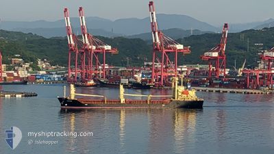
ASAKAZE
Cargo
Current Trip
| Time Travelled | 4 days |
|---|---|
| Remaining Time | 5 days |
| Distance Travelled | 1274.54 nm |
| Remaining Distance | 1686.51 nm |
| AVG Speed | 11.7 Knots |
| MAX Speed | 14 Knots |
| AVG Wind | 10.5 knots |
| MAX Wind | 21.7 knots |
| MIN Temp | 16.8°C / 62.24°F |
| MAX Temp | 28.2°C / 82.76°F |
| Draught | 7.7 m |
| Position Received | 4 d ago |
Current Position
| Longitude | 136.97544° |
|---|---|
| Latitude | 34.57905° |
| Status | Under way using engine |
| Speed | 13.3 Knots |
| Course | 123.4° |
| Area | Philippine Sea |
| Station | T-AIS |
| Position Received | 4 d ago |
Info
Information
The current position of ASAKAZE is in Philippine Sea with coordinates 34.57905° / 136.97544° as reported on 2024-04-28 00:32 by AIS to our vessel tracker app. The vessel's current speed is 13.3 Knots and is heading at the port of MAP TA PHUT. The estimated time of arrival as calculated by MyShipTracking vessel tracking app is 2024-05-08 11:13 LT
The vessel ASAKAZE (IMO: 9691187, MMSI: 371930000) is a Cargo It's sailing under the flag of [PA] Panama.
In this page you can find informations about the vessels current position, last detected port calls, and current voyage information. If the vessels is not in coverage by AIS you will find the latest position.
The current position of ASAKAZE is detected by our AIS receivers and we are not responsible for the reliability of the data. The last position was recorded while the vessel was in Coverage by the Ais receivers of our vessel tracking app.
The current draught of ASAKAZE as reported by AIS is 7.7 meters
Weather
| Temperature | 27.8°C / 82.04°F |
|---|---|
| Wind Speed | 18 knots |
| Direction | 55° NE |
| Pressure | 1012.2 hPa |
| Humidity | 82 % |
| Cloud Coverage | 61 % |
Featured Company
Events
| Time | Event | Details | Position / Dest | Info |
|---|---|---|---|---|
| 2024-04-28 00:40 | Status Changed | Default Under way using engine |
34.55951 / 137.00176
TH MAT
|
Speed: 13.3 kn Course: 123.4° |
| 2024-04-28 00:32 | OUT of Coverage |
34.57905 / 136.97544
Philippine Sea
TH MAT
|
Speed: 13.3 kn Course: 123.4° |
|
| 2024-04-27 23:49 | Status Changed | Under way using engine Default |
34.66989 / 136.82767
TH MAT
|
Speed: 13 kn Course: 156° |
| 2024-04-27 23:36 | Status Changed | Default Under way using engine |
34.71364 / 136.80534
TH MAT
|
Speed: 12.9 kn Course: 153.6° |
| 2024-04-27 22:58 | Status Changed | Under way using engine Default |
34.84500 / 136.76230
TH MAT
|
Speed: 12.9 kn Course: 179° |
| 2024-04-27 22:57 | Status Changed | Default Under way using engine |
34.84918 / 136.76222
TH MAT
|
Speed: 12.8 kn Course: 179.4° |
| 2024-04-27 22:48 | Status Changed | Under way using engine Default |
34.88046 / 136.76195
TH MAT
|
Speed: 12.6 kn Course: 181° |
| 2024-04-27 22:44 | Status Changed | Default Under way using engine |
34.89227 / 136.76205
TH MAT
|
Speed: 12.6 kn Course: 182.6° |
| 2024-04-27 22:13 | Draught Changed | 7.7 4.7 |
34.98984 / 136.81574
TH MAT
|
Speed: 12 kn Course: 215.7° |
| 2024-04-27 22:13 | Destination Changed | TH MAT JP NGO |
34.98984 / 136.81574
TH MAT
|
Speed: 12 kn Course: 215.7° |