

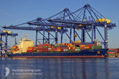
AS CARELIA
Not available

Current Trip
| Time Travelled | 13 h, 10 mins |
|---|---|
| Remaining Time | 8 h, 3 mins |
| Distance Travelled | 218.60 nm |
| Remaining Distance | 139.78 nm |
| AVG Speed | 16.6 Knots |
| MAX Speed | 18.4 Knots |
| AVG Wind | 5.7 knots |
| MAX Wind | 12.5 knots |
| MIN Temp | 11.5°C / 52.7°F |
| MAX Temp | 16.9°C / 62.42°F |
| Draught | 9 m |
| Position Received | 1 m ago |
Current Position
| Longitude | --- |
|---|---|
| Latitude | --- |
| Status | Under way using engine |
| Speed | 15.9 Knots |
| Course | 35° |
| Area | Mediterranean Sea - Western Basin |
| Station | T-AIS |
| Position Received | 1 m ago |
Information
The current position of AS CARELIA is in Mediterranean Sea - Western Basin with coordinates 37.53121° / -0.50945° as reported on 2025-03-27 14:20 by AIS to our vessel tracker app. The vessel's current speed is 15.9 Knots and is heading at the port of VALENCIA. The estimated time of arrival as calculated by MyShipTracking vessel tracking app is 2025-03-27 23:24 LT
The vessel AS CARELIA (MMSI: 255806092) is a Not available It's sailing under the flag of [PT] Portugal.
In this page you can find informations about the vessels current position, last detected port calls, and current voyage information. If the vessels is not in coverage by AIS you will find the latest position.
The current position of AS CARELIA is detected by our AIS receivers and we are not responsible for the reliability of the data. The last position was recorded while the vessel was in Coverage by the Ais receivers of our vessel tracking app.
The current draught of AS CARELIA as reported by AIS is 9 meters
Weather
| Temperature | 16.3°C / 61.34°F |
|---|---|
| Wind Speed | 6 knots |
| Direction | 93° E |
| Pressure | 1014.6 hPa |
| Humidity | 63.1 % |
| Cloud Coverage | 6 % |


Featured Company
Last Port Calls
| Port | Arrival | Departure | Time In Port |
|---|---|---|---|
| 2025-03-26 18:18 | 2025-03-27 02:11 | 7 h | |
| 2025-03-24 07:29 | 2025-03-24 23:28 | 15 h | |
| 2025-03-13 10:23 | 2025-03-14 01:25 | 15 h | |
| 2025-03-09 19:24 | 2025-03-10 02:11 | 6 h | |
| 2025-03-04 23:44 | 2025-03-06 05:07 | 1 d | |
| 2025-02-19 20:30 | 2025-02-20 23:48 | 1 d | |
| 2025-02-16 06:07 | 2025-02-16 23:17 | 17 h | |
| 2025-02-15 05:15 | 2025-02-15 20:04 | 14 h | |
| 2025-02-04 18:50 | 2025-02-13 17:10 | 8 d | |
| 2025-02-02 23:12 | 2025-02-03 14:46 | 15 h |
Last Trips
| Origin | Departure | Destination | Arrival | Distance | |
|---|---|---|---|---|---|
| 2025-03-24 23:28 | 2025-03-26 18:18 | 631.00 nm | |||
| 2025-03-14 01:25 | 2025-03-24 07:29 | 4034.73 nm | |||
| 2025-03-10 02:11 | 2025-03-13 10:23 | 685.49 nm | |||
| 2025-03-06 05:07 | 2025-03-09 19:24 | 826.51 nm | |||
| 2025-02-20 23:48 | 2025-03-04 23:44 | 4143.13 nm | |||
| 2025-02-16 23:17 | 2025-02-19 20:30 | 389.34 nm | |||
| 2025-02-15 20:04 | 2025-02-16 06:07 | 88.20 nm | |||
| 2025-02-13 17:10 | 2025-02-15 05:15 | 19.10 nm | |||
| 2025-02-03 14:46 | 2025-02-04 18:50 | 209.88 nm | |||
| 2025-01-31 23:19 | 2025-02-02 23:12 | 631.13 nm |
Events
| Time | Event | Details | Position / Dest | Info |
|---|---|---|---|---|
| 2025-03-27 13:46 | ETA Changed | 2025/03/27 23:00 |
37.43336 / -.66334
ESVLC
|
Speed: 15.9 kn Course: 55° |
| 2025-03-27 13:21 | ETA Changed | 2025/03/27 23:00 |
37.36299 / -.77360
ESVLC
|
Speed: 16.9 kn Course: 50° |
| 2025-03-27 11:53 | Status Changed | Under way using engine Default |
37.07275 / -1.15193
ESVLC
|
Speed: 17 kn Course: 45° |
| 2025-03-27 11:52 | Status Changed | Default Under way using engine |
37.07049 / -1.15478
ESVLC
|
Speed: 17 kn Course: 45.5° |
| 2025-03-27 10:58 | Status Changed | Under way using engine Default |
36.90821 / -1.39577
ESVLC
|
Speed: 16.8 kn Course: 54° |
| 2025-03-27 10:52 | Status Changed | Default Under way using engine |
36.89165 / -1.42347
ESVLC
|
Speed: 16.8 kn Course: 53.5° |
| 2025-03-27 10:36 | Status Changed | Under way using engine Default |
36.84789 / -1.49817
ESVLC
|
Speed: 16.9 kn Course: 46° |
| 2025-03-27 10:14 | Status Changed | Default Under way using engine |
36.78129 / -1.59083
ESVLC
|
Speed: 16.7 kn Course: 47.5° |
| 2025-03-27 09:09 | Status Changed | Under way using engine Default |
36.59460 / -1.88150
ESVLC
|
Speed: 16.7 kn Course: 50° |
| 2025-03-27 09:07 | Change Sea Area | Spanish part of the Mediterranean Sea - Western Basin Spanish part of the Alboran Sea |
36.58742 / -1.89201
Mediterranean Sea - Western Basin
ESVLC
|
Speed: 16.8 kn Course: 49.6° |