

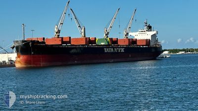
ARUNA NAZIK
Bulk Carrier

Current Trip
| Time Travelled | 12 days |
|---|---|
| Remaining Time | 2 days |
| Distance Travelled | 2868.38 nm |
| Remaining Distance | 893.53 nm |
| AVG Speed | 9.5 Knots |
| MAX Speed | 12.4 Knots |
| AVG Wind | 16.2 knots |
| MAX Wind | 34 knots |
| MIN Temp | 5.5°C / 41.9°F |
| MAX Temp | 19.8°C / 67.64°F |
| Draught | 13 m |
| Position Received | 1 d ago |
Current Position
| Longitude | --- |
|---|---|
| Latitude | --- |
| Status | Under way using engine |
| Speed | 11.1 Knots |
| Course | 217.5° |
| Area | North Atlantic Ocean |
| Station | T-AIS |
| Position Received | 1 d ago |
Information
The current position of ARUNA NAZIK is in North Atlantic Ocean with coordinates 27.52405° / -13.94233° as reported on 2025-03-12 14:48 by AIS to our vessel tracker app. The vessel's current speed is 11.1 Knots and is heading at the port of ALGECIRAS. The estimated time of arrival as calculated by MyShipTracking vessel tracking app is 2025-03-16 12:10 LT
The vessel ARUNA NAZIK (IMO: 9583146, MMSI: 538010428) is a Bulk Carrier that was built in 2012 ( 13 years old ). It's sailing under the flag of [MH] Marshall Is.
In this page you can find informations about the vessels current position, last detected port calls, and current voyage information. If the vessels is not in coverage by AIS you will find the latest position.
The current position of ARUNA NAZIK is detected by our AIS receivers and we are not responsible for the reliability of the data. The last position was recorded while the vessel was in Coverage by the Ais receivers of our vessel tracking app.
The current draught of ARUNA NAZIK as reported by AIS is 13 meters
Weather
| Temperature | 19.8°C / 67.64°F |
|---|---|
| Wind Speed | 13 knots |
| Direction | 341° NNW |
| Pressure | 1014.6 hPa |
| Humidity | 71.8 % |
| Cloud Coverage | 1 % |


Featured Company
Last Port Calls
| Port | Arrival | Departure | Time In Port |
|---|---|---|---|
| 2025-02-24 00:44 | 2025-03-01 02:43 | 5 d | |
| 2025-02-11 16:16 | 2025-02-17 04:37 | 5 d | |
| 2025-01-18 21:59 | 2025-01-28 23:47 | 10 d | |
| 2025-01-03 18:28 |
Most Visited Ports (Last year)
| Port | Arrivals | |
|---|---|---|
| 3 | ||
| 2 | ||
| 1 | ||
| 1 | ||
| 1 | ||
| 1 |
Last Trips
| Origin | Departure | Destination | Arrival | Distance | |
|---|---|---|---|---|---|
| 2025-02-17 04:37 | 2025-02-24 00:44 | 1122.70 nm | |||
| 2025-01-28 23:47 | 2025-02-11 16:16 | 3498.38 nm | |||
| 2025-01-03 18:28 | 2025-01-18 21:59 | 3482.86 nm |
Events
| Time | Event | Details | Position / Dest | Info |
|---|---|---|---|---|
| 2025-03-12 14:58 | Status Changed | Default Under way using engine |
27.49911 / -13.96588
ES ALG
|
Speed: 11.1 kn Course: 217.5° |
| 2025-03-12 14:48 | Status Changed | Under way using engine Default |
27.52405 / -13.94233
ES ALG
|
Speed: 11.2 kn Course: 219° |
| 2025-03-12 14:48 | OUT of Coverage |
27.52405 / -13.94233
North Atlantic Ocean
|
Speed: 11.1 kn Course: 217.5° |
|
| 2025-03-12 14:30 | Status Changed | Default Under way using engine |
27.56675 / -13.90390
ES ALG
|
Speed: 11.5 kn Course: 218.8° |
| 2025-03-12 14:13 | Detected in Sea | Western Saharan part of the North Atlantic Ocean |
27.61025 / -13.86380
North Atlantic Ocean
|
Speed: 11.5 kn Course: 219.1° |
| 2025-03-12 14:13 | Status Changed | Under way using engine Default |
27.61025 / -13.86380
ES ALG
|
Speed: 11.7 kn Course: 220° |
| 2025-03-12 13:55 | IN Coverage |
27.61025 / -13.86380
North Atlantic Ocean
|
Speed: 11.5 kn Course: 219.1° |
|
| 2025-03-12 08:29 | Status Changed | Default Under way using engine |
28.52808 / -13.23981
ES ALG
|
Speed: 10.9 kn Course: 206.5° |
| 2025-03-12 08:23 | Change Sea Area | Spanish (Canary Islands) part of the North Atlantic Ocean Spanish part of the North Atlantic Ocean |
28.54410 / -13.23093
North Atlantic Ocean
|
Speed: 10.9 kn Course: 206.5° |
| 2025-03-12 08:23 | OUT of Coverage |
28.54410 / -13.23093
North Atlantic Ocean
|
Speed: 10.9 kn Course: 206.5° |