
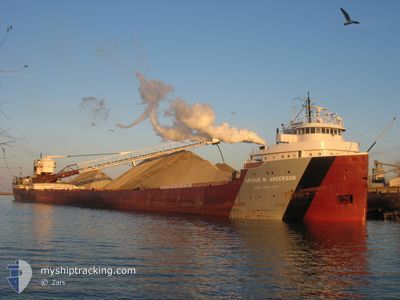
ARTHUR M. ANDERSON
Self Discharging Bulk Carrier
Current Trip
LOVELY BREVORT
| Time Travelled | 1 day |
|---|---|
| Remaining Time | --- |
| Distance Travelled | 304.73 nm |
| Remaining Distance | --- |
| AVG Speed | 12.3 Knots |
| MAX Speed | 13.2 Knots |
| AVG Wind | 8.4 knots |
| MAX Wind | 14.9 knots |
| MIN Temp | 6°C / 42.8°F |
| MAX Temp | 13.8°C / 56.84°F |
| Draught | 0 m |
| Position Received | 1 d ago |
Current Position
| Longitude | -86.81755° |
|---|---|
| Latitude | 43.35668° |
| Status | Under way using engine |
| Speed | 13 Knots |
| Course | 11.7° |
| Area | --- |
| Station | T-AIS |
| Position Received | 1 d ago |
Info
Information
The current position of ARTHUR M. ANDERSON is in --- with coordinates 43.35668° / -86.81755° as reported on 2024-05-08 21:38 by AIS to our vessel tracker app. The vessel's current speed is 13 Knots
The vessel ARTHUR M. ANDERSON (IMO: 5025691, MMSI: 366972020) is a Self Discharging Bulk Carrier that was built in 1952 ( 72 years old ). It's sailing under the flag of [US] USA.
In this page you can find informations about the vessels current position, last detected port calls, and current voyage information. If the vessels is not in coverage by AIS you will find the latest position.
The current position of ARTHUR M. ANDERSON is detected by our AIS receivers and we are not responsible for the reliability of the data. The last position was recorded while the vessel was in Coverage by the Ais receivers of our vessel tracking app.
Weather
| Temperature | 10.5°C / 50.9°F |
|---|---|
| Wind Speed | 7 knots |
| Direction | 345° NNW |
| Pressure | 1013 hPa |
| Humidity | 66.4 % |
| Cloud Coverage | 69 % |
Featured Company
Last Port Calls
| Port | Arrival | Departure | Time In Port |
|---|---|---|---|
| 2024-05-08 04:23 | 2024-05-08 13:29 | 9 h | |
| 2024-05-06 16:02 | 2024-05-06 19:41 | 3 h | |
| 2024-05-04 07:12 | 2024-05-05 12:54 | 1 d | |
| 2024-05-03 04:55 | 2024-05-03 05:40 | 44 m | |
| 2024-05-02 01:14 | 2024-05-02 04:01 | 2 h | |
| 2024-04-29 23:28 | 2024-04-30 01:34 | 2 h | |
| 2024-04-27 05:11 | 2024-04-28 11:24 | 1 d | |
| 2024-04-25 23:27 | 2024-04-26 01:22 | 1 h | |
| 2024-04-24 04:26 | 2024-04-24 16:18 | 11 h | |
| 2024-04-22 17:17 | 2024-04-22 19:41 | 2 h |
Most Visited Ports (Last year)
| Port | Arrivals | |
|---|---|---|
| 66 | ||
| 23 | ||
| 19 | ||
| 17 | ||
| 13 | ||
| 9 |
Last Trips
| Origin | Departure | Destination | Arrival | Distance | |
|---|---|---|---|---|---|
| 2024-05-06 15:41 | 2024-05-07 23:23 | 385.95 nm | |||
| 2024-05-05 07:54 | 2024-05-06 12:02 | 323.78 nm | |||
| 2024-05-03 01:40 | 2024-05-04 02:12 | 319.79 nm | |||
| 2024-05-02 00:01 | 2024-05-03 00:55 | 285.46 nm | |||
| 2024-04-29 21:34 | 2024-05-01 21:14 | 382.42 nm | |||
| 2024-04-28 06:24 | 2024-04-29 19:28 | 422.02 nm | |||
| 2024-04-25 21:22 | 2024-04-27 00:11 | 339.70 nm | |||
| 2024-04-24 11:18 | 2024-04-25 19:27 | 370.76 nm | |||
| 2024-04-22 15:41 | 2024-04-23 23:26 | 383.86 nm | |||
| 2024-04-21 06:37 | 2024-04-22 13:17 | 324.57 nm |
Events
| Time | Event | Details | Position / Dest | Info |
|---|---|---|---|---|
| 2024-05-10 00:44 | START Moving | 20 nm, North West of ST IGNACE |
46.01333 / -85.15166
LOVELY BREVORT
|
Speed: 6 kn Course: 169° |
| 2024-05-09 13:29 | STOP Moving | 18.4 nm, North West of ST IGNACE |
46.02667 / -85.09834
LOVELY BREVORT
|
Speed: Course: -1° |
| 2024-05-08 21:46 | Status Changed | Default Under way using engine |
43.38559 / -86.80923
LOVELY BREVORT
|
Speed: 13 kn Course: 11.7° |
| 2024-05-08 21:38 | OUT of Coverage |
43.35668 / -86.81755
LOVELY BREVORT
|
Speed: 13 kn Course: 11.7° |
|
| 2024-05-08 21:15 | Status Changed | Under way using engine Default |
43.27755 / -86.84066
LOVELY BREVORT
|
Speed: 13 kn Course: 12° |
| 2024-05-08 21:14 | Status Changed | Default Under way using engine |
43.27159 / -86.84241
LOVELY BREVORT
|
Speed: 13 kn Course: 12.5° |
| 2024-05-08 18:03 | Status Changed | Under way using engine Default |
42.59663 / -87.03879
LOVELY BREVORT
|
Speed: 13 kn Course: 11° |
| 2024-05-08 18:03 | IN Coverage |
42.60124 / -87.03750
LOVELY BREVORT
|
Speed: 13 kn Course: 11.6° |
|
| 2024-05-08 16:51 | Status Changed | Default Under way using engine |
42.34206 / -87.11234
LOVELY BREVORT
|
Speed: 13 kn Course: 12.2° |
| 2024-05-08 16:48 | OUT of Coverage |
42.33020 / -87.11576
LOVELY BREVORT
|
Speed: 13 kn Course: 12.2° |