
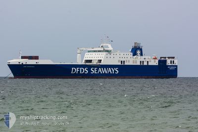
ARK GERMANIA
Ro-Ro Cargo
Current Trip
| Time Travelled | 27 days |
|---|---|
| Remaining Time | --- |
| Distance Travelled | 10515.00 nm |
| Remaining Distance | --- |
| AVG Speed | 17.1 Knots |
| MAX Speed | 21 Knots |
| AVG Wind | 12.9 knots |
| MAX Wind | 33.9 knots |
| MIN Temp | -0.2°C / 31.64°F |
| MAX Temp | 29.4°C / 84.92°F |
| Draught | 6.2 m |
| Position Received | 9 d ago |
Current Position
| Longitude | -57.39714° |
|---|---|
| Latitude | -38.67440° |
| Status | Under way using engine |
| Speed | 15.7 Knots |
| Course | 248.2° |
| Area | South Atlantic Ocean |
| Station | T-AIS |
| Position Received | 9 d ago |
Info
Information
The current position of ARK GERMANIA is in South Atlantic Ocean with coordinates -38.67440° / -57.39714° as reported on 2024-05-02 22:32 by AIS to our vessel tracker app. The vessel's current speed is 15.7 Knots and is heading at the port of BAHIA BLANCA. The estimated time of arrival as calculated by MyShipTracking vessel tracking app is 2024-05-03 12:00 LT
The vessel ARK GERMANIA (IMO: 9609952, MMSI: 219551000) is a Ro-Ro Cargo that was built in 2014 ( 10 years old ). It's sailing under the flag of [DK] Denmark.
In this page you can find informations about the vessels current position, last detected port calls, and current voyage information. If the vessels is not in coverage by AIS you will find the latest position.
The current position of ARK GERMANIA is detected by our AIS receivers and we are not responsible for the reliability of the data. The last position was recorded while the vessel was in Coverage by the Ais receivers of our vessel tracking app.
The current draught of ARK GERMANIA as reported by AIS is 6.2 meters
Weather
| Temperature | 21.7°C / 71.06°F |
|---|---|
| Wind Speed | 17 knots |
| Direction | 84° E |
| Pressure | 1016.4 hPa |
| Humidity | 79.6 % |
| Cloud Coverage | 100 % |
Featured Company
Last Port Calls
| Port | Arrival | Departure | Time In Port |
|---|---|---|---|
| 2024-04-03 06:14 | 2024-04-14 17:12 | 11 d | |
| 2024-03-18 16:11 | 2024-04-01 18:41 | 14 d | |
| 2024-03-17 13:54 | 2024-03-17 17:20 | 3 h | |
| 2024-03-16 14:13 | 2024-03-16 19:59 | 5 h | |
| 2024-03-15 14:02 | 2024-03-15 19:04 | 5 h | |
| 2024-03-14 14:34 | 2024-03-14 20:21 | 5 h | |
| 2024-03-13 14:05 | 2024-03-13 19:27 | 5 h | |
| 2024-03-12 14:31 | 2024-03-12 20:07 | 5 h | |
| 2024-03-10 15:27 | 2024-03-11 19:23 | 1 d | |
| 2024-03-09 14:10 | 2024-03-09 19:38 | 5 h |
Most Visited Ports (Last year)
| Port | Arrivals | |
|---|---|---|
| 122 | ||
| 119 | ||
| 2 | ||
| 1 | ||
| 1 | ||
| 1 |
Last Trips
| Origin | Departure | Destination | Arrival | Distance | |
|---|---|---|---|---|---|
| 2024-04-01 20:41 | 2024-04-03 08:14 | 412.81 nm | |||
| 2024-03-17 18:20 | 2024-03-18 17:11 | 379.35 nm | |||
| 2024-03-16 19:59 | 2024-03-17 14:54 | 330.36 nm | |||
| 2024-03-15 20:04 | 2024-03-16 14:13 | 328.23 nm | |||
| 2024-03-14 20:21 | 2024-03-15 15:02 | 330.45 nm | |||
| 2024-03-13 20:27 | 2024-03-14 14:34 | 329.00 nm | |||
| 2024-03-12 20:07 | 2024-03-13 15:05 | 330.55 nm | |||
| 2024-03-11 20:23 | 2024-03-12 14:31 | 328.71 nm | |||
| 2024-03-09 19:38 | 2024-03-10 16:27 | 329.79 nm | |||
| 2024-03-08 19:59 | 2024-03-09 14:10 | 328.86 nm |
Events
| Time | Event | Details | Position / Dest | Info |
|---|---|---|---|---|
| 2024-05-03 21:55 | START Moving | 15.89 nm, South East of PUERTO ROSALES |
-39.08776 / -61.79844
ARBHI
|
Speed: 5.9 kn Course: 173° |
| 2024-05-03 13:29 | STOP Moving | 15.71 nm, South East of PUERTO ROSALES |
-39.08357 / -61.79906
ARBHI
|
Speed: 0.3 kn Course: 86° |
| 2024-05-02 22:42 | Status Changed | Default Under way using engine |
-38.69764 / -57.44868
ARBHI
|
Speed: 15.7 kn Course: 248.2° |
| 2024-05-02 22:32 | OUT of Coverage |
-38.67440 / -57.39714
South Atlantic Ocean
ARBHI
|
Speed: 15.7 kn Course: 248.2° |
|
| 2024-05-02 20:56 | ETA Changed | 2024/05/03 12:00 2024/05/03 15:00 |
-38.48132 / -56.92168
ARBHI
|
Speed: 16 kn Course: 240.9° |
| 2024-05-02 20:28 | Change Sea Area | Argentinean part of the South Atlantic Ocean Spanish part of the North Atlantic Ocean |
-38.42160 / -56.78331
South Atlantic Ocean
ARBHI
|
Speed: 15.5 kn Course: 239.8° |
| 2024-05-02 20:28 | Status Changed | Under way using engine Default |
-38.42160 / -56.78331
ARBHI
|
Speed: 16 kn Course: 240° |
| 2024-05-02 20:18 | IN Coverage |
-38.42160 / -56.78331
South Atlantic Ocean
ARBHI
|
Speed: 15.5 kn Course: 239.8° |