
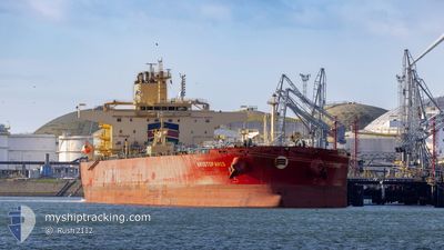
ARISTOFANIS
Tanker
Current Trip
BOURGAS
| Time Travelled | 2 days |
|---|---|
| Remaining Time | --- |
| Distance Travelled | 389.69 nm |
| Remaining Distance | --- |
| AVG Speed | 9.9 Knots |
| MAX Speed | 15.2 Knots |
| AVG Wind | 14.9 knots |
| MAX Wind | 20.9 knots |
| MIN Temp | 13.8°C / 56.84°F |
| MAX Temp | 15°C / 59°F |
| Draught | 11.6 m |
| Position Received | 3 d ago |
Current Position
| Longitude | 28.20156° |
|---|---|
| Latitude | 42.49671° |
| Status | Under way using engine |
| Speed | 11.8 Knots |
| Course | 282.6° |
| Area | Black Sea |
| Station | T-AIS |
| Position Received | 3 d ago |
Info
Information
The current position of ARISTOFANIS is in Black Sea with coordinates 42.49671° / 28.20156° as reported on 2024-05-06 23:30 by AIS to our vessel tracker app. The vessel's current speed is 11.8 Knots
The vessel ARISTOFANIS (IMO: 9867621, MMSI: 538008714) is a Tanker It's sailing under the flag of [MH] Marshall Is.
In this page you can find informations about the vessels current position, last detected port calls, and current voyage information. If the vessels is not in coverage by AIS you will find the latest position.
The current position of ARISTOFANIS is detected by our AIS receivers and we are not responsible for the reliability of the data. The last position was recorded while the vessel was in Coverage by the Ais receivers of our vessel tracking app.
The current draught of ARISTOFANIS as reported by AIS is 11.6 meters
Weather
| Temperature | 15°C / 59°F |
|---|---|
| Wind Speed | 11 knots |
| Direction | 78° ENE |
| Pressure | 1013.2 hPa |
| Humidity | 88.4 % |
| Cloud Coverage | 82 % |
Featured Company
Last Port Calls
| Port | Arrival | Departure | Time In Port |
|---|---|---|---|
| 2024-05-07 07:08 | 2024-05-08 16:48 | 1 d | |
| 2024-04-21 06:29 | 2024-04-21 15:47 | 9 h | |
| 2024-04-11 03:26 | 2024-04-12 08:01 | 1 d | |
| 2024-03-29 04:10 | 2024-03-29 13:31 | 9 h | |
| 2024-03-13 00:30 | 2024-03-16 12:24 | 3 d | |
| 2024-03-03 00:10 | 2024-03-04 03:13 | 1 d |
Last Trips
| Origin | Departure | Destination | Arrival | Distance | |
|---|---|---|---|---|---|
| 2024-04-12 11:01 | 2024-05-07 10:08 | 2576.87 nm | |||
| 2024-04-12 11:01 | 2024-04-21 08:29 | 1173.53 nm | |||
| 2024-03-16 13:24 | 2024-04-11 06:26 | 4606.13 nm | |||
| 2024-03-16 13:24 | 2024-03-29 06:10 | 3383.13 nm | |||
| 2024-03-04 04:13 | 2024-03-13 01:30 | 74.53 nm | |||
| 2024-02-10 19:02 | 2024-03-03 01:10 | 3622.29 nm |
Events
| Time | Event | Details | Position / Dest | Info |
|---|---|---|---|---|
| 2024-05-10 15:30 | START Moving |
42.99546 / 35.60572
BOURGAS
|
Speed: 4.4 kn Course: 121° |
|
| 2024-05-10 08:42 | STOP Moving |
43.19833 / 35.53833
BOURGAS
|
Speed: Course: -1° |
|
| 2024-05-08 16:48 | PORT DEPARTURE |
|
42.46802 / 27.53221
BOURGAS
|
Speed: 5.1 kn Course: 19° |
| 2024-05-08 16:36 | START Moving |
42.45072 / 27.53241
[BG] BURGAS
|
Speed: 3.3 kn Course: 334° |
|
| 2024-05-07 07:08 | PORT ARRIVAL |
|
42.46355 / 27.52334
[BG] BURGAS
|
Speed: 4.8 kn Course: 211° |
| 2024-05-07 06:29 | START Moving | 4.04 nm, East of BURGAS |
42.48984 / 27.57293
BOURGAS
|
Speed: 3.7 kn Course: 247° |
| 2024-05-06 23:36 | Status Changed | Default Under way using engine |
42.50120 / 28.17250
BOURGAS
|
Speed: 11.8 kn Course: 282.6° |
| 2024-05-06 23:30 | OUT of Coverage |
42.49671 / 28.20156
Black Sea
BOURGAS
|
Speed: 11.8 kn Course: 282.6° |
|
| 2024-05-06 23:23 | Status Changed | Under way using engine Default |
42.49214 / 28.23186
BOURGAS
|
Speed: 11.8 kn Course: 296° |
| 2024-05-06 23:08 | Status Changed | Default Under way using engine |
42.46325 / 28.28178
BOURGAS
|
Speed: 11.9 kn Course: 320.6° |