
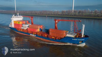
ARCTIC COMMANDER
General Cargo
Current Trip
| Time Travelled | 22 h, 6 mins |
|---|---|
| Remaining Time | 6 h, 19 mins |
| Distance Travelled | 303.45 nm |
| Remaining Distance | 91.24 nm |
| AVG Speed | 14.1 Knots |
| MAX Speed | 16.1 Knots |
| AVG Wind | 8.6 knots |
| MAX Wind | 22 knots |
| MIN Temp | 0.9°C / 33.62°F |
| MAX Temp | 7.7°C / 45.86°F |
| Draught | 5 m |
| Position Received | Now |
Current Position
| Longitude | --- |
|---|---|
| Latitude | --- |
| Status | Under way using engine |
| Speed | 13.5 Knots |
| Course | 339.8° |
| Area | North Sea |
| Station | T-AIS |
| Position Received | Now |
Info
Information
The current position of ARCTIC COMMANDER is in North Sea with coordinates 57.55347° / 5.98067° as reported on 2025-12-06 04:08 by AIS to our vessel tracker app. The vessel's current speed is 13.5 Knots and is heading at the port of TANANGER. The estimated time of arrival as calculated by MyShipTracking vessel tracking app is 2025-12-06 11:28 LT
The vessel ARCTIC COMMANDER (IMO: 9143829, MMSI: 314292000) is a General Cargo that was built in 1997 ( 28 years old ). It's sailing under the flag of [BB] Barbados.
In this page you can find informations about the vessels current position, last detected port calls, and current voyage information. If the vessels is not in coverage by AIS you will find the latest position.
The current position of ARCTIC COMMANDER is detected by our AIS receivers and we are not responsible for the reliability of the data. The last position was recorded while the vessel was in Coverage by the Ais receivers of our vessel tracking app.
The current draught of ARCTIC COMMANDER as reported by AIS is 5 meters
Weather
| Temperature | 7.6°C / 45.68°F |
|---|---|
| Wind Speed | 22 knots |
| Direction | 128° SE |
| Pressure | 1003.5 hPa |
| Humidity | 78.3 % |
| Cloud Coverage | 100 % |
Featured Company
Last Port Calls
| Port | Arrival | Departure | Time In Port |
|---|---|---|---|
| 2025-12-04 09:53 | 2025-12-05 07:03 | 21 h | |
| 2025-12-01 19:06 | 2025-12-01 21:45 | 2 h | |
| 2025-12-01 06:57 | 2025-12-01 10:27 | 3 h | |
| 2025-11-30 11:09 | 2025-11-30 13:55 | 2 h | |
| 2025-11-30 03:45 | 2025-11-30 04:53 | 1 h | |
| 2025-11-29 23:02 | 2025-11-30 01:42 | 2 h | |
| 2025-11-27 14:27 | 2025-11-28 10:48 | 20 h | |
| 2025-11-24 16:22 | 2025-11-24 20:57 | 4 h | |
| 2025-11-24 13:26 | 2025-11-24 15:12 | 1 h | |
| 2025-11-23 07:42 | 2025-11-23 12:44 | 5 h |
Most Visited Ports (Last year)
| Port | Arrivals | |
|---|---|---|
| 56 | ||
| 47 | ||
| 47 | ||
| 47 | ||
| 46 | ||
| 29 |
Last Trips
| Origin | Departure | Destination | Arrival | Distance | |
|---|---|---|---|---|---|
| 2025-12-01 21:45 | 2025-12-04 09:53 | 671.03 nm | |||
| 2025-12-01 10:27 | 2025-12-01 19:06 | 13.56 nm | |||
| 2025-11-30 13:55 | 2025-12-01 06:57 | 167.96 nm | |||
| 2025-11-30 04:53 | 2025-11-30 11:09 | 76.33 nm | |||
| 2025-11-30 01:42 | 2025-11-30 03:45 | 27.72 nm | |||
| 2025-11-28 10:48 | 2025-11-29 23:02 | 428.56 nm | |||
| 2025-11-24 20:57 | 2025-11-27 14:27 | 642.45 nm | |||
| 2025-11-24 15:12 | 2025-11-24 16:22 | 13.39 nm | |||
| 2025-11-23 12:44 | 2025-11-24 13:26 | 230.99 nm | |||
| 2025-11-23 01:23 | 2025-11-23 07:42 | 76.44 nm |
Events
| Time | Event | Details | Position / Dest | Info |
|---|---|---|---|---|
| 2025-12-06 02:10 | Draught Changed | 5 4.4 |
57.11924 / 6.16465
NOTAE
|
Speed: 13.5 kn Course: 349.9° |
| 2025-12-06 02:10 | ETA Changed | 2025/12/06 11:00 2025/12/06 12:00 |
57.11924 / 6.16465
NOTAE
|
Speed: 13.5 kn Course: 349.9° |
| 2025-12-06 01:42 | Status Changed | Under way using engine Default |
57.01649 / 6.20758
NOTAE
|
Speed: 14 kn Course: 344° |
| 2025-12-06 01:37 | Status Changed | Default Under way using engine |
56.99667 / 6.21667
NOTAE
|
Speed: 13.8 kn Course: 343° |
| 2025-12-06 01:36 | Status Changed | Under way using engine Default |
56.99288 / 6.21762
NOTAE
|
Speed: 13.8 kn Course: 344° |
| 2025-12-06 01:36 | IN Coverage |
56.99288 / 6.21762
North Sea
NOTAE
|
Speed: 13.8 kn Course: 343° |
|
| 2025-12-06 01:36 | Detected in Sea | Norwegian part of the North Sea |
56.99288 / 6.21762
North Sea
NOTAE
|
Speed: 13.8 kn Course: 343° |
| 2025-12-05 08:49 | Status Changed | Default Under way using engine |
53.86715 / 9.05362
NOTAE
|
Speed: 13.2 kn Course: 248.7° |
| 2025-12-05 08:41 | OUT of Coverage |
53.87764 / 9.09622
North Sea
NOTAE
|
Speed: 13.2 kn Course: 248.7° |
|
| 2025-12-05 06:03 | PORT DEPARTURE |
|
53.54552 / 9.85595
NOTAE
|
Speed: 12.3 kn Course: 289° |