

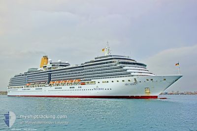
ARCADIA
Passengers Ship

Current Trip
NAWVB
| Time Travelled | 3 days |
|---|---|
| Remaining Time | --- |
| Distance Travelled | 1689.74 nm |
| Remaining Distance | --- |
| AVG Speed | 18.4 Knots |
| MAX Speed | 19.4 Knots |
| AVG Wind | 12.5 knots |
| MAX Wind | 17 knots |
| MIN Temp | 16.9°C / 62.42°F |
| MAX Temp | 28.4°C / 83.12°F |
| Draught | 8.2 m |
| Position Received | 6 d ago |
Current Position
| Longitude | --- |
|---|---|
| Latitude | --- |
| Status | Under way using engine |
| Speed | 9.1 Knots |
| Course | 300.1° |
| Area | South Atlantic Ocean |
| Station | T-AIS |
| Position Received | 6 d ago |
Information
The current position of ARCADIA is in South Atlantic Ocean with coordinates -33.68600° / 18.16868° as reported on 2025-03-24 18:11 by AIS to our vessel tracker app. The vessel's current speed is 9.1 Knots
The vessel ARCADIA (IMO: 9226906, MMSI: 310459000) is a Passengers Ship that was built in 2005 ( 20 years old ). It's sailing under the flag of [BM] Bermuda.
In this page you can find informations about the vessels current position, last detected port calls, and current voyage information. If the vessels is not in coverage by AIS you will find the latest position.
The current position of ARCADIA is detected by our AIS receivers and we are not responsible for the reliability of the data. The last position was recorded while the vessel was in Coverage by the Ais receivers of our vessel tracking app.
The current draught of ARCADIA as reported by AIS is 8.2 meters
Weather
| Temperature | 28.2°C / 82.76°F |
|---|---|
| Wind Speed | 10 knots |
| Direction | 208° SSW |
| Pressure | 1009.1 hPa |
| Humidity | 74.4 % |
| Cloud Coverage | 100 % |


Featured Company
Last Port Calls
| Port | Arrival | Departure | Time In Port |
|---|---|---|---|
| 2025-03-27 04:21 | 2025-03-27 18:08 | 13 h | |
| 2025-03-23 07:51 | 2025-03-24 17:58 | 1 d | |
| 2025-03-18 07:12 | 2025-03-18 18:25 | 11 h | |
| 2025-03-17 07:29 | 2025-03-17 20:17 | 12 h | |
| 2025-03-10 06:56 | 2025-03-10 17:50 | 10 h | |
| 2025-03-09 07:41 | 2025-03-09 19:30 | 11 h | |
| 2025-03-07 17:08 | 2025-03-08 20:36 | 1 d | |
| 2025-03-05 07:43 | 2025-03-05 18:56 | 11 h | |
| 2025-03-03 06:24 | 2025-03-03 17:32 | 11 h | |
| 2025-02-28 05:26 | 2025-02-28 21:34 | 16 h |
Last Trips
| Origin | Departure | Destination | Arrival | Distance | |
|---|---|---|---|---|---|
| 2025-03-24 17:58 | 2025-03-27 04:21 | 727.07 nm | |||
| 2025-03-18 18:25 | 2025-03-23 07:51 | 2202.14 nm | |||
| 2025-03-17 20:17 | 2025-03-18 07:12 | 136.89 nm | |||
| 2025-03-10 17:50 | 2025-03-17 07:29 | 3063.42 nm | |||
| 2025-03-09 19:30 | 2025-03-10 06:56 | 198.62 nm | |||
| 2025-03-08 20:36 | 2025-03-09 07:41 | 203.23 nm | |||
| 2025-03-05 18:56 | 2025-03-07 17:08 | 760.57 nm | |||
| 2025-03-03 17:32 | 2025-03-05 07:43 | 668.10 nm | |||
| 2025-02-28 21:34 | 2025-03-03 06:24 | 957.77 nm | |||
| 2025-02-24 18:29 | 2025-02-28 05:26 | 1282.12 nm |
Events
| Time | Event | Details | Position / Dest | Info |
|---|---|---|---|---|
| 2025-03-27 16:08 | PORT DEPARTURE |
|
-22.92530 / 14.49730
NAWVB
|
Speed: 9.8 kn Course: 2° |
| 2025-03-27 15:57 | START Moving |
-22.95104 / 14.49131
[NA] WALVIS BAY
|
Speed: 4.4 kn Course: 88° |
|
| 2025-03-27 02:37 | STOP Moving |
-22.95319 / 14.48611
[NA] WALVIS BAY
|
Speed: 0.3 kn Course: 281° |
|
| 2025-03-27 02:21 | PORT ARRIVAL |
|
-22.93619 / 14.49676
[NA] WALVIS BAY
|
Speed: 12.1 kn Course: 184° |
| 2025-03-24 18:17 | Status Changed | Default Under way using engine |
-33.67894 / 18.15891
NAWVB
|
Speed: 9.1 kn Course: 300.1° |
| 2025-03-24 18:11 | OUT of Coverage |
-33.68600 / 18.16868
South Atlantic Ocean
NAWVB
|
Speed: 9.1 kn Course: 300.1° |
|
| 2025-03-24 18:08 | Status Changed | Under way using engine Default |
-33.68957 / 18.17619
NAWVB
|
Speed: 17.5 kn Course: 322° |
| 2025-03-24 17:55 | Status Changed | Default Under way using engine |
-33.73315 / 18.21693
NAWVB
|
Speed: 9.3 kn Course: 325.1° |
| 2025-03-24 15:58 | PORT DEPARTURE |
|
-33.89690 / 18.43655
NAWVB
|
Speed: 5.9 kn Course: 348° |
| 2025-03-24 15:49 | START Moving |
-33.90994 / 18.43348
[ZA] CAPE TOWN
|
Speed: 3.1 kn Course: 10° |