
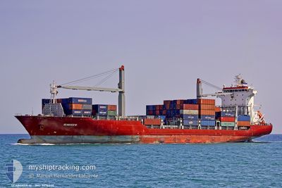
APL OCEANIA
Container Ship
Current Trip
JP YOK HM2
| Time Travelled | 8 days |
|---|---|
| Remaining Time | --- |
| Distance Travelled | 2549.75 nm |
| Remaining Distance | --- |
| AVG Speed | 14.7 Knots |
| MAX Speed | 20.1 Knots |
| AVG Wind | 13.5 knots |
| MAX Wind | 30 knots |
| MIN Temp | 3.6°C / 38.48°F |
| MAX Temp | 28.3°C / 82.94°F |
| Draught | 9.2 m |
| Position Received | 7 d ago |
Current Position
| Longitude | --- |
|---|---|
| Latitude | --- |
| Status | Under way using engine |
| Speed | 3.7 Knots |
| Course | 173° |
| Area | Philippine Sea |
| Station | T-AIS |
| Position Received | 7 d ago |
Info
Information
The current position of APL OCEANIA is in Philippine Sea with coordinates 35.17715° / 139.41072° as reported on 2026-01-03 03:36 by AIS to our vessel tracker app. The vessel's current speed is 3.7 Knots
The vessel APL OCEANIA (IMO: 9436070, MMSI: 367619000) is a Container Ship that was built in 2010 ( 16 years old ). It's sailing under the flag of [US] USA.
In this page you can find informations about the vessels current position, last detected port calls, and current voyage information. If the vessels is not in coverage by AIS you will find the latest position.
The current position of APL OCEANIA is detected by our AIS receivers and we are not responsible for the reliability of the data. The last position was recorded while the vessel was in Coverage by the Ais receivers of our vessel tracking app.
The current draught of APL OCEANIA as reported by AIS is 9.2 meters
Weather
| Temperature | 18.6°C / 65.48°F |
|---|---|
| Wind Speed | 27 knots |
| Direction | 298° WNW |
| Pressure | 1013.5 hPa |
| Humidity | 60.9 % |
| Cloud Coverage | 100 % |
Featured Company
Last Port Calls
| Port | Arrival | Departure | Time In Port |
|---|---|---|---|
| 2026-01-02 06:42 | 2026-01-02 17:25 | 10 h | |
| 2025-12-30 12:36 | 2025-12-30 17:34 | 4 h | |
| 2025-12-29 03:00 | 2025-12-30 00:32 | 21 h | |
| 2025-12-17 06:17 | 2025-12-17 14:41 | 8 h | |
| 2025-12-14 09:48 | 2025-12-14 15:50 | 6 h | |
| 2025-12-13 06:57 | 2025-12-13 21:25 | 14 h | |
| 2025-12-02 23:36 | 2025-12-03 18:00 | 18 h | |
| 2025-11-30 11:46 | 2025-11-30 21:43 | 9 h | |
| 2025-11-29 04:41 | 2025-11-29 19:21 | 14 h | |
| 2025-11-16 06:58 | 2025-11-16 17:17 | 10 h |
Last Trips
| Origin | Departure | Destination | Arrival | Distance | |
|---|---|---|---|---|---|
| 2025-12-30 17:34 | 2026-01-02 06:42 | 673.93 nm | |||
| 2025-12-30 00:32 | 2025-12-30 12:36 | 130.39 nm | |||
| 2025-12-17 14:41 | 2025-12-29 03:00 | 3372.76 nm | |||
| 2025-12-14 15:50 | 2025-12-17 06:17 | 693.70 nm | |||
| 2025-12-13 21:25 | 2025-12-14 09:48 | 139.44 nm | |||
| 2025-12-03 18:00 | 2025-12-13 06:57 | 3063.54 nm | |||
| 2025-11-30 21:43 | 2025-12-02 23:36 | 630.27 nm | |||
| 2025-11-29 19:21 | 2025-11-30 11:46 | 163.32 nm | |||
| 2025-11-16 17:17 | 2025-11-29 04:41 | 2999.64 nm | |||
| 2025-11-14 04:46 | 2025-11-16 06:58 | 628.44 nm |
Events
| Time | Event | Details | Position / Dest | Info |
|---|---|---|---|---|
| 2026-01-08 05:41 | START Moving |
13.45848 / 144.66429
JP YOK HM2
|
Speed: 5.8 kn Course: 251° |
|
| 2026-01-07 04:59 | STOP Moving |
13.46027 / 144.67123
JP YOK HM2
|
Speed: 0.3 kn Course: 267° |
|
| 2026-01-03 03:45 | Status Changed | Default Under way using engine |
35.16572 / 139.41403
JP YOK HM2
|
Speed: 3.7 kn Course: 173° |
| 2026-01-03 03:36 | OUT of Coverage |
35.17715 / 139.41072
Philippine Sea
|
Speed: 3.7 kn Course: 126.2° |
|
| 2026-01-03 03:34 | Status Changed | Under way using engine Default |
35.17808 / 139.40769
JP YOK HM2
|
Speed: 3.2 kn Course: 99° |
| 2026-01-03 03:33 | START Moving | 8.22 nm, South of CHIGASAKI |
35.17792 / 139.40642
JP YOK HM2
|
Speed: 3.2 kn Course: 99° |
| 2026-01-03 03:25 | IN Coverage |
35.17808 / 139.40769
Philippine Sea
|
Speed: 3.6 kn Course: 81.8° |
|
| 2026-01-03 02:28 | STOP Moving | 8.39 nm, South of HIRATSUKA |
35.17456 / 139.39291
JP YOK HM2
|
Speed: 0.3 kn Course: 82° |
| 2026-01-03 01:13 | Status Changed | Default Under way using engine |
35.16731 / 139.37584
JP YOK HM2
|
Speed: 1.6 kn Course: 338° |
| 2026-01-03 01:07 | OUT of Coverage |
35.16508 / 139.37595
Philippine Sea
|
Speed: 1.6 kn Course: 344.4° |