
APANEMO
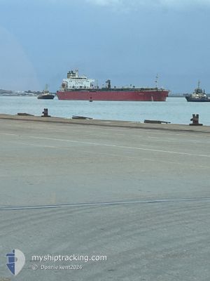
Oil Products Tanker
Current Trip
RABIGH
| Time Travelled | 8 days |
|---|---|
| Remaining Time | --- |
| Distance Travelled | 511.30 nm |
| Remaining Distance | --- |
| AVG Speed | 12.2 Knots |
| MAX Speed | 12.9 Knots |
| AVG Wind | 13 knots |
| MAX Wind | 28.8 knots |
| MIN Temp | 16.5°C / 61.7°F |
| MAX Temp | 23.1°C / 73.58°F |
| Draught | 8.2 m |
| Position Received | 10 d ago |
Current Position
| Longitude | --- |
|---|---|
| Latitude | --- |
| Status | Under way using engine |
| Speed | 7.5 Knots |
| Course | 17.7° |
| Area | Red Sea |
| Station | T-AIS |
| Position Received | 10 d ago |
Info
Information
The current position of APANEMO is in Red Sea with coordinates 22.54359° / 38.75352° as reported on 2025-03-04 19:38 by AIS to our vessel tracker app. The vessel's current speed is 7.5 Knots
The vessel APANEMO (IMO: 9448164, MMSI: 215089000) is a Oil Products Tanker that was built in 2009 ( 16 years old ). It's sailing under the flag of [MT] Malta.
In this page you can find informations about the vessels current position, last detected port calls, and current voyage information. If the vessels is not in coverage by AIS you will find the latest position.
The current position of APANEMO is detected by our AIS receivers and we are not responsible for the reliability of the data. The last position was recorded while the vessel was in Coverage by the Ais receivers of our vessel tracking app.
The current draught of APANEMO as reported by AIS is 8.2 meters
Weather
| Temperature | 22.2°C / 71.96°F |
|---|---|
| Wind Speed | 28 knots |
| Direction | 326° NW |
| Pressure | 1013 hPa |
| Humidity | 49.7 % |
| Cloud Coverage | --- |
Featured Company
Events
| Time | Event | Details | Position / Dest | Info |
|---|---|---|---|---|
| 2025-03-08 16:56 | STOP Moving |
28.71908 / 33.09127
RABIGH
|
Speed: 0.2 kn Course: 59° |
|
| 2025-03-06 23:41 | PORT DEPARTURE |
|
22.74271 / 38.94559
RABIGH
|
Speed: 6.3 kn Course: 239° |
| 2025-03-05 22:37 | STOP Moving |
22.73795 / 39.00667
[SA] RABIGH
|
Speed: 0.2 kn Course: 320° |
|
| 2025-03-05 22:00 | PORT ARRIVAL |
|
22.73248 / 38.98057
[SA] RABIGH
|
Speed: 5.9 kn Course: 99° |
| 2025-03-05 20:38 | START Moving | 10.02 nm, West of RABIGH |
22.68101 / 38.82546
RABIGH
|
Speed: 50.1 kn Course: 141° |
| 2025-03-05 19:27 | STOP Moving | 14.05 nm, South West of RABIGH |
22.64500 / 38.76290
RABIGH
|
Speed: 0.2 kn Course: 337° |