
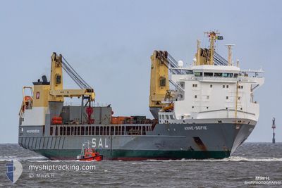
ANNE-SOFIE
General Cargo
Current Trip
| Time Travelled | 11 days |
|---|---|
| Remaining Time | 41 mins |
| Distance Travelled | 301.90 nm |
| Remaining Distance | 25.99 nm |
| AVG Speed | 11.7 Knots |
| MAX Speed | 16.9 Knots |
| AVG Wind | 22.8 knots |
| MAX Wind | 38 knots |
| MIN Temp | 0.7°C / 33.26°F |
| MAX Temp | 8.2°C / 46.76°F |
| Draught | 7.7 m |
| Position Received | 5 d ago |
Current Position
| Longitude | --- |
|---|---|
| Latitude | --- |
| Status | At anchor |
| Speed | |
| Course | 314° |
| Area | North Sea |
| Station | T-AIS |
| Position Received | 5 d ago |
Info
Information
The current position of ANNE-SOFIE is in North Sea with coordinates 54.05087° / 8.13119° as reported on 2025-12-29 01:58 by AIS to our vessel tracker app. The vessel's current speed is 0 Knots and is heading at the port of CUXHAVEN. The estimated time of arrival as calculated by MyShipTracking vessel tracking app is 2026-01-03 21:22 LT
The vessel ANNE-SOFIE (IMO: 9376490, MMSI: 218412000) is a General Cargo that was built in 2008 ( 18 years old ). It's sailing under the flag of [DE] Germany.
In this page you can find informations about the vessels current position, last detected port calls, and current voyage information. If the vessels is not in coverage by AIS you will find the latest position.
The current position of ANNE-SOFIE is detected by our AIS receivers and we are not responsible for the reliability of the data. The last position was recorded while the vessel was in Coverage by the Ais receivers of our vessel tracking app.
The current draught of ANNE-SOFIE as reported by AIS is 7.7 meters
Weather
| Temperature | 0.9°C / 33.62°F |
|---|---|
| Wind Speed | 21 knots |
| Direction | 346° NNW |
| Pressure | 999 hPa |
| Humidity | 63.1 % |
| Cloud Coverage | 100 % |
Featured Company
Last Port Calls
| Port | Arrival | Departure | Time In Port |
|---|---|---|---|
| 2025-12-12 09:39 | 2025-12-23 16:25 | 11 d | |
| 2025-11-25 14:22 | 2025-11-30 18:18 | 5 d | |
| 2025-11-07 13:42 | 2025-11-09 18:02 | 2 d | |
| 2025-11-02 11:06 |
Most Visited Ports (Last year)
| Port | Arrivals | |
|---|---|---|
| 10 | ||
| 7 | ||
| 4 | ||
| 2 | ||
| 1 | ||
| 1 |
Last Trips
| Origin | Departure | Destination | Arrival | Distance | |
|---|---|---|---|---|---|
| 2025-11-30 18:18 | 2025-12-12 09:39 | 4334.21 nm | |||
| 2025-11-09 18:02 | 2025-11-25 14:22 | 4565.27 nm | |||
| 2025-11-02 11:06 | 2025-11-07 13:42 | 31.53 nm |
Events
| Time | Event | Details | Position / Dest | Info |
|---|---|---|---|---|
| 2026-01-03 18:45 | STOP Moving | 8.76 nm, South East of HELGOLAND |
54.08906 / 8.09918
DECUX
|
Speed: 0.2 kn Course: 321° |
| 2026-01-03 16:24 | START Moving | 11.44 nm, South East of HELGOLAND |
54.05630 / 8.15233
DECUX
|
Speed: 9 kn Course: 319° |
| 2026-01-02 19:36 | STOP Moving | 11.64 nm, South East of HELGOLAND |
54.05383 / 8.15607
DECUX
|
Speed: 0.1 kn Course: 304° |
| 2026-01-02 19:04 | START Moving | 8.86 nm, South East of HELGOLAND |
54.08416 / 8.09668
DECUX
|
Speed: 6 kn Course: 122° |
| 2026-01-02 14:29 | STOP Moving | 9.84 nm, South East of HELGOLAND |
54.08579 / 8.13218
DECUX
|
Speed: 0.3 kn Course: 314° |
| 2026-01-02 13:29 | START Moving | 9.92 nm, South East of HELGOLAND |
54.09439 / 8.14361
DECUX
|
Speed: 3.3 kn Course: 295° |
| 2026-01-02 07:20 | STOP Moving | 11.3 nm, South East of HELGOLAND |
54.09135 / 8.18468
DECUX
|
Speed: 0.3 kn Course: 289° |
| 2026-01-02 06:58 | START Moving | 11.06 nm, South East of HELGOLAND |
54.09398 / 8.17947
DECUX
|
Speed: 3.1 kn Course: 290° |
| 2026-01-02 00:42 | STOP Moving | 10.48 nm, East of HELGOLAND |
54.12427 / 8.18158
DECUX
|
Speed: 0.3 kn Course: 281° |
| 2026-01-01 17:34 | START Moving | 10.83 nm, South East of HELGOLAND |
54.07965 / 8.15888
DECUX
|
Speed: 3.4 kn Course: 258° |