
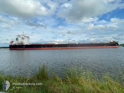
ANDREAS JR
Cargo
Current Trip
IR BKM
| Time Travelled | 11 days |
|---|---|
| Remaining Time | --- |
| Distance Travelled | 3084.29 nm |
| Remaining Distance | --- |
| AVG Speed | 9.5 Knots |
| MAX Speed | 13.7 Knots |
| AVG Wind | 16.1 knots |
| MAX Wind | 28.8 knots |
| MIN Temp | 15.4°C / 59.72°F |
| MAX Temp | 28.2°C / 82.76°F |
| Draught | 13.3 m |
| Position Received | 7 d ago |
Current Position
| Longitude | --- |
|---|---|
| Latitude | --- |
| Status | Under way using engine |
| Speed | 9.3 Knots |
| Course | 302.6° |
| Area | Indian Ocean |
| Station | T-AIS |
| Position Received | 7 d ago |
Info
Information
The current position of ANDREAS JR is in Indian Ocean with coordinates -35.11705° / 115.77358° as reported on 2025-02-22 19:10 by AIS to our vessel tracker app. The vessel's current speed is 9.3 Knots
The vessel ANDREAS JR (IMO: 9949352, MMSI: 538010386) is a Cargo It's sailing under the flag of [MH] Marshall Is.
In this page you can find informations about the vessels current position, last detected port calls, and current voyage information. If the vessels is not in coverage by AIS you will find the latest position.
The current position of ANDREAS JR is detected by our AIS receivers and we are not responsible for the reliability of the data. The last position was recorded while the vessel was in Coverage by the Ais receivers of our vessel tracking app.
The current draught of ANDREAS JR as reported by AIS is 13.3 meters
Weather
| Temperature | 28°C / 82.4°F |
|---|---|
| Wind Speed | 17 knots |
| Direction | 103° ESE |
| Pressure | 1009.1 hPa |
| Humidity | 80.7 % |
| Cloud Coverage | 53 % |
Featured Company
Last Port Calls
| Port | Arrival | Departure | Time In Port |
|---|---|---|---|
| 2025-02-15 08:42 | 2025-02-18 22:06 | 3 d | |
| 2025-02-04 05:43 | 2025-02-06 19:51 | 2 d | |
| 2025-01-17 17:26 | 2025-01-24 11:16 | 6 d |
Most Visited Ports (Last year)
| Port | Arrivals | |
|---|---|---|
| 1 | ||
| 1 | ||
| 1 | ||
| 1 | ||
| 1 | ||
| 1 |
Last Trips
| Origin | Departure | Destination | Arrival | Distance | |
|---|---|---|---|---|---|
| 2025-02-06 19:51 | 2025-02-15 08:42 | 1327.35 nm | |||
| 2025-01-24 11:16 | 2025-02-04 05:43 | 2775.06 nm | |||
| 2024-12-09 20:37 | 2025-01-17 17:26 | 9945.83 nm |
Events
| Time | Event | Details | Position / Dest | Info |
|---|---|---|---|---|
| 2025-02-22 19:16 | Status Changed | Default Under way using engine |
-35.10829 / 115.75449
IR BKM
|
Speed: 9.3 kn Course: 302.6° |
| 2025-02-22 19:10 | Status Changed | Under way using engine Default |
-35.11705 / 115.77358
IR BKM
|
Speed: 9.4 kn Course: 298° |
| 2025-02-22 19:10 | OUT of Coverage |
-35.11705 / 115.77358
Indian Ocean
IR BKM
|
Speed: 9.3 kn Course: 302.6° |
|
| 2025-02-22 18:52 | Status Changed | Default Under way using engine |
-35.13881 / 115.81989
IR BKM
|
Speed: 9.1 kn Course: 299.6° |
| 2025-02-22 18:46 | Status Changed | Under way using engine Default |
-35.14677 / 115.83746
IR BKM
|
Speed: 9.2 kn Course: 300° |
| 2025-02-22 18:45 | Status Changed | Default Under way using engine |
-35.14874 / 115.84141
IR BKM
|
Speed: 9 kn Course: 295.9° |
| 2025-02-22 18:37 | Status Changed | Under way using engine Default |
-35.15763 / 115.86062
IR BKM
|
Speed: 9 kn Course: 303° |
| 2025-02-22 18:28 | Status Changed | Default Under way using engine |
-35.16885 / 115.88437
IR BKM
|
Speed: 9 kn Course: 301.8° |
| 2025-02-22 18:23 | Status Changed | Under way using engine Default |
-35.17620 / 115.90040
IR BKM
|
Speed: 9.1 kn Course: 297° |
| 2025-02-22 18:20 | Status Changed | Default Under way using engine |
-35.17886 / 115.90565
IR BKM
|
Speed: 9.4 kn Course: 303.5° |