
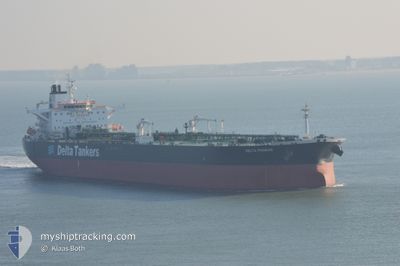
ANDAMAN SKIES
Crude Oil Tanker
Current Trip
| Time Travelled | 27 days |
|---|---|
| Remaining Time | 8 days |
| Distance Travelled | 6186.48 nm |
| Remaining Distance | 2590.29 nm |
| AVG Speed | 10.8 Knots |
| MAX Speed | 10.8 Knots |
| AVG Wind | 9.9 knots |
| MAX Wind | 31 knots |
| MIN Temp | 10.7°C / 51.26°F |
| MAX Temp | 34.2°C / 93.56°F |
| Draught | 14.2 m |
| Position Received | 15 d ago |
Current Position
| Longitude | 39.12940° |
|---|---|
| Latitude | 18.59495° |
| Status | Under way using engine |
| Speed | 12.4 Knots |
| Course | 155° |
| Area | Red Sea |
| Station | T-AIS |
| Position Received | 15 d ago |
Info
Information
The current position of ANDAMAN SKIES is in Red Sea with coordinates 18.59495° / 39.12940° as reported on 2024-04-16 05:22 by AIS to our vessel tracker app. The vessel's current speed is 12.4 Knots and is heading at the port of VISAKHAPATNAM. The estimated time of arrival as calculated by MyShipTracking vessel tracking app is 2024-05-11 01:03 LT
The vessel ANDAMAN SKIES (IMO: 9288693, MMSI: 518998632) is a Crude Oil Tanker that was built in 2004 ( 20 years old ). It's sailing under the flag of [CK] Cook Is.
In this page you can find informations about the vessels current position, last detected port calls, and current voyage information. If the vessels is not in coverage by AIS you will find the latest position.
The current position of ANDAMAN SKIES is detected by our AIS receivers and we are not responsible for the reliability of the data. The last position was recorded while the vessel was in Coverage by the Ais receivers of our vessel tracking app.
The current draught of ANDAMAN SKIES as reported by AIS is 14.2 meters
Weather
| Temperature | 29.8°C / 85.64°F |
|---|---|
| Wind Speed | 11 knots |
| Direction | 141° SE |
| Pressure | 1006.6 hPa |
| Humidity | 77.6 % |
| Cloud Coverage | 93 % |
Featured Company
Last Port Calls
| Port | Arrival | Departure | Time In Port |
|---|---|---|---|
| 2024-04-13 04:34 | 2024-04-13 13:55 | 9 h | |
| 2024-04-03 14:09 | 2024-04-04 15:57 | 1 d | |
| 2024-03-25 22:57 | 2024-03-27 13:53 | 1 d | |
| 2024-03-06 15:06 | 2024-03-08 03:00 | 1 d | |
| 2024-03-06 01:40 | 2024-03-06 04:35 | 2 h |
Last Trips
| Origin | Departure | Destination | Arrival | Distance | |
|---|---|---|---|---|---|
| 2024-04-04 18:57 | 2024-04-13 06:34 | 1308.06 nm | |||
| 2024-03-27 16:53 | 2024-04-03 17:09 | 870.10 nm | |||
| 2024-03-08 06:00 | 2024-03-26 01:57 | 4598.13 nm | |||
| 2024-03-06 07:35 | 2024-03-06 18:06 | 2.51 nm | |||
| 2024-02-16 18:43 | 2024-03-06 04:40 | 4501.96 nm |
Events
| Time | Event | Details | Position / Dest | Info |
|---|---|---|---|---|
| 2024-04-26 19:40 | START Moving | 3.17 nm, South West of NHAVA SHEVA |
18.93457 / 72.89500
IN VTZ
|
Speed: 4.4 kn Course: 240° |
| 2024-04-25 07:20 | STOP Moving | 3.14 nm, West of NHAVA SHEVA |
18.93675 / 72.89459
IN VTZ
|
Speed: 0.3 kn Course: 48° |