
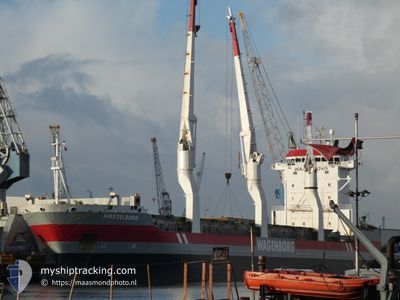
AMSTELBORG
General Cargo
Current Trip
| Trip Time | 1 h, 36 mins |
|---|---|
| Trip Distance | 18.78 nm |
| AVG Speed | 12.2 Knots |
| MAX Speed | 13.9 Knots |
| Draught | 8 m |
| AVG Wind | 8.9 knots |
| MAX Wind | 10.7 knots |
| MIN Temp | -0.4°C / 31.28°F |
| MAX Temp | 0.5°C / 32.9°F |
| Position Received | 9 d ago |
Current Position
| Longitude | --- |
|---|---|
| Latitude | --- |
| Status | Under way using engine |
| Speed | 14.5 Knots |
| Course | 27° |
| Area | Gulf of Bothnia |
| Station | T-AIS |
| Position Received | 9 d ago |
Information
The current position of AMSTELBORG is in Gulf of Bothnia with coordinates 63.51827° / 20.70930° as reported on 2025-01-13 22:51 by AIS to our vessel tracker app. The vessel's current speed is 14.5 Knots and is currently inside the port of AJOS.
The vessel AMSTELBORG (IMO: 9333527, MMSI: 244301000) is a General Cargo that was built in 2006 ( 19 years old ). It's sailing under the flag of [NL] Netherlands.
In this page you can find informations about the vessels current position, last detected port calls, and current voyage information. If the vessels is not in coverage by AIS you will find the latest position.
The current position of AMSTELBORG is detected by our AIS receivers and we are not responsible for the reliability of the data. The last position was recorded while the vessel was in Coverage by the Ais receivers of our vessel tracking app.
The current draught of AMSTELBORG as reported by AIS is 8 meters
Weather
| Temperature | -15.2°C / 4.64°F |
|---|---|
| Wind Speed | 4 knots |
| Direction | 345° NNW |
| Pressure | 1007.5 hPa |
| Humidity | 97.3 % |
| Cloud Coverage | 53 % |
Featured Company
Last Port Calls
| Port | Arrival | Departure | Time In Port |
|---|---|---|---|
| 2025-01-19 09:05 | |||
| 2025-01-14 14:43 | 2025-01-19 07:29 | 4 d | |
| 2024-12-18 18:50 | 2024-12-21 13:53 | 2 d | |
| 2024-11-18 13:29 | 2024-11-24 07:42 | 5 d |
Last Trips
| Origin | Departure | Destination | Arrival | Distance | |
|---|---|---|---|---|---|
| 2025-01-19 09:29 | 2025-01-19 11:05 | 18.78 nm | |||
| 2024-12-21 08:53 | 2025-01-14 16:43 | 6373.46 nm | |||
| 2024-11-24 04:42 | 2024-12-18 13:50 | 2283.79 nm | |||
| 2024-10-19 06:53 | 2024-11-18 10:29 | 4320.40 nm |
Events
| Time | Event | Details | Position / Dest | Info |
|---|---|---|---|---|
| 2025-01-19 09:21 | STOP Moving |
65.66737 / 24.51076
[FI] AJOS
|
Speed: 0.1 kn Course: 35° |
|
| 2025-01-19 09:05 | PORT ARRIVAL |
|
65.65498 / 24.50832
[FI] AJOS
|
Speed: 12.1 kn Course: 14° |
| 2025-01-19 07:29 | PORT DEPARTURE |
|
65.74090 / 24.15874
TORNIO FITOR
|
Speed: 6.7 kn Course: 172° |
| 2025-01-19 07:25 | START Moving |
65.75050 / 24.15451
[FI] ROYTTA
|
Speed: 6.7 kn Course: 172° |
|
| 2025-01-14 14:59 | STOP Moving |
65.75440 / 24.15518
[FI] ROYTTA
|
Speed: 0.1 kn Course: 70° |
|
| 2025-01-14 14:43 | PORT ARRIVAL |
|
65.75415 / 24.15411
[FI] ROYTTA
|
Speed: 2.3 kn Course: 348° |
| 2025-01-14 12:27 | START Moving | 5.36 nm, South of AJOS |
65.57438 / 24.45658
TORNIO FITOR
|
Speed: 4.6 kn Course: 9° |
| 2025-01-14 11:54 | STOP Moving | 6.55 nm, South of AJOS |
65.55526 / 24.44447
TORNIO FITOR
|
Speed: 0.2 kn Course: 16° |
| 2025-01-13 22:57 | Status Changed | Default Under way using engine |
63.53527 / 20.74373
TORNIO FITOR
|
Speed: 14.5 kn Course: 27° |
| 2025-01-13 22:51 | OUT of Coverage |
63.51827 / 20.70930
Gulf of Bothnia
TORNIO FITOR
|
Speed: 14.5 kn Course: 27° |