

AMO
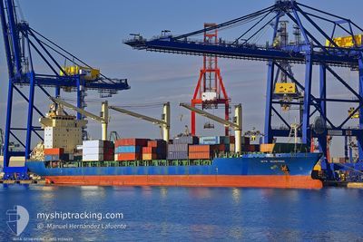
Container Ship

Current Trip
| Trip Time | --- |
|---|---|
| Trip Distance | --- |
| AVG Speed | --- |
| MAX Speed | --- |
| Draught | --- |
| AVG Wind | --- |
| MAX Wind | --- |
| MIN Temp | --- |
| MAX Temp | --- |
| Position Received | 7 d ago |
Current Position
| Longitude | --- |
|---|---|
| Latitude | --- |
| Status | Under way using engine |
| Speed | 10.3 Knots |
| Course | 62.5° |
| Area | Black Sea |
| Station | T-AIS |
| Position Received | 7 d ago |
Information
The current position of AMO is in Black Sea with coordinates 41.42272° / 29.63183° as reported on 2025-04-09 05:02 by AIS to our vessel tracker app. The vessel's current speed is 10.3 Knots and is currently inside the port of NOVOROSSIYSK.
The vessel AMO (IMO: 9134622, MMSI: 334955000) is a Container Ship that was built in 1997 ( 28 years old ). It's sailing under the flag of [HN] Honduras.
In this page you can find informations about the vessels current position, last detected port calls, and current voyage information. If the vessels is not in coverage by AIS you will find the latest position.
The current position of AMO is detected by our AIS receivers and we are not responsible for the reliability of the data. The last position was recorded while the vessel was in Coverage by the Ais receivers of our vessel tracking app.
The current draught of AMO as reported by AIS is 9 meters
Weather
| Temperature | 13.2°C / 55.76°F |
|---|---|
| Wind Speed | 13 knots |
| Direction | 57° ENE |
| Pressure | 1025.7 hPa |
| Humidity | 68.2 % |
| Cloud Coverage | 63 % |


Featured Company
Last Port Calls
| Port | Arrival | Departure | Time In Port |
|---|---|---|---|
| 2025-04-05 21:36 | 2025-04-07 07:19 | 1 d | |
| 2025-03-25 07:26 | 2025-03-26 03:41 | 20 h | |
| 2025-03-15 12:55 | 2025-03-16 12:17 | 23 h | |
| 2025-03-08 16:08 | 2025-03-11 08:37 | 2 d | |
| 2025-02-23 06:52 | 2025-02-24 04:58 | 22 h | |
| 2025-02-03 15:41 | 2025-02-05 00:25 | 1 d |
Most Visited Ports (Last year)
| Port | Arrivals | |
|---|---|---|
| 13 | ||
| 7 | ||
| 4 | ||
| 3 | ||
| 2 | ||
| 2 |
Last Trips
| Origin | Departure | Destination | Arrival | Distance | |
|---|---|---|---|---|---|
| 2025-03-16 12:17 | 2025-03-25 07:26 | 1093.29 nm | |||
| 2025-03-11 08:37 | 2025-03-15 12:55 | 550.37 nm | |||
| 2025-02-24 04:58 | 2025-03-08 16:08 | 691.36 nm | |||
| 2025-02-05 00:25 | 2025-02-23 06:52 | 1210.43 nm | |||
| 2025-01-28 18:06 | 2025-02-03 15:41 | 654.98 nm |
Events
| Time | Event | Details | Position / Dest | Info |
|---|---|---|---|---|
| 2025-04-11 14:11 | STOP Moving |
44.07215 / 37.45725
RU NLE
|
Speed: 0.3 kn Course: 172° |
|
| 2025-04-09 05:05 | Status Changed | Default Under way using engine |
41.42640 / 29.64134
RU NLE
|
Speed: 10.3 kn Course: 62.5° |
| 2025-04-09 05:02 | Status Changed | Under way using engine Default |
41.42272 / 29.63183
RU NLE
|
Speed: 10.2 kn Course: 61° |
| 2025-04-09 05:02 | OUT of Coverage |
41.42272 / 29.63183
Black Sea
RU NLE
|
Speed: 10.3 kn Course: 62.5° |
|
| 2025-04-09 04:45 | Status Changed | Default Under way using engine |
41.39939 / 29.57424
RU NLE
|
Speed: 10.3 kn Course: 61.8° |
| 2025-04-09 04:32 | Status Changed | Under way using engine Default |
41.38192 / 29.52953
RU NLE
|
Speed: 10.6 kn Course: 63° |
| 2025-04-09 04:26 | Status Changed | Default Under way using engine |
41.37429 / 29.50959
RU NLE
|
Speed: 10.5 kn Course: 61.2° |
| 2025-04-09 02:40 | Change Sea Area | Turkish part of the Black Sea Turkish part of the Sea of Marmara |
41.23365 / 29.14453
Black Sea
RU NLE
|
Speed: 10.3 kn Course: 36.6° |
| 2025-04-08 22:48 | START Moving | 10.8 nm, South West of MALTEPE |
40.78757 / 28.96101
RU NLE
|
Speed: 3.1 kn Course: 213° |
| 2025-04-08 17:50 | STOP Moving | 8.92 nm, South West of MALTEPE |
40.78109 / 29.04450
RU NLE
|
Speed: 0.3 kn Course: 102° |