
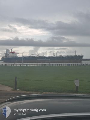
AMALTHEA
Crude Oil Tanker
Current Trip
| Time Travelled | 21 days |
|---|---|
| Remaining Time | --- |
| Distance Travelled | 3568.41 nm |
| Remaining Distance | --- |
| AVG Speed | 8.2 Knots |
| MAX Speed | 15.4 Knots |
| AVG Wind | 22.9 knots |
| MAX Wind | 52.8 knots |
| MIN Temp | -12.6°C / 9.32°F |
| MAX Temp | 16.1°C / 60.98°F |
| Draught | 8.7 m |
| Position Received | 17 d ago |
Current Position
| Longitude | --- |
|---|---|
| Latitude | --- |
| Status | Under way using engine |
| Speed | 9.5 Knots |
| Course | 253.5° |
| Area | English Channel |
| Station | T-AIS |
| Position Received | 17 d ago |
Info
Information
The current position of AMALTHEA is in English Channel with coordinates 49.78962° / -4.52473° as reported on 2025-01-30 15:17 by AIS to our vessel tracker app. The vessel's current speed is 9.5 Knots and is heading at the port of WHIFFEN HEAD.
The vessel AMALTHEA (IMO: 9298650, MMSI: 240447000) is a Crude Oil Tanker that was built in 2006 ( 19 years old ). It's sailing under the flag of [GR] Greece.
In this page you can find informations about the vessels current position, last detected port calls, and current voyage information. If the vessels is not in coverage by AIS you will find the latest position.
The current position of AMALTHEA is detected by our AIS receivers and we are not responsible for the reliability of the data. The last position was recorded while the vessel was in Coverage by the Ais receivers of our vessel tracking app.
The current draught of AMALTHEA as reported by AIS is 8.7 meters
Weather
| Temperature | -0.5°C / 31.1°F |
|---|---|
| Wind Speed | 25 knots |
| Direction | 291° WNW |
| Pressure | 1005.9 hPa |
| Humidity | 85.4 % |
| Cloud Coverage | 86 % |
Featured Company
Last Port Calls
| Port | Arrival | Departure | Time In Port |
|---|---|---|---|
| 2025-01-25 11:31 | 2025-01-26 19:19 | 1 d | |
| 2025-01-12 19:59 | 2025-01-14 00:15 | 1 d | |
| 2024-12-30 10:48 | 2025-01-01 13:16 | 2 d |
Most Visited Ports (Last year)
| Port | Arrivals | |
|---|---|---|
| 5 | ||
| 4 | ||
| 4 | ||
| 4 | ||
| 3 | ||
| 1 |
Last Trips
| Origin | Departure | Destination | Arrival | Distance | |
|---|---|---|---|---|---|
| 2025-01-13 20:45 | 2025-01-25 12:31 | 2729.30 nm | |||
| 2025-01-01 13:16 | 2025-01-12 16:29 | 2295.53 nm | |||
| 2024-11-27 10:00 | 2024-12-30 10:48 | 5351.48 nm |
Events
| Time | Event | Details | Position / Dest | Info |
|---|---|---|---|---|
| 2025-02-15 18:17 | START Moving |
46.92515 / -52.34581
CA WHH
|
Speed: 3.2 kn Course: 271° |
|
| 2025-02-15 17:58 | STOP Moving |
46.92684 / -52.33759
CA WHH
|
Speed: 0.2 kn Course: 269° |
|
| 2025-02-13 16:39 | START Moving | 3.99 nm, South of NORTH HARBOUR |
47.78894 / -54.13129
CA WHH
|
Speed: 3.2 kn Course: 152° |
| 2025-02-12 20:00 | STOP Moving | 3.71 nm, South of NORTH HARBOUR |
47.79224 / -54.12392
CA WHH
|
Speed: 0.3 kn Course: 279° |
| 2025-02-12 02:43 | START Moving |
46.55601 / -55.05823
CA WHH
|
Speed: 5.2 kn Course: 68° |
|
| 2025-02-11 22:42 | STOP Moving |
46.59814 / -54.91227
CA WHH
|
Speed: 0.2 kn Course: 281° |
|
| 2025-02-10 13:43 | START Moving |
46.02275 / -51.82728
CA WHH
|
Speed: 3.1 kn Course: 301° |
|
| 2025-02-10 13:06 | STOP Moving |
46.02304 / -51.80402
CA WHH
|
Speed: 0.2 kn Course: 310° |