

AMADEUS
Fishing

Current Trip
HARLINGEN
| Time Travelled | 3 days |
|---|---|
| Remaining Time | --- |
| Distance Travelled | 133.75 nm |
| Remaining Distance | --- |
| AVG Speed | 8 Knots |
| MAX Speed | 9.3 Knots |
| AVG Wind | 8.5 knots |
| MAX Wind | 14 knots |
| MIN Temp | 8.3°C / 46.94°F |
| MAX Temp | 10.1°C / 50.18°F |
| Draught | 3.5 m |
| Position Received | 1 m ago |
Current Position
| Longitude | --- |
|---|---|
| Latitude | --- |
| Status | Engaged in Fishing |
| Speed | 0.8 Knots |
| Course | 83° |
| Area | North Sea |
| Station | T-AIS |
| Position Received | 1 m ago |
Information
The current position of AMADEUS is in North Sea with coordinates 54.75861° / 6.87320° as reported on 2025-04-25 01:16 by AIS to our vessel tracker app. The vessel's current speed is 0.8 Knots
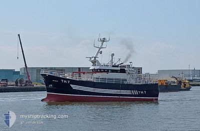
The vessel AMADEUS (MMSI: 235001620) is a Fishing It's sailing under the flag of [GB] United Kingdom.
In this page you can find informations about the vessels current position, last detected port calls, and current voyage information. If the vessels is not in coverage by AIS you will find the latest position.
The current position of AMADEUS is detected by our AIS receivers and we are not responsible for the reliability of the data. The last position was recorded while the vessel was in Coverage by the Ais receivers of our vessel tracking app.
The current draught of AMADEUS as reported by AIS is 3.5 meters
Weather
| Temperature | 8.3°C / 46.94°F |
|---|---|
| Wind Speed | 12 knots |
| Direction | --- N |
| Pressure | 1021.9 hPa |
| Humidity | 83.5 % |
| Cloud Coverage | 8 % |


Featured Company
Last Port Calls
| Port | Arrival | Departure | Time In Port |
|---|---|---|---|
| 2025-04-21 01:19 | 2025-04-22 00:13 | 22 h | |
| 2025-04-18 23:05 |
Most Visited Ports (Last year)
| Port | Arrivals | |
|---|---|---|
| 27 | ||
| 1 | ||
| 1 |
Last Trips
| Origin | Departure | Destination | Arrival | Distance | |
|---|---|---|---|---|---|
| 2025-04-18 23:05 | 2025-04-21 01:19 | 395.46 nm |
Events
| Time | Event | Details | Position / Dest | Info |
|---|---|---|---|---|
| 2025-04-24 20:10 | STOP Moving |
54.75084 / 6.88267
HARLINGEN
|
Speed: 0.3 kn Course: 353° |
|
| 2025-04-24 18:57 | IN Coverage |
54.73880 / 6.88484
North Sea
|
Speed: 3.9 kn Course: 85.3° |
|
| 2025-04-24 14:49 | OUT of Coverage |
54.68350 / 6.94830
North Sea
|
Speed: 4 kn Course: 97.7° |
|
| 2025-04-24 14:49 | IN Coverage |
54.68350 / 6.94830
North Sea
|
Speed: 4 kn Course: 97.7° |
|
| 2025-04-24 13:40 | OUT of Coverage |
54.66696 / 6.95854
North Sea
|
Speed: 3.2 kn Course: 267.7° |
|
| 2025-04-24 13:20 | IN Coverage |
54.66927 / 7.01403
North Sea
|
Speed: 4.7 kn Course: 27.1° |
|
| 2025-04-24 09:52 | OUT of Coverage |
54.60040 / 7.10283
North Sea
|
Speed: 8.4 kn Course: 271° |
|
| 2025-04-24 09:41 | IN Coverage |
54.60095 / 7.14501
North Sea
|
Speed: 6.8 kn Course: 122.2° |
|
| 2025-04-24 07:14 | OUT of Coverage |
54.62346 / 7.09011
North Sea
|
Speed: 2.3 kn Course: 307.6° |
|
| 2025-04-24 06:26 | IN Coverage |
54.63704 / 7.11352
North Sea
|
Speed: 3.5 kn Course: 86.8° |