
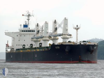
ALTUS
Bulk Carrier
Current Trip
| Time Travelled | 19 days |
|---|---|
| Remaining Time | --- |
| Distance Travelled | 4280.38 nm |
| Remaining Distance | 9.13 nm |
| AVG Speed | 10.4 Knots |
| MAX Speed | 16.1 Knots |
| AVG Wind | 17.2 knots |
| MAX Wind | 43 knots |
| MIN Temp | 5.4°C / 41.72°F |
| MAX Temp | 23.8°C / 74.84°F |
| Draught | 7.3 m |
| Position Received | 1 m ago |
Current Position
| Longitude | --- |
|---|---|
| Latitude | --- |
| Status | At anchor |
| Speed | 0.1 Knots |
| Course | 346° |
| Area | Baltic Sea |
| Station | T-AIS |
| Position Received | 1 m ago |
Info
Information
The current position of ALTUS is in Baltic Sea with coordinates 55.70273° / 20.84542° as reported on 2025-12-12 15:33 by AIS to our vessel tracker app. The vessel's current speed is 0.1 Knots and is heading at the port of KLAIPEDA. The estimated time of arrival as calculated by MyShipTracking vessel tracking app is 2025-12-11 11:00 LT
The vessel ALTUS (IMO: 9650169, MMSI: 209766000) is a Bulk Carrier that was built in 2012 ( 13 years old ). It's sailing under the flag of [CY] Cyprus.
In this page you can find informations about the vessels current position, last detected port calls, and current voyage information. If the vessels is not in coverage by AIS you will find the latest position.
The current position of ALTUS is detected by our AIS receivers and we are not responsible for the reliability of the data. The last position was recorded while the vessel was in Coverage by the Ais receivers of our vessel tracking app.
The current draught of ALTUS as reported by AIS is 7.3 meters
Weather
| Temperature | 7.2°C / 44.96°F |
|---|---|
| Wind Speed | 14 knots |
| Direction | 8° N |
| Pressure | 1021.4 hPa |
| Humidity | 80.7 % |
| Cloud Coverage | 73 % |
Featured Company
Last Port Calls
| Port | Arrival | Departure | Time In Port |
|---|---|---|---|
| 2025-11-16 21:08 | 2025-11-23 01:09 | 6 d | |
| 2025-11-09 03:32 | 2025-11-09 17:52 | 14 h | |
| 2025-11-05 13:37 | 2025-11-05 13:39 | 2 m | |
| 2025-10-07 13:09 | 2025-10-11 20:33 | 4 d |
Most Visited Ports (Last year)
| Port | Arrivals | |
|---|---|---|
| 5 | ||
| 3 | ||
| 3 | ||
| 2 | ||
| 2 | ||
| 1 |
Last Trips
| Origin | Departure | Destination | Arrival | Distance | |
|---|---|---|---|---|---|
| 2025-11-09 17:52 | 2025-11-16 21:08 | 53.51 nm | |||
| 2025-11-05 13:39 | 2025-11-09 03:32 | 513.39 nm | |||
| 2025-10-11 20:33 | 2025-11-05 13:37 | 6159.01 nm | |||
| 2025-09-19 04:04 | 2025-10-07 13:09 | 5279.87 nm |
Events
| Time | Event | Details | Position / Dest | Info |
|---|---|---|---|---|
| 2025-12-12 15:09 | Status Changed | At anchor Default |
55.70276 / 20.84634
KLAIPEDA LTKLJ
|
Speed: 0.3 kn Course: 356° |
| 2025-12-12 15:03 | Status Changed | Default At anchor |
55.70269 / 20.84579
KLAIPEDA LTKLJ
|
Speed: 0.1 kn Course: 353° |
| 2025-12-12 14:48 | Status Changed | At anchor Default |
55.70279 / 20.84698
KLAIPEDA LTKLJ
|
Speed: 0.2 kn Course: 356° |
| 2025-12-12 14:39 | Status Changed | Default At anchor |
55.70263 / 20.84598
KLAIPEDA LTKLJ
|
Speed: 0.7 kn Course: 322° |
| 2025-12-12 14:27 | Status Changed | At anchor Under way using engine |
55.70482 / 20.84797
KLAIPEDA LTKLJ
|
Speed: 0.3 kn Course: 289° |
| 2025-12-12 14:23 | STOP Moving | 9.68 nm, West of KLAIPEDA |
55.70491 / 20.84819
KLAIPEDA LTKLJ
|
Speed: 0.1 kn Course: 320° |
| 2025-12-12 14:13 | Status Changed | Under way using engine Not under command |
55.70099 / 20.85124
KLAIPEDA LTKLJ
|
Speed: 2.1 kn Course: 338° |
| 2025-12-12 12:30 | Status Changed | Not under command Default |
55.54356 / 20.62736
KLAIPEDA LTKLJ
|
Speed: 9.1 kn Course: 51° |
| 2025-12-12 12:14 | IN Coverage |
55.54501 / 20.63010
Baltic Sea
|
Speed: 11.1 kn Course: 47.2° |
|
| 2025-12-11 19:38 | OUT of Coverage |
55.60655 / 20.61752
Baltic Sea
|
Speed: 2.9 kn Course: 242.9° |