
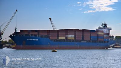
ALLSEAS PIONEER
General Cargo
Current Trip
RUNVX
| Time Travelled | 2 days |
|---|---|
| Remaining Time | --- |
| Distance Travelled | 411.18 nm |
| Remaining Distance | --- |
| AVG Speed | 9.4 Knots |
| MAX Speed | 13.6 Knots |
| AVG Wind | 5.3 knots |
| MAX Wind | 11 knots |
| MIN Temp | 13°C / 55.4°F |
| MAX Temp | 19.3°C / 66.74°F |
| Draught | 6.7 m |
| Position Received | 1 d ago |
Current Position
| Longitude | 29.40576° |
|---|---|
| Latitude | 41.35015° |
| Status | Under way using engine |
| Speed | 13.2 Knots |
| Course | 61° |
| Area | Black Sea |
| Station | T-AIS |
| Position Received | 1 d ago |
Info
Information
The current position of ALLSEAS PIONEER is in Black Sea with coordinates 41.35015° / 29.40576° as reported on 2024-04-26 14:16 by AIS to our vessel tracker app. The vessel's current speed is 13.2 Knots
The vessel ALLSEAS PIONEER (IMO: 9262558, MMSI: 636093075) is a General Cargo that was built in 2003 ( 21 years old ). It's sailing under the flag of [LR] Liberia.
In this page you can find informations about the vessels current position, last detected port calls, and current voyage information. If the vessels is not in coverage by AIS you will find the latest position.
The current position of ALLSEAS PIONEER is detected by our AIS receivers and we are not responsible for the reliability of the data. The last position was recorded while the vessel was in Coverage by the Ais receivers of our vessel tracking app.
The current draught of ALLSEAS PIONEER as reported by AIS is 6.7 meters
Weather
| Temperature | 14.2°C / 57.56°F |
|---|---|
| Wind Speed | 6 knots |
| Direction | 52° NE |
| Pressure | 1017.1 hPa |
| Humidity | 90 % |
| Cloud Coverage | 100 % |
Featured Company
Last Port Calls
| Port | Arrival | Departure | Time In Port |
|---|---|---|---|
| 2024-04-25 06:14 | 2024-04-25 13:21 | 7 h | |
| 2024-04-24 17:00 | 2024-04-25 00:54 | 7 h | |
| 2024-04-21 03:55 | 2024-04-21 13:19 | 9 h | |
| 2024-04-17 15:27 | 2024-04-18 12:17 | 20 h | |
| 2024-04-15 03:46 | 2024-04-15 12:14 | 8 h | |
| 2024-04-04 21:48 | 2024-04-07 11:22 | 2 d | |
| 2024-03-28 11:16 | 2024-03-29 09:27 | 22 h | |
| 2024-03-13 11:17 | 2024-03-27 13:41 | 14 d |
Most Visited Ports (Last year)
| Port | Arrivals | |
|---|---|---|
| 6 | ||
| 4 | ||
| 3 | ||
| 3 | ||
| 2 | ||
| 2 |
Last Trips
| Origin | Departure | Destination | Arrival | Distance | |
|---|---|---|---|---|---|
| 2024-04-25 03:54 | 2024-04-25 09:14 | 55.08 nm | |||
| 2024-04-18 15:17 | 2024-04-24 20:00 | 1514.29 nm | |||
| 2024-04-18 15:17 | 2024-04-21 05:55 | 626.92 nm | |||
| 2024-04-07 14:22 | 2024-04-17 18:27 | 2080.59 nm | |||
| 2024-04-07 14:22 | 2024-04-15 05:46 | 1360.02 nm | |||
| 2024-03-29 11:27 | 2024-04-05 00:48 | 1471.33 nm | |||
| 2024-03-27 15:41 | 2024-03-28 13:16 | 107.60 nm | |||
| 2024-01-15 13:09 | 2024-03-13 13:17 | 4113.53 nm |
Events
| Time | Event | Details | Position / Dest | Info |
|---|---|---|---|---|
| 2024-04-26 14:18 | Status Changed | Default Under way using engine |
41.35220 / 29.41074
RUNVX
|
Speed: 13.2 kn Course: 61° |
| 2024-04-26 14:16 | Status Changed | Under way using engine Default |
41.35015 / 29.40576
RUNVX
|
Speed: 13 kn Course: 64° |
| 2024-04-26 14:16 | OUT of Coverage |
41.35015 / 29.40576
Black Sea
RUNVX
|
Speed: 13.2 kn Course: 61° |
|
| 2024-04-26 13:48 | Status Changed | Default Under way using engine |
41.30300 / 29.28581
RUNVX
|
Speed: 12.9 kn Course: 64.6° |
| 2024-04-26 13:14 | Detected in Sea | Turkish part of the Black Sea |
41.23350 / 29.15607
Black Sea
RUNVX
|
Speed: 11.6 kn Course: 46.2° |
| 2024-04-26 13:00 | ETA Changed | 2024/04/27 23:00 2024/04/27 05:00 |
41.20455 / 29.11668
RUNVX
|
Speed: 9.2 kn Course: 45.9° |
| 2024-04-26 09:51 | START Moving | 6.38 nm, South West of KARTAL |
40.80663 / 29.10444
RUNVX
|
Speed: 3.1 kn Course: 243° |
| 2024-04-26 06:57 | STOP Moving | 7.06 nm, South of MALTEPE |
40.80214 / 29.08744
RUNVX
|
Speed: 0.3 kn Course: 183° |
| 2024-04-26 06:25 | START Moving | 6.62 nm, South West of KARTAL |
40.79458 / 29.11469
RUNVX
|
Speed: 3.1 kn Course: 324° |
| 2024-04-26 05:56 | STOP Moving | 6.96 nm, South West of KARTAL |
40.79068 / 29.10906
RUNVX
|
Speed: 0.3 kn Course: 354° |