
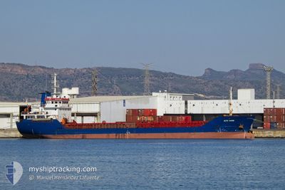
ALIYE HANIM
General Cargo
Current Trip
| Time Travelled | 3 days |
|---|---|
| Remaining Time | --- |
| Distance Travelled | 286.34 nm |
| Remaining Distance | --- |
| AVG Speed | 9.3 Knots |
| MAX Speed | 12.8 Knots |
| AVG Wind | 11.5 knots |
| MAX Wind | 33 knots |
| MIN Temp | 1.8°C / 35.24°F |
| MAX Temp | 16.4°C / 61.52°F |
| Draught | 3.4 m |
| Position Received | 11 h, 38 m ago |
Current Position
| Longitude | --- |
|---|---|
| Latitude | --- |
| Status | At anchor |
| Speed | 0.3 Knots |
| Course | 149° |
| Area | Aegean Sea |
| Station | T-AIS |
| Position Received | 11 h, 38 m ago |
Info
Information
The current position of ALIYE HANIM is in Aegean Sea with coordinates 38.89057° / 26.98541° as reported on 2026-01-10 05:58 by AIS to our vessel tracker app. The vessel's current speed is 0.3 Knots
The vessel ALIYE HANIM (IMO: 9414723, MMSI: 271000930) is a General Cargo that was built in 2007 ( 19 years old ). It's sailing under the flag of [TR] Turkey.
In this page you can find informations about the vessels current position, last detected port calls, and current voyage information. If the vessels is not in coverage by AIS you will find the latest position.
The current position of ALIYE HANIM is detected by our AIS receivers and we are not responsible for the reliability of the data. The last position was recorded while the vessel was in Coverage by the Ais receivers of our vessel tracking app.
The current draught of ALIYE HANIM as reported by AIS is 3.4 meters
Weather
| Temperature | 13.7°C / 56.66°F |
|---|---|
| Wind Speed | 26 knots |
| Direction | 204° SSW |
| Pressure | 1003.7 hPa |
| Humidity | 82.2 % |
| Cloud Coverage | 23 % |
Featured Company
Last Port Calls
| Port | Arrival | Departure | Time In Port |
|---|---|---|---|
| 2026-01-07 08:04 | 2026-01-07 16:28 | 8 h | |
| 2025-12-31 11:32 | 2026-01-03 20:17 | 3 d | |
| 2025-12-28 21:51 | 2025-12-29 17:48 | 19 h | |
| 2025-12-25 06:30 | 2025-12-26 08:28 | 1 d | |
| 2025-12-22 08:09 | 2025-12-23 18:56 | 1 d | |
| 2025-12-19 09:19 | 2025-12-20 16:14 | 1 d | |
| 2025-12-15 00:05 | 2025-12-18 12:41 | 3 d | |
| 2025-12-09 17:06 | 2025-12-12 13:49 | 2 d | |
| 2025-12-08 21:24 | 2025-12-09 13:33 | 16 h | |
| 2025-12-06 07:29 | 2025-12-07 07:05 | 23 h |
Last Trips
| Origin | Departure | Destination | Arrival | Distance | |
|---|---|---|---|---|---|
| 2026-01-03 20:17 | 2026-01-07 08:04 | 272.54 nm | |||
| 2025-12-29 17:48 | 2025-12-31 11:32 | 286.24 nm | |||
| 2025-12-26 08:28 | 2025-12-28 21:51 | 274.77 nm | |||
| 2025-12-23 18:56 | 2025-12-25 06:30 | 233.14 nm | |||
| 2025-12-20 16:14 | 2025-12-22 08:09 | 222.98 nm | |||
| 2025-12-18 12:41 | 2025-12-19 09:19 | 97.94 nm | |||
| 2025-12-12 13:49 | 2025-12-15 00:05 | 253.97 nm | |||
| 2025-12-09 13:33 | 2025-12-09 17:06 | 8.59 nm | |||
| 2025-12-07 07:05 | 2025-12-08 21:24 | 273.22 nm | |||
| 2025-12-02 12:12 | 2025-12-06 07:29 | 640.12 nm |
Events
| Time | Event | Details | Position / Dest | Info |
|---|---|---|---|---|
| 2026-01-10 16:00 | STOP Moving | 4.26 nm, North of ALIAGA |
38.89036 / 26.99080
TR NEM
|
Speed: 0.3 kn Course: 201° |
| 2026-01-10 15:45 | START Moving | 4.11 nm, North of ALIAGA |
38.88866 / 26.98816
TR NEM
|
Speed: 3.3 kn Course: 174° |
| 2026-01-10 06:05 | Status Changed | Default At anchor |
38.89085 / 26.98603
TR NEM
|
Speed: 0.3 kn Course: 149° |
| 2026-01-10 05:58 | OUT of Coverage |
38.89057 / 26.98541
Aegean Sea
|
Speed: 0.3 kn Course: 59.2° |
|
| 2026-01-10 05:57 | Status Changed | At anchor Default |
38.89055 / 26.98533
TR NEM
|
Speed: 0.1 kn Course: 147° |
| 2026-01-10 05:53 | IN Coverage |
38.89057 / 26.98541
Aegean Sea
|
Speed: 0.3 kn Course: 59.2° |
|
| 2026-01-10 02:49 | Status Changed | Default At anchor |
38.89028 / 26.98476
TR NEM
|
Speed: 0.1 kn Course: 135° |
| 2026-01-10 02:41 | Status Changed | At anchor Default |
38.89034 / 26.98489
TR NEM
|
Speed: 0.1 kn Course: 130° |
| 2026-01-10 02:41 | OUT of Coverage |
38.89034 / 26.98489
Aegean Sea
|
Speed: 0.1 kn Course: 135° |
|
| 2026-01-10 02:33 | IN Coverage |
38.89034 / 26.98489
Aegean Sea
|
Speed: 0.1 kn Course: 135° |