
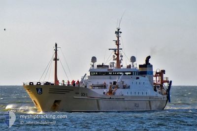
ALIDA
Trawler
Current Trip
NOUADIBHOU
| Time Travelled | 45 days |
|---|---|
| Remaining Time | --- |
| Distance Travelled | 393.47 nm |
| Remaining Distance | --- |
| AVG Speed | 4.3 Knots |
| MAX Speed | 12.8 Knots |
| AVG Wind | 15.8 knots |
| MAX Wind | 20 knots |
| MIN Temp | 19.3°C / 66.74°F |
| MAX Temp | 23.6°C / 74.48°F |
| Draught | 5.8 m |
| Position Received | 6 h, 57 m ago |
Current Position
| Longitude | -16.77200° |
|---|---|
| Latitude | 19.04500° |
| Status | Under way using engine |
| Speed | 4.1 Knots |
| Course | 19° |
| Area | North Atlantic Ocean |
| Station | T-AIS |
| Position Received | 6 h, 57 m ago |
Info
Information
The current position of ALIDA is in North Atlantic Ocean with coordinates 19.04500° / -16.77200° as reported on 2024-05-02 13:39 by AIS to our vessel tracker app. The vessel's current speed is 4.1 Knots
The vessel ALIDA (IMO: 8224418, MMSI: 244309000) is a Trawler that was built in 1984 ( 40 years old ). It's sailing under the flag of [NL] Netherlands.
In this page you can find informations about the vessels current position, last detected port calls, and current voyage information. If the vessels is not in coverage by AIS you will find the latest position.
The current position of ALIDA is detected by our AIS receivers and we are not responsible for the reliability of the data. The last position was recorded while the vessel was in Coverage by the Ais receivers of our vessel tracking app.
The current draught of ALIDA as reported by AIS is 5.8 meters
Weather
| Temperature | 20.5°C / 68.9°F |
|---|---|
| Wind Speed | 14 knots |
| Direction | 347° NNW |
| Pressure | 1011.2 hPa |
| Humidity | 71.9 % |
| Cloud Coverage | --- |
Featured Company
Last Port Calls
| Port | Arrival | Departure | Time In Port |
|---|---|---|---|
| 2024-03-12 07:58 | 2024-03-18 16:13 | 6 d | |
| 2024-03-11 21:38 |
Most Visited Ports (Last year)
| Port | Arrivals | |
|---|---|---|
| 9 | ||
| 2 | ||
| 1 | ||
| 1 | ||
| 1 |
Last Trips
| Origin | Departure | Destination | Arrival | Distance | |
|---|---|---|---|---|---|
| 2024-03-11 22:38 | 2024-03-12 08:58 | 126.22 nm |
Events
| Time | Event | Details | Position / Dest | Info |
|---|---|---|---|---|
| 2024-05-02 13:39 | OUT of Coverage |
19.04500 / -16.77200
North Atlantic Ocean
|
Speed: 4.1 kn Course: 15° |
|
| 2024-05-02 12:47 | IN Coverage |
18.99367 / -16.75100
North Atlantic Ocean
|
Speed: 3.8 kn Course: 342° |
|
| 2024-05-02 08:00 | OUT of Coverage |
19.06767 / -16.72367
North Atlantic Ocean
|
Speed: 11.1 kn Course: 15° |
|
| 2024-05-02 07:28 | IN Coverage |
19.02617 / -16.75250
North Atlantic Ocean
|
Speed: 2.7 kn Course: 128° |
|
| 2024-05-02 05:36 | OUT of Coverage |
19.11417 / -16.71850
North Atlantic Ocean
|
Speed: 3.8 kn Course: 30° |
|
| 2024-05-02 04:10 | IN Coverage |
19.04100 / -16.74467
North Atlantic Ocean
|
Speed: 2.9 kn Course: 185° |
|
| 2024-05-02 02:42 | OUT of Coverage |
19.10850 / -16.68917
North Atlantic Ocean
|
Speed: 5 kn Course: 280° |
|
| 2024-05-02 02:42 | IN Coverage |
19.10850 / -16.68917
North Atlantic Ocean
|
Speed: 5 kn Course: 280° |
|
| 2024-05-02 00:04 | OUT of Coverage |
19.16700 / -16.72400
North Atlantic Ocean
|
Speed: 4.5 kn Course: 324° |
|
| 2024-05-01 23:35 | IN Coverage |
19.14000 / -16.71650
North Atlantic Ocean
|
Speed: 4.7 kn Course: 305° |