
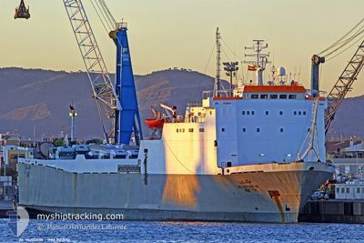
ALHUSSEIN
Ro-Ro Cargo
Current Trip
MRA_LY
| Time Travelled | 2 days |
|---|---|
| Remaining Time | --- |
| Distance Travelled | 475.48 nm |
| Remaining Distance | --- |
| AVG Speed | 9.1 Knots |
| MAX Speed | 10 Knots |
| AVG Wind | 8.5 knots |
| MAX Wind | 11.9 knots |
| MIN Temp | 17.7°C / 63.86°F |
| MAX Temp | 19.8°C / 67.64°F |
| Draught | 4.5 m |
| Position Received | 4 d ago |
Current Position
| Longitude | 12.00534° |
|---|---|
| Latitude | 36.54757° |
| Status | Under way using engine |
| Speed | 10.3 Knots |
| Course | 144.8° |
| Area | Mediterranean Sea - Eastern Basin |
| Station | T-AIS |
| Position Received | 4 d ago |
Info
Information
The current position of ALHUSSEIN is in Mediterranean Sea - Eastern Basin with coordinates 36.54757° / 12.00534° as reported on 2024-05-02 03:29 by AIS to our vessel tracker app. The vessel's current speed is 10.3 Knots
The vessel ALHUSSEIN (IMO: 8318116, MMSI: 341414000) is a Ro-Ro Cargo that was built in 1985 ( 39 years old ). It's sailing under the flag of [KN] St Kitts Nevis.
In this page you can find informations about the vessels current position, last detected port calls, and current voyage information. If the vessels is not in coverage by AIS you will find the latest position.
The current position of ALHUSSEIN is detected by our AIS receivers and we are not responsible for the reliability of the data. The last position was recorded while the vessel was in Coverage by the Ais receivers of our vessel tracking app.
The current draught of ALHUSSEIN as reported by AIS is 4.5 meters
Weather
| Temperature | 18.1°C / 64.58°F |
|---|---|
| Wind Speed | 8 knots |
| Direction | 304° NW |
| Pressure | 1018.3 hPa |
| Humidity | 75.8 % |
| Cloud Coverage | 42 % |
Featured Company
Last Port Calls
| Port | Arrival | Departure | Time In Port |
|---|---|---|---|
| 2024-05-03 17:10 | 2024-05-04 17:19 | 1 d | |
| 2024-04-27 19:25 | 2024-04-29 17:35 | 1 d | |
| 2024-04-26 04:04 | 2024-04-26 20:44 | 16 h | |
| 2024-04-16 19:35 | 2024-04-17 21:38 | 1 d | |
| 2024-04-09 15:05 | 2024-04-11 00:48 | 1 d | |
| 2024-03-24 12:29 |
Last Trips
| Origin | Departure | Destination | Arrival | Distance | |
|---|---|---|---|---|---|
| 2024-04-29 19:35 | 2024-05-03 19:10 | 861.55 nm | |||
| 2024-04-26 22:44 | 2024-04-27 21:25 | 229.55 nm | |||
| 2024-04-17 23:38 | 2024-04-26 06:04 | 905.55 nm | |||
| 2024-04-11 02:48 | 2024-04-16 21:35 | 960.40 nm | |||
| 2024-03-24 14:29 | 2024-04-09 17:05 | 1700.96 nm |
Events
| Time | Event | Details | Position / Dest | Info |
|---|---|---|---|---|
| 2024-05-04 17:19 | PORT DEPARTURE |
|
32.37167 / 15.24833
MRA_LY
|
Speed: 4 kn Course: -1° |
| 2024-05-04 17:04 | START Moving |
32.36666 / 15.22333
[LY] MISURATA
|
Speed: 4 kn Course: -1° |
|
| 2024-05-03 17:16 | STOP Moving |
32.37167 / 15.22167
[LY] MISURATA
|
Speed: Course: -1° |
|
| 2024-05-03 17:10 | PORT ARRIVAL |
|
32.37167 / 15.22500
[LY] MISURATA
|
Speed: 6 kn Course: 266° |
| 2024-05-03 16:55 | START Moving | 1.16 nm, North East of MISURATA |
32.37333 / 15.25167
MRA_LY
|
Speed: 7 kn Course: 263° |
| 2024-05-03 10:19 | STOP Moving | 2.89 nm, North East of MISURATA |
32.39489 / 15.27435
MRA_LY
|
Speed: 0.1 kn Course: 49° |
| 2024-05-02 03:32 | Status Changed | Default Under way using engine |
36.54020 / 12.01188
MRA_LY
|
Speed: 10.3 kn Course: 144.8° |
| 2024-05-02 03:29 | OUT of Coverage |
36.54757 / 12.00534
Mediterranean Sea - Eastern Basin
MRA_LY
|
Speed: 10.3 kn Course: 144.8° |
|
| 2024-05-02 03:24 | Change Sea Area | Italian part of the Mediterranean Sea - Eastern Basin French part of the Mediterranean Sea - Western Basin |
36.55936 / 11.99508
Mediterranean Sea - Eastern Basin
MRA_LY
|
Speed: 10.3 kn Course: 144.1° |
| 2024-05-02 03:24 | Status Changed | Under way using engine Default |
36.55936 / 11.99508
MRA_LY
|
Speed: 10.2 kn Course: 141° |