
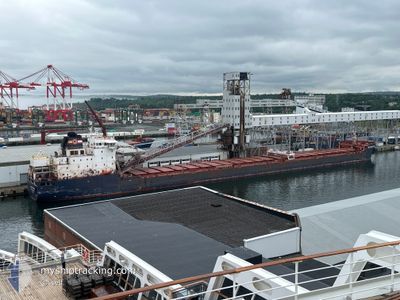
ALGOMA MARINER
Self Discharging Bulk Carrier
Current Trip
| Trip Time | 4 days |
|---|---|
| Trip Distance | 770.48 nm |
| AVG Speed | 11.3 Knots |
| MAX Speed | 16.7 Knots |
| Draught | 7.1 m |
| AVG Wind | 11.6 knots |
| MAX Wind | 25.7 knots |
| MIN Temp | -11.4°C / 11.48°F |
| MAX Temp | 0.8°C / 33.44°F |
| Position Received | 1 d ago |
Current Position
| Longitude | --- |
|---|---|
| Latitude | --- |
| Status | Under way using engine |
| Speed | 15.2 Knots |
| Course | 42.5° |
| Area | Gulf of St-Lawrence |
| Station | T-AIS |
| Position Received | 1 d ago |
Info
Information
The current position of ALGOMA MARINER is in Gulf of St-Lawrence with coordinates 47.16459° / -70.65190° as reported on 2025-01-10 00:08 by AIS to our vessel tracker app. The vessel's current speed is 15.2 Knots and is currently inside the port of PORT CARTIER.
The vessel ALGOMA MARINER (IMO: 9587893, MMSI: 316014050) is a Self Discharging Bulk Carrier that was built in 2011 ( 14 years old ). It's sailing under the flag of [CA] Canada.
In this page you can find informations about the vessels current position, last detected port calls, and current voyage information. If the vessels is not in coverage by AIS you will find the latest position.
The current position of ALGOMA MARINER is detected by our AIS receivers and we are not responsible for the reliability of the data. The last position was recorded while the vessel was in Coverage by the Ais receivers of our vessel tracking app.
The current draught of ALGOMA MARINER as reported by AIS is 7.1 meters
Weather
| Temperature | -6.5°C / 20.3°F |
|---|---|
| Wind Speed | 9 knots |
| Direction | 347° NNW |
| Pressure | 1006.2 hPa |
| Humidity | 78.7 % |
| Cloud Coverage | 100 % |
Featured Company
Last Port Calls
| Port | Arrival | Departure | Time In Port |
|---|---|---|---|
| 2025-01-10 19:41 | |||
| 2025-01-06 03:56 | 2025-01-06 16:10 | 12 h | |
| 2025-01-03 23:09 | 2025-01-04 19:46 | 20 h | |
| 2024-12-31 22:53 | 2025-01-02 09:02 | 1 d | |
| 2024-12-29 19:03 | 2024-12-30 08:53 | 13 h | |
| 2024-12-26 15:49 | 2024-12-27 02:39 | 10 h | |
| 2024-12-23 05:12 | 2024-12-25 03:58 | 1 d | |
| 2024-12-22 16:17 | 2024-12-22 18:23 | 2 h | |
| 2024-12-20 03:33 | 2024-12-21 21:52 | 1 d | |
| 2024-12-19 05:12 | 2024-12-19 08:12 | 3 h |
Most Visited Ports (Last year)
| Port | Arrivals | |
|---|---|---|
| 36 | ||
| 18 | ||
| 18 | ||
| 11 | ||
| 5 | ||
| 5 |
Last Trips
| Origin | Departure | Destination | Arrival | Distance | |
|---|---|---|---|---|---|
| 2025-01-06 11:10 | 2025-01-10 14:41 | 770.48 nm | |||
| 2025-01-04 14:46 | 2025-01-05 22:56 | 402.95 nm | |||
| 2025-01-02 04:02 | 2025-01-03 18:09 | 317.74 nm | |||
| 2024-12-30 03:53 | 2024-12-31 17:53 | 322.33 nm | |||
| 2024-12-26 21:39 | 2024-12-29 14:03 | 403.32 nm | |||
| 2024-12-24 22:58 | 2024-12-26 10:49 | 278.79 nm | |||
| 2024-12-22 13:23 | 2024-12-23 00:12 | 125.60 nm | |||
| 2024-12-21 16:52 | 2024-12-22 11:17 | 108.56 nm | |||
| 2024-12-19 03:12 | 2024-12-19 22:33 | 101.45 nm | |||
| 2024-12-16 19:16 | 2024-12-19 00:12 | 404.26 nm |
Events
| Time | Event | Details | Position / Dest | Info |
|---|---|---|---|---|
| 2025-01-10 19:56 | STOP Moving |
50.03325 / -66.78203
[CA] PORT CARTIER
|
Speed: Course: 257° |
|
| 2025-01-10 19:41 | PORT ARRIVAL |
|
50.03009 / -66.78247
[CA] PORT CARTIER
|
Speed: 3.2 kn Course: 6° |
| 2025-01-10 00:13 | Status Changed | Default Under way using engine |
47.18183 / -70.62830
CAPCA CH68
|
Speed: 15.2 kn Course: 42.5° |
| 2025-01-10 00:08 | OUT of Coverage |
47.16459 / -70.65190
Gulf of St-Lawrence
CAPCA CH68
|
Speed: 15.2 kn Course: 42.5° |
|
| 2025-01-10 00:05 | Status Changed | Under way using engine Default |
47.15513 / -70.66329
CAPCA CH68
|
Speed: 16.2 kn Course: 33° |
| 2025-01-09 23:59 | Status Changed | Default Under way using engine |
47.13451 / -70.68321
CAPCA CH68
|
Speed: 16.3 kn Course: 32.8° |
| 2025-01-09 22:35 | Status Changed | Under way using engine Default |
46.85188 / -71.01017
CAPCA CH68
|
Speed: 15.5 kn Course: 75° |
| 2025-01-09 22:27 | Status Changed | Default Under way using engine |
46.84150 / -71.06233
CAPCA CH68
|
Speed: 14.7 kn Course: 92.8° |
| 2025-01-09 21:07 | Status Changed | Under way using engine Default |
46.72160 / -71.38251
CAPCA CH68
|
Speed: 13.5 kn Course: 78° |
| 2025-01-09 21:03 | Status Changed | Default Under way using engine |
46.71862 / -71.40208
CAPCA CH68
|
Speed: 13.2 kn Course: 78.1° |