
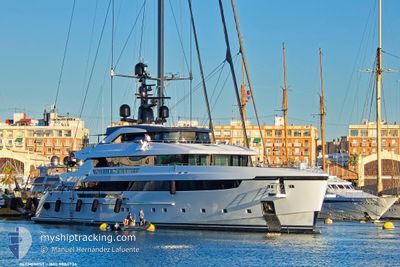
ALCHEMIST
Pleasure Craft
Current Trip
VIEUX FORT
| Time Travelled | 9 h, 15 mins |
|---|---|
| Remaining Time | --- |
| Distance Travelled | 0.04 nm |
| Remaining Distance | --- |
| AVG Speed | --- |
| MAX Speed | --- |
| AVG Wind | 11.5 knots |
| MAX Wind | 12 knots |
| MIN Temp | 25°C / 77°F |
| MAX Temp | 25.7°C / 78.26°F |
| Draught | 3.2 m |
| Position Received | 3 m ago |
Current Position
| Longitude | --- |
|---|---|
| Latitude | --- |
| Status | At anchor |
| Speed | |
| Course | 104° |
| Area | Caribbean Sea |
| Station | T-AIS |
| Position Received | 3 m ago |
Info
Information
The current position of ALCHEMIST is in Caribbean Sea with coordinates 13.85417° / -61.06255° as reported on 2026-01-05 12:44 by AIS to our vessel tracker app. The vessel's current speed is 0 Knots
The vessel ALCHEMIST (IMO: 9884734, MMSI: 538072144) is a Pleasure Craft It's sailing under the flag of [MH] Marshall Is.
In this page you can find informations about the vessels current position, last detected port calls, and current voyage information. If the vessels is not in coverage by AIS you will find the latest position.
The current position of ALCHEMIST is detected by our AIS receivers and we are not responsible for the reliability of the data. The last position was recorded while the vessel was in Coverage by the Ais receivers of our vessel tracking app.
The current draught of ALCHEMIST as reported by AIS is 3.2 meters
Weather
| Temperature | 25.9°C / 78.62°F |
|---|---|
| Wind Speed | 13 knots |
| Direction | 107° ESE |
| Pressure | 1014.8 hPa |
| Humidity | 68.9 % |
| Cloud Coverage | 75 % |
Featured Company
Last Port Calls
| Port | Arrival | Departure | Time In Port |
|---|---|---|---|
| 2026-01-04 14:13 | 2026-01-04 23:32 | 9 h | |
| 2025-12-19 22:50 | 2025-12-24 16:32 | 4 d | |
| 2025-12-16 12:43 | 2025-12-17 12:15 | 23 h | |
| 2025-11-22 08:23 |
Events
| Time | Event | Details | Position / Dest | Info |
|---|---|---|---|---|
| 2026-01-05 06:56 | IN Coverage |
13.85436 / -61.06246
Caribbean Sea
|
Speed: Course: 269° |
|
| 2026-01-05 05:17 | OUT of Coverage |
13.85408 / -61.06239
Caribbean Sea
|
Speed: Course: 295° |
|
| 2026-01-05 04:59 | IN Coverage |
13.85408 / -61.06235
Caribbean Sea
|
Speed: Course: 292° |
|
| 2026-01-05 03:41 | OUT of Coverage |
13.85413 / -61.06212
Caribbean Sea
|
Speed: Course: 126° |
|
| 2026-01-05 03:32 | IN Coverage |
13.85414 / -61.06215
Caribbean Sea
|
Speed: Course: 109° |
|
| 2026-01-05 03:32 | PORT DEPARTURE |
|
13.85414 / -61.06215
VIEUX FORT
|
Speed: Course: 150° |
| 2026-01-04 18:54 | OUT of Coverage |
13.71719 / -60.95666
Caribbean Sea
[LC] VIEUX FORT
|
Speed: Course: 165.5° |
|
| 2026-01-04 18:22 | Destination Changed | VIEUX FORT ST LUCIA |
13.71680 / -60.95696
[LC] VIEUX FORT
|
Speed: Course: 128° |
| 2026-01-04 18:22 | ETA Changed | 2026/01/04 11:00 2026/01/03 12:00 |
13.71680 / -60.95696
[LC] VIEUX FORT
|
Speed: Course: 128° |
| 2026-01-04 18:13 | PORT ARRIVAL |
|
13.71713 / -60.95676
[LC] VIEUX FORT
|
Speed: Course: 122° |